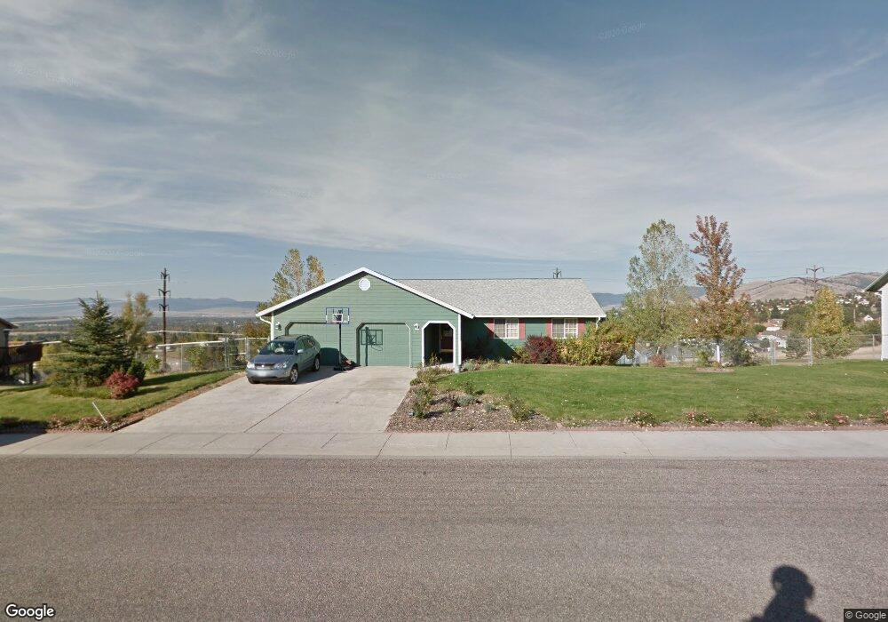
6970 Linda Vista Blvd Missoula, MT 59803
Miller Creek NeighborhoodEstimated Value: $755,000 - $777,000
3
Beds
2
Baths
1,952
Sq Ft
$394/Sq Ft
Est. Value
About This Home
This home is located at 6970 Linda Vista Blvd, Missoula, MT 59803 and is currently estimated at $769,267, approximately $394 per square foot. 6970 Linda Vista Blvd is a home located in Missoula County with nearby schools including Jeannette Rankin Elementary School, Porter Middle School, and Sentinel High School.
Ownership History
Date
Name
Owned For
Owner Type
Purchase Details
Closed on
Jul 2, 2021
Sold by
Thompson James W and Thompson Carola L
Bought by
James & Carola Thompson Family Living Trust and Thompson
Current Estimated Value
Purchase Details
Closed on
Jan 30, 2002
Sold by
Winterrowd Patrick E
Bought by
Thompson James W and Thompson Carola L
Home Financials for this Owner
Home Financials are based on the most recent Mortgage that was taken out on this home.
Original Mortgage
$200,000
Interest Rate
7.17%
Mortgage Type
Construction
Create a Home Valuation Report for This Property
The Home Valuation Report is an in-depth analysis detailing your home's value as well as a comparison with similar homes in the area
Home Values in the Area
Average Home Value in this Area
Purchase History
| Date | Buyer | Sale Price | Title Company |
|---|---|---|---|
| James & Carola Thompson Family Living Trust | -- | None Listed On Document | |
| James & Carola Thompson Family Living Trust | -- | None Listed On Document | |
| Thompson James W | -- | -- |
Source: Public Records
Mortgage History
| Date | Status | Borrower | Loan Amount |
|---|---|---|---|
| Previous Owner | Thompson James W | $200,000 |
Source: Public Records
Tax History Compared to Growth
Tax History
| Year | Tax Paid | Tax Assessment Tax Assessment Total Assessment is a certain percentage of the fair market value that is determined by local assessors to be the total taxable value of land and additions on the property. | Land | Improvement |
|---|---|---|---|---|
| 2025 | $7,546 | $763,500 | $128,356 | $635,144 |
| 2024 | $7,152 | $627,800 | $102,723 | $525,077 |
| 2023 | $6,954 | $627,800 | $102,723 | $525,077 |
| 2022 | $5,785 | $450,100 | $0 | $0 |
| 2021 | $5,233 | $450,100 | $0 | $0 |
| 2020 | $5,529 | $436,100 | $0 | $0 |
| 2019 | $5,513 | $436,100 | $0 | $0 |
| 2018 | $5,002 | $383,500 | $0 | $0 |
| 2017 | $4,387 | $383,500 | $0 | $0 |
| 2016 | $4,504 | $369,200 | $0 | $0 |
| 2015 | $4,155 | $369,200 | $0 | $0 |
| 2014 | $4,130 | $205,322 | $0 | $0 |
Source: Public Records
Map
Nearby Homes
- 5065 Jeff Dr
- 6915 Shaver Dr
- 6610 Justin Ct
- 7006 Max Dr
- 6994 Shaver Dr
- 7206 Shaver Dr
- 7003 Jenaya Ct
- 7022 Max Dr
- 4863 Scott Allen Dr
- 3495 Loraine Dr
- 4060 Jamie Ann Ln
- 7044 Guinevere Dr
- 7037 Max Dr
- 6275 Marias St
- 7032 Jenaya Ct
- 7083 Shaver Dr
- 7070 Max Dr
- 7123 Shaver Dr
- Nhn Avery Ln
- 6650 Linda Vista Blvd
- 6980 Linda Vista Blvd
- 6960 Linda Vista Blvd
- 6965 Linda Vista Blvd
- 6975 Linda Vista Blvd
- 3615 Brandon Way
- 6955 Linda Vista Blvd
- 3621 Brandon Way
- 6990 Linda Vista Blvd
- 6950 Linda Vista Blvd
- 3601 Brandon Way
- 6985 Linda Vista Blvd
- 3631 Brandon Way
- 6945 Linda Vista Blvd
- 3593 Brandon Way
- 3641 Brandon Way
- 6940 Linda Vista Blvd
- 5075 Jeff Dr
- 3587 Brandon Way
- 6935 Linda Vista Blvd
- 5055 Jeff Dr