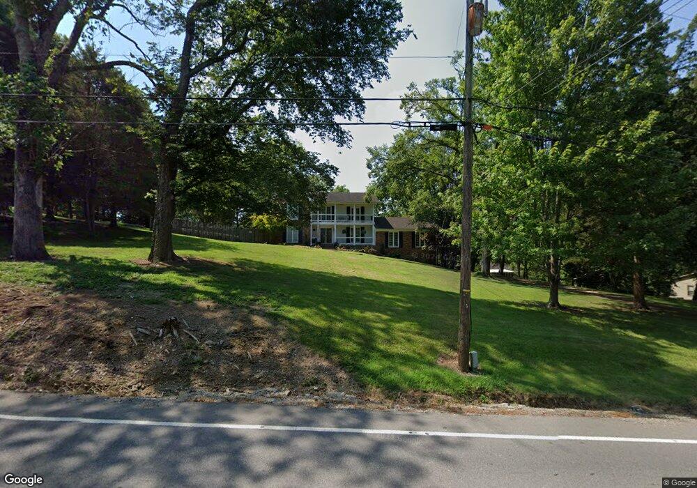
699 Sneed Rd W Franklin, TN 37069
Estimated Value: $740,000 - $1,076,000
--
Bed
3
Baths
3,024
Sq Ft
$274/Sq Ft
Est. Value
About This Home
This home is located at 699 Sneed Rd W, Franklin, TN 37069 and is currently estimated at $829,308, approximately $274 per square foot. 699 Sneed Rd W is a home located in Williamson County with nearby schools including Grassland Elementary School, Grassland Middle School, and Franklin High School.
Ownership History
Date
Name
Owned For
Owner Type
Purchase Details
Closed on
Apr 10, 2007
Sold by
Daschner Brian D
Bought by
Traviss Michael and Traviss Tamara J
Current Estimated Value
Home Financials for this Owner
Home Financials are based on the most recent Mortgage that was taken out on this home.
Original Mortgage
$216,000
Outstanding Balance
$129,953
Interest Rate
6.15%
Mortgage Type
Purchase Money Mortgage
Estimated Equity
$699,355
Purchase Details
Closed on
May 2, 2003
Sold by
Daschner Marie N
Bought by
Daschner Brian D
Home Financials for this Owner
Home Financials are based on the most recent Mortgage that was taken out on this home.
Original Mortgage
$50,000
Interest Rate
5.2%
Mortgage Type
Credit Line Revolving
Purchase Details
Closed on
Jul 1, 1996
Sold by
Busby Robert T
Bought by
Daschner Brian D
Create a Home Valuation Report for This Property
The Home Valuation Report is an in-depth analysis detailing your home's value as well as a comparison with similar homes in the area
Home Values in the Area
Average Home Value in this Area
Purchase History
| Date | Buyer | Sale Price | Title Company |
|---|---|---|---|
| Traviss Michael | $270,000 | Closing & Title Services Inc | |
| Daschner Brian D | -- | -- | |
| Daschner Brian D | $175,000 | -- |
Source: Public Records
Mortgage History
| Date | Status | Borrower | Loan Amount |
|---|---|---|---|
| Open | Traviss Michael | $216,000 | |
| Previous Owner | Daschner Brian D | $50,000 |
Source: Public Records
Tax History Compared to Growth
Tax History
| Year | Tax Paid | Tax Assessment Tax Assessment Total Assessment is a certain percentage of the fair market value that is determined by local assessors to be the total taxable value of land and additions on the property. | Land | Improvement |
|---|---|---|---|---|
| 2025 | $2,385 | $209,350 | $75,000 | $134,350 |
| 2024 | $2,385 | $126,875 | $31,250 | $95,625 |
| 2023 | $2,385 | $126,875 | $31,250 | $95,625 |
| 2022 | $2,385 | $126,875 | $31,250 | $95,625 |
| 2021 | $2,385 | $126,875 | $31,250 | $95,625 |
| 2020 | $2,245 | $101,125 | $23,750 | $77,375 |
| 2019 | $2,245 | $101,125 | $23,750 | $77,375 |
| 2018 | $2,174 | $101,125 | $23,750 | $77,375 |
| 2017 | $2,174 | $101,125 | $23,750 | $77,375 |
| 2016 | $0 | $101,125 | $23,750 | $77,375 |
| 2015 | -- | $85,525 | $21,250 | $64,275 |
| 2014 | -- | $85,525 | $21,250 | $64,275 |
Source: Public Records
Map
Nearby Homes
- 161 Saint Andrews Dr
- 123 Saint Andrews Dr
- 6211 Temple Rd
- 5621 Traceside Dr
- 159 N Berwick Ln
- 162 N Berwick Ln
- 5720 Templegate Dr
- 896 Sneed Rd W
- 543 Trace Creek Dr
- 5728 Templegate Dr
- 8039 Tennessee 100
- 808 Carsten St
- 424 Sandcastle Rd
- 917 Dauphine St
- 9157 Highway 100
- 0 Pasquo Rd
- 1304 McQuiddy Rd
- 2002 Gildridge Dr Unit 302
- 2002 Gildridge Dr Unit 301
- 2002 Gildridge Dr Unit 203
- 153 Saint Andrews Dr
- 632 Sneed Rd W
- 673 Sneed Rd W
- 703 Sneed Rd W
- 149 Saint Andrews Dr
- 700 Sneed Rd W
- 145 Saint Andrews Dr
- 165 Saint Andrews Dr
- 152 Saint Andrews Dr
- 665 Sneed Rd W
- 146 Saint Andrews Dr
- 139 St Andrews
- 139 Saint Andrews Dr
- 160 Saint Andrews Dr
- 707 Sneed Rd W
- 142 Saint Andrews Dr
- 698 Sneed Rd W
- 702 Sneed Rd W
- 135 Saint Andrews Dr
- 2701 Longwood Dr