Estimated Value: $805,278 - $892,000
4
Beds
2
Baths
1,856
Sq Ft
$458/Sq Ft
Est. Value
About This Home
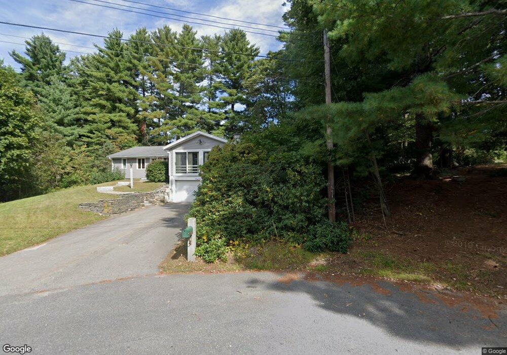
This home is located at 7 Betsy Ross Cir, Acton, MA 01720 and is currently estimated at $850,320, approximately $458 per square foot. 7 Betsy Ross Cir is a home located in Middlesex County with nearby schools including Acton-Boxborough Regional High School.
Ownership History
Date
Name
Owned For
Owner Type
Purchase Details
Closed on
Nov 14, 2024
Sold by
Paakki John F
Bought by
John Paakki Irt and Paakki
Current Estimated Value
Purchase Details
Closed on
Dec 5, 2006
Sold by
Betsy Ross Circle T and Zilembo Barry
Bought by
Paakki John F
Home Financials for this Owner
Home Financials are based on the most recent Mortgage that was taken out on this home.
Original Mortgage
$377,700
Interest Rate
6.36%
Mortgage Type
Purchase Money Mortgage
Purchase Details
Closed on
May 8, 1997
Sold by
Est Parker Barbara J and Hathaway Susan R
Bought by
Paakki John F and Zilembo Dorothy A
Create a Home Valuation Report for This Property
The Home Valuation Report is an in-depth analysis detailing your home's value as well as a comparison with similar homes in the area
Home Values in the Area
Average Home Value in this Area
Purchase History
| Date | Buyer | Sale Price | Title Company |
|---|---|---|---|
| John Paakki Irt | -- | None Available | |
| John Paakki Irt | -- | None Available | |
| Paakki John F | $98,960 | -- | |
| Paakki John F | $189,000 | -- | |
| Paakki John F | $98,960 | -- | |
| Paakki John F | $189,000 | -- |
Source: Public Records
Mortgage History
| Date | Status | Borrower | Loan Amount |
|---|---|---|---|
| Previous Owner | Paakki John F | $384,300 | |
| Previous Owner | Paakki John F | $377,700 |
Source: Public Records
Tax History Compared to Growth
Tax History
| Year | Tax Paid | Tax Assessment Tax Assessment Total Assessment is a certain percentage of the fair market value that is determined by local assessors to be the total taxable value of land and additions on the property. | Land | Improvement |
|---|---|---|---|---|
| 2025 | $11,696 | $682,000 | $310,500 | $371,500 |
| 2024 | $11,269 | $676,000 | $310,500 | $365,500 |
| 2023 | $10,761 | $612,800 | $282,300 | $330,500 |
| 2022 | $10,746 | $552,500 | $245,200 | $307,300 |
| 2021 | $10,261 | $507,200 | $227,100 | $280,100 |
| 2020 | $9,608 | $499,400 | $227,100 | $272,300 |
| 2019 | $9,057 | $467,600 | $227,100 | $240,500 |
| 2018 | $8,506 | $438,900 | $227,100 | $211,800 |
| 2017 | $8,365 | $438,900 | $227,100 | $211,800 |
| 2016 | $7,829 | $407,100 | $227,100 | $180,000 |
| 2015 | $7,369 | $386,800 | $227,100 | $159,700 |
| 2014 | $7,389 | $379,900 | $227,100 | $152,800 |
Source: Public Records
Map
Nearby Homes
- 68 Macintosh Ln
- 12 Olde Lantern Rd
- 134 Russet Ln
- 92 Willow St Unit 3
- 92 Willow St Unit 2
- 90 Willow St Unit 1
- 96 Cedarwood Rd
- 3 Heather Hill Rd
- 89 Windsor Ave
- 285 Central St Unit 285
- 5 Elm St Unit 1
- 9 Elm St Unit 1
- 4,7,8 Crestwood Ln
- 31 Mohawk Dr
- 777 Depot Rd
- 207 Boxboro Rd
- 169 Main St
- 4 Huron Rd
- 19 Railroad St Unit C2
- 220 Red Acre Rd
- 8 Betsy Ross Cir
- 5 Shady Ln
- 5 Betsy Ross Cir
- 148 Summer St
- 7 Shady Ln
- 6 Betsy Ross Cir
- 4 Ethan Allen Dr
- 2 Ethan Allen Dr
- 1 Shady Ln
- 3 Betsy Ross Cir
- 6 Ethan Allen Dr
- 9 Shady Ln
- 4 Betsy Ross Cir
- 1 Ethan Allen Dr
- 149 Summer St
- 6 Shady Ln
- 10 Paul Revere Rd
- 6 Paul Revere Rd
- 8 Ethan Allen Dr
- 8 Paul Revere Rd