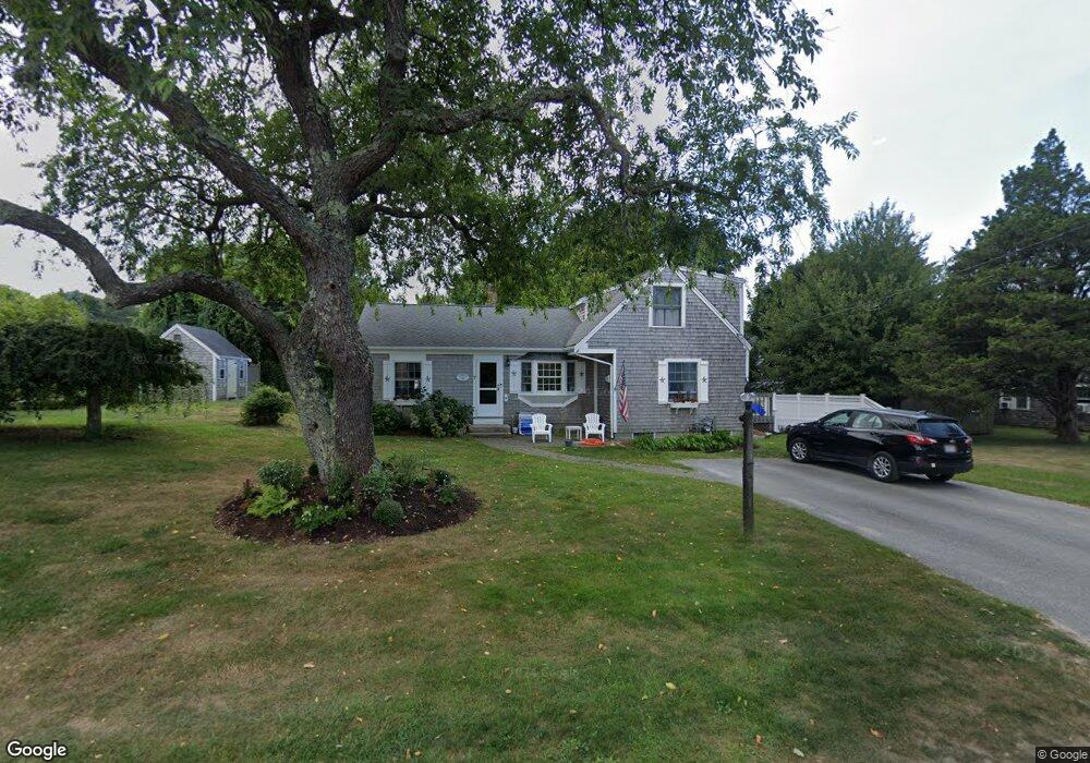
7 Cedar Hill Rd Brewster, MA 02631
Estimated Value: $1,015,000 - $1,224,000
4
Beds
2
Baths
1,405
Sq Ft
$814/Sq Ft
Est. Value
About This Home
This home is located at 7 Cedar Hill Rd, Brewster, MA 02631 and is currently estimated at $1,143,274, approximately $813 per square foot. 7 Cedar Hill Rd is a home located in Barnstable County with nearby schools including Nauset Regional Middle School, Nauset Regional High School, and Latham School.
Ownership History
Date
Name
Owned For
Owner Type
Purchase Details
Closed on
May 8, 2024
Sold by
Macleod William D and Macleod Susan M
Bought by
7 Cedar Hill Rd Nt and Macleod
Current Estimated Value
Purchase Details
Closed on
May 1, 2015
Sold by
Mclaughlin Pauline M E and Mclaughlin Quatieri
Bought by
Macleod William D and Macleod Susan M
Home Financials for this Owner
Home Financials are based on the most recent Mortgage that was taken out on this home.
Original Mortgage
$250,000
Interest Rate
3.76%
Mortgage Type
New Conventional
Purchase Details
Closed on
Jun 16, 1988
Sold by
Sullivan Paul D
Bought by
Mclaughlin Francis J
Home Financials for this Owner
Home Financials are based on the most recent Mortgage that was taken out on this home.
Original Mortgage
$80,000
Interest Rate
10.24%
Mortgage Type
Purchase Money Mortgage
Create a Home Valuation Report for This Property
The Home Valuation Report is an in-depth analysis detailing your home's value as well as a comparison with similar homes in the area
Home Values in the Area
Average Home Value in this Area
Purchase History
| Date | Buyer | Sale Price | Title Company |
|---|---|---|---|
| 7 Cedar Hill Rd Nt | -- | None Available | |
| 7 Cedar Hill Rd Nt | -- | None Available | |
| Macleod William D | $450,000 | -- | |
| Mclaughlin Francis J | $180,000 | -- |
Source: Public Records
Mortgage History
| Date | Status | Borrower | Loan Amount |
|---|---|---|---|
| Previous Owner | Macleod William D | $250,000 | |
| Previous Owner | Mclaughlin Francis J | $64,000 | |
| Previous Owner | Mclaughlin Francis J | $80,000 |
Source: Public Records
Tax History Compared to Growth
Tax History
| Year | Tax Paid | Tax Assessment Tax Assessment Total Assessment is a certain percentage of the fair market value that is determined by local assessors to be the total taxable value of land and additions on the property. | Land | Improvement |
|---|---|---|---|---|
| 2025 | $6,865 | $997,800 | $706,700 | $291,100 |
| 2024 | $6,441 | $945,800 | $666,700 | $279,100 |
| 2023 | $5,610 | $802,600 | $552,600 | $250,000 |
| 2022 | $5,283 | $673,000 | $460,400 | $212,600 |
| 2021 | $5,030 | $586,300 | $400,300 | $186,000 |
| 2020 | $3,301 | $580,300 | $400,300 | $180,000 |
| 2019 | $3,138 | $553,700 | $385,000 | $168,700 |
| 2018 | $4,538 | $549,400 | $385,000 | $164,400 |
| 2017 | $4,434 | $528,500 | $385,000 | $143,500 |
| 2016 | $4,375 | $519,000 | $377,500 | $141,500 |
| 2015 | -- | $508,300 | $370,000 | $138,300 |
Source: Public Records
Map
Nearby Homes
- 429 Paines Creek Rd
- 20 Spring Ln
- 21 Sea Meadow Ln
- 240 Robbins Hill Rd
- 1424 Main St
- 1580 Main St
- 309 Great Fields Rd
- 1861 Main St
- 0 Canoe Pond Dr
- 2019 Main St
- 597 Great Fields Rd
- 30 Fox Crossing Rd
- 120 Red Maple Rd
- 11 Island Creek Ln
- 88 Whiffletree Ave
- 92 Whiffletree Ave
- 728 Great Fields Rd
- 102 Wildwood Rd
- 40 Harbor Rd
- 55 Leona Terrace
- 7 Hillcrest Dr
- 19 Cedar Hill Rd
- 18 Hillcrest Dr
- 448 Paine's Creek Rd
- 448 Paines Creek Rd
- 6 Hillcrest Dr
- 28 Hillcrest Dr
- 456 Paines Creek Rd
- 2 Cedar Hill Rd
- 14 Cedar Hill Rd
- 29 Cedar Hill Rd
- 435 Paines Creek Rd
- 439 Paines Creek Rd
- 416 Paines Creek Rd
- 24 Cedar Hill Rd
- 427 Paines Creek Rd
- 429 Paine's Creek Rd Unit 429
- 81 Captain Young Way
- 466 Paines Creek Rd
- 38 Hillcrest Dr