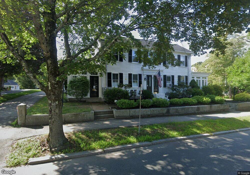
7 Chestnut St Andover, MA 01810
Southern Andover NeighborhoodEstimated Value: $999,000 - $1,294,209
4
Beds
2
Baths
2,722
Sq Ft
$403/Sq Ft
Est. Value
About This Home
This home is located at 7 Chestnut St, Andover, MA 01810 and is currently estimated at $1,097,302, approximately $403 per square foot. 7 Chestnut St is a home located in Essex County with nearby schools including Bancroft Elementary School, Doherty Middle School, and Andover High School.
Ownership History
Date
Name
Owned For
Owner Type
Purchase Details
Closed on
Apr 5, 2013
Sold by
Doherty Christopher and Doherty Sheryl A
Bought by
Doherty Christopher and Doherty Sheryl A
Current Estimated Value
Home Financials for this Owner
Home Financials are based on the most recent Mortgage that was taken out on this home.
Original Mortgage
$340,000
Outstanding Balance
$70,034
Interest Rate
3.58%
Mortgage Type
New Conventional
Estimated Equity
$1,027,268
Purchase Details
Closed on
Mar 30, 1984
Bought by
Doherty Christopher and Doherty Sheryl A
Create a Home Valuation Report for This Property
The Home Valuation Report is an in-depth analysis detailing your home's value as well as a comparison with similar homes in the area
Home Values in the Area
Average Home Value in this Area
Purchase History
| Date | Buyer | Sale Price | Title Company |
|---|---|---|---|
| Doherty Christopher | -- | -- | |
| Doherty Christopher | -- | -- | |
| Doherty Christopher | $90,000 | -- |
Source: Public Records
Mortgage History
| Date | Status | Borrower | Loan Amount |
|---|---|---|---|
| Open | Doherty Christopher | $340,000 | |
| Closed | Doherty Christopher | $340,000 |
Source: Public Records
Tax History Compared to Growth
Tax History
| Year | Tax Paid | Tax Assessment Tax Assessment Total Assessment is a certain percentage of the fair market value that is determined by local assessors to be the total taxable value of land and additions on the property. | Land | Improvement |
|---|---|---|---|---|
| 2024 | $12,879 | $999,900 | $463,700 | $536,200 |
| 2023 | $11,345 | $830,500 | $417,600 | $412,900 |
| 2022 | $10,197 | $698,400 | $369,600 | $328,800 |
| 2021 | $9,750 | $637,700 | $336,000 | $301,700 |
| 2020 | $9,177 | $611,400 | $327,800 | $283,600 |
| 2019 | $8,776 | $574,700 | $315,100 | $259,600 |
| 2018 | $8,405 | $537,400 | $297,100 | $240,300 |
| 2017 | $7,642 | $503,400 | $291,300 | $212,100 |
| 2016 | $7,103 | $479,300 | $291,300 | $188,000 |
| 2015 | $7,010 | $468,300 | $280,200 | $188,100 |
Source: Public Records
Map
Nearby Homes
- Lot 7 Weeping Willow Dr
- 9 Chapman Ave
- 10 Maple Ave Unit 3
- 61 Elm St Unit 61
- 47 Abbot St
- 42 Stevens St
- 20 Walnut Ave
- 2 Powder Mill Square Unit 2B
- 103 Central St
- 105 Central St
- 105 Elm St Unit A
- 5 Castle Heights Rd
- 32 Lucerne Dr
- 38 Lincoln Cir E
- 18 Bryan Ln Unit 18
- 53 Salem St
- 204 Chestnut St
- 156 High St
- 31 Porter Rd
- 4 Hammond Way
- 5 Chestnut St
- 5 Chestnut St Unit Front
- 6 Chestnut St
- 8 Chestnut St
- 8 Chestnut St
- 2 Chestnut St
- 2 Chestnut St
- 15 Chestnut St Unit A 2nd Flr
- 15 Chestnut St Unit B 2nd flr
- 15 Chestnut St Unit 7
- 15 Chestnut St Unit 6
- 15 Chestnut St Unit 3
- 15 Chestnut St Unit 5
- 15 Chestnut St
- 77 Main St Unit B
- 77 Main St
- Lot 7A St Augustine Dr Unit Lot 7A
- Lot 5A St Augustine Dr Unit Lot 5A
- 36 Central St Unit 8
- 36 Central St Unit 7