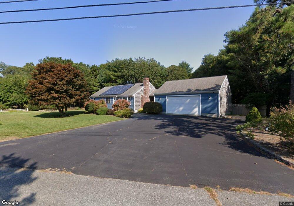
7 Ensign Rd Centerville, MA 02632
Centerville NeighborhoodEstimated Value: $588,896 - $612,000
3
Beds
2
Baths
1,001
Sq Ft
$596/Sq Ft
Est. Value
About This Home
This home is located at 7 Ensign Rd, Centerville, MA 02632 and is currently estimated at $596,224, approximately $595 per square foot. 7 Ensign Rd is a home located in Barnstable County with nearby schools including West Villages Elementary School, Barnstable United Elementary School, and Barnstable Intermediate School.
Ownership History
Date
Name
Owned For
Owner Type
Purchase Details
Closed on
Dec 20, 2021
Sold by
Hunt Brian D and Hunt Shay G
Bought by
Hunt Brian D
Current Estimated Value
Home Financials for this Owner
Home Financials are based on the most recent Mortgage that was taken out on this home.
Original Mortgage
$315,000
Outstanding Balance
$289,121
Interest Rate
3.11%
Mortgage Type
New Conventional
Estimated Equity
$307,103
Purchase Details
Closed on
Apr 4, 2000
Sold by
Freitas Malcolm P and Freitas Sharon E
Bought by
Ouellette Shay G
Home Financials for this Owner
Home Financials are based on the most recent Mortgage that was taken out on this home.
Original Mortgage
$133,475
Interest Rate
8.4%
Mortgage Type
Purchase Money Mortgage
Create a Home Valuation Report for This Property
The Home Valuation Report is an in-depth analysis detailing your home's value as well as a comparison with similar homes in the area
Home Values in the Area
Average Home Value in this Area
Purchase History
| Date | Buyer | Sale Price | Title Company |
|---|---|---|---|
| Hunt Brian D | -- | None Available | |
| Hunt Brian D | -- | None Available | |
| Ouellette Shay G | $140,500 | -- | |
| Ouellette Shay G | $140,500 | -- |
Source: Public Records
Mortgage History
| Date | Status | Borrower | Loan Amount |
|---|---|---|---|
| Open | Hunt Brian D | $315,000 | |
| Closed | Hunt Brian D | $315,000 | |
| Previous Owner | Ouellette Shay G | $200,000 | |
| Previous Owner | Ouellette Shay G | $180,000 | |
| Previous Owner | Ouellette Shay G | $133,475 |
Source: Public Records
Tax History
| Year | Tax Paid | Tax Assessment Tax Assessment Total Assessment is a certain percentage of the fair market value that is determined by local assessors to be the total taxable value of land and additions on the property. | Land | Improvement |
|---|---|---|---|---|
| 2025 | $4,029 | $498,000 | $155,900 | $342,100 |
| 2024 | $3,867 | $495,100 | $155,900 | $339,200 |
| 2023 | $3,660 | $438,900 | $141,700 | $297,200 |
| 2022 | $3,503 | $363,400 | $105,000 | $258,400 |
| 2021 | $3,355 | $319,800 | $105,000 | $214,800 |
| 2020 | $3,429 | $312,900 | $105,000 | $207,900 |
| 2019 | $3,284 | $291,100 | $105,000 | $186,100 |
| 2018 | $2,997 | $267,100 | $110,500 | $156,600 |
| 2017 | $2,797 | $259,900 | $110,500 | $149,400 |
| 2016 | $2,844 | $260,900 | $111,500 | $149,400 |
| 2015 | $2,721 | $250,800 | $109,000 | $141,800 |
Source: Public Records
Map
Nearby Homes
- 7 Ebenezer
- 21 Shannon Way
- 315 Prince Hinckley Rd
- 87 Foxglove Rd
- 16 Bridgets Path
- 90 Guildford Rd
- 200 Lumbert Mill Rd
- 1028 Old Falmouth Rd
- 5 Conaumet Rd
- 1044 Old Falmouth Rd
- 192 Sandy Valley Rd
- 81 Falling Leaf Ln
- 81 Monomoy Cir
- 296 Buckskin Path
- 369 Bumps River Rd
- 68 Lakeside Dr
- 900 Old Stage Rd
- 38 Lakeside Dr
- 32 Willington Ave
- 34 Mistic Dr
- 22 Ensign Rd
- 142 Ensign Rd
- 0 Ensign Rd
- 723 Lumbert Mill Rd
- 746 Lumbert Mill Rd
- 711 Lumbert Mill Rd
- 25 Ensign Rd
- 746 Lumbert's Mill
- 36 Ensign Rd
- 123 Ensign Rd
- 12 Ebenezer Rd
- 735 Lumbert Mill Rd
- 134 Ensign Rd
- 12 Ebenezer
- 41 Ensign Rd
- 26 Ebenezer Rd
- 128 Ensign Rd
- 50 Ensign Rd
- 7 Ebenezer Rd
- 107 Ensign Rd