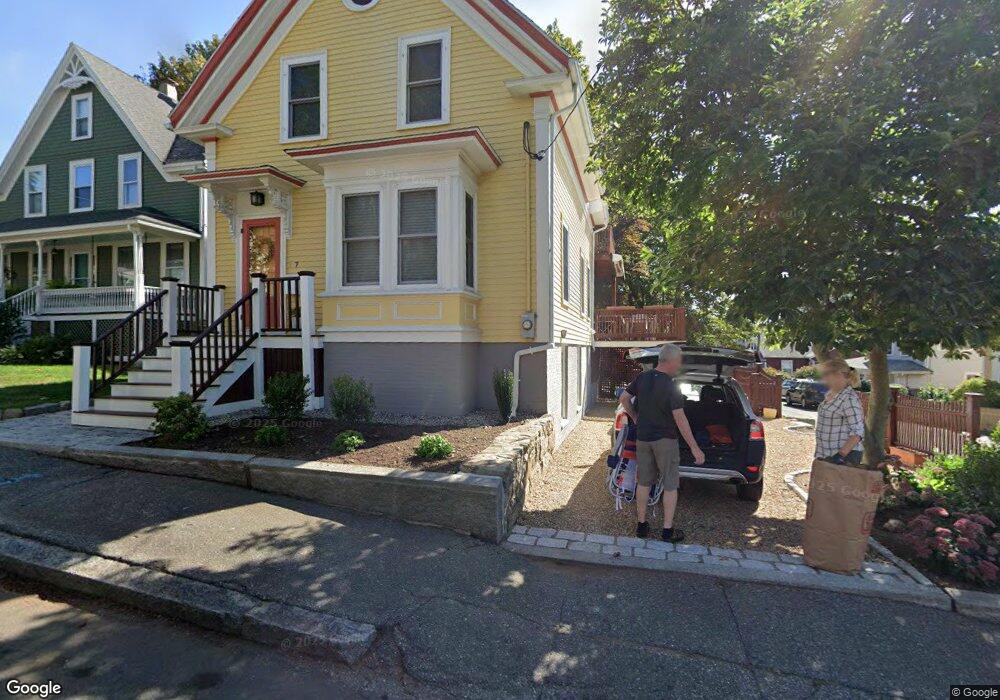
7 Gerring Rd Gloucester, MA 01930
East Gloucester NeighborhoodEstimated Value: $837,956 - $1,039,000
4
Beds
2
Baths
1,447
Sq Ft
$656/Sq Ft
Est. Value
About This Home
This home is located at 7 Gerring Rd, Gloucester, MA 01930 and is currently estimated at $949,739, approximately $656 per square foot. 7 Gerring Rd is a home located in Essex County with nearby schools including East Gloucester Elementary School, Ralph B O'maley Middle School, and Gloucester High School.
Ownership History
Date
Name
Owned For
Owner Type
Purchase Details
Closed on
Mar 23, 2012
Sold by
Lavoie Dean R and Lavoie Bonnie A
Bought by
Dilascio Michael J and Dilascio Eva C
Current Estimated Value
Purchase Details
Closed on
Nov 17, 2011
Sold by
Lavoie Dean R and Lavoie Bonnie A
Bought by
Dilasco Michael J and Dilasco Eva C
Purchase Details
Closed on
Dec 14, 2004
Sold by
Engel Christine T and Engel John Carlton
Bought by
Lavoie Dean R
Purchase Details
Closed on
Oct 24, 1994
Sold by
Williams Miriam C
Bought by
Engel John C
Create a Home Valuation Report for This Property
The Home Valuation Report is an in-depth analysis detailing your home's value as well as a comparison with similar homes in the area
Home Values in the Area
Average Home Value in this Area
Purchase History
| Date | Buyer | Sale Price | Title Company |
|---|---|---|---|
| Dilascio Michael J | $380,000 | -- | |
| Dilasco Michael J | $380,000 | -- | |
| Lavoie Dean R | $449,000 | -- | |
| Engel John C | $50,000 | -- |
Source: Public Records
Mortgage History
| Date | Status | Borrower | Loan Amount |
|---|---|---|---|
| Open | Engel John C | $300,000 | |
| Previous Owner | Engel John C | $417,000 | |
| Previous Owner | Engel John C | $46,000 |
Source: Public Records
Tax History
| Year | Tax Paid | Tax Assessment Tax Assessment Total Assessment is a certain percentage of the fair market value that is determined by local assessors to be the total taxable value of land and additions on the property. | Land | Improvement |
|---|---|---|---|---|
| 2025 | $7,298 | $750,800 | $280,200 | $470,600 |
| 2024 | $7,176 | $737,500 | $266,900 | $470,600 |
| 2023 | $6,877 | $649,400 | $238,300 | $411,100 |
| 2022 | $6,805 | $580,100 | $207,200 | $372,900 |
| 2021 | $6,567 | $527,900 | $188,400 | $339,500 |
| 2020 | $6,323 | $512,800 | $177,700 | $335,100 |
| 2019 | $6,019 | $474,300 | $177,700 | $296,600 |
| 2018 | $5,778 | $446,900 | $177,700 | $269,200 |
| 2017 | $5,600 | $424,600 | $169,200 | $255,400 |
| 2016 | $5,273 | $387,400 | $160,500 | $226,900 |
| 2015 | $5,053 | $370,200 | $160,500 | $209,700 |
Source: Public Records
Map
Nearby Homes
- 1 Wonson St
- 73 Rocky Neck Ave Unit 2
- 60 Rocky Neck Ave Unit 202
- 197 E Main St Unit 1
- 15 Raven Ln Unit 15
- 10 Seaview Rd
- 11 Ocean View Dr
- 191 Main St Unit 3
- 191 Main St Unit 2A
- 139A Prospect St
- 35 Middle St Unit 4
- 33 Middle St
- 3 Mondello Square
- 15 Mount Vernon St
- 36 Eastern Ave
- 113 Pleasant St
- 87 Atlantic Rd Unit 2
- 50 Warner St
- 33 Maplewood Ave Unit 310
- 5 Wise Place
- 9 Gerring Rd
- 1 Barberry Ln
- 6 Gerring Rd
- 12 Gerring Rd Unit R
- 3 Gerring Rd
- 3 Barberry Ln
- 135 Mount Pleasant Ave
- 8 Gerring Rd Unit B
- 8 Gerring Rd Unit A
- 8 Gerring Rd
- 8 Gerring Rd Unit 8
- 8 Gerring Rd Unit 1
- 141 Mount Pleasant Ave
- 4 Gerring Rd
- 7 Barberry Ln
- 139 Mount Pleasant Ave
- 234 E Main St
- 8R Gerring Rd Unit B
- 8R Gerring Rd Unit 1,2
- 236 E Main St
Your Personal Tour Guide
Ask me questions while you tour the home.