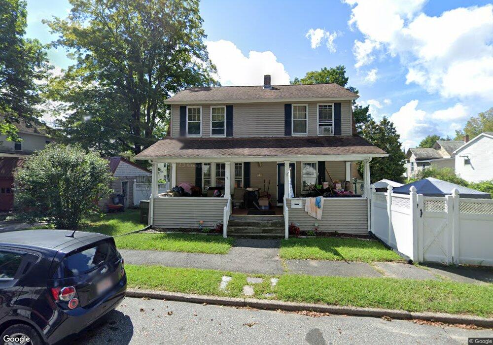
7 Grove St Palmer, MA 01069
Estimated Value: $287,000 - $349,000
4
Beds
2
Baths
1,680
Sq Ft
$186/Sq Ft
Est. Value
About This Home
This home is located at 7 Grove St, Palmer, MA 01069 and is currently estimated at $312,256, approximately $185 per square foot. 7 Grove St is a home located in Hampden County with nearby schools including Old Mill Pond Elementary School, Converse Middle School, and Palmer High School.
Ownership History
Date
Name
Owned For
Owner Type
Purchase Details
Closed on
Jun 17, 2003
Sold by
Sullivan Denise L and Sullivan Patrick W
Bought by
Stone Anne M and Stone Anne
Current Estimated Value
Home Financials for this Owner
Home Financials are based on the most recent Mortgage that was taken out on this home.
Original Mortgage
$151,200
Outstanding Balance
$63,904
Interest Rate
5.77%
Mortgage Type
Purchase Money Mortgage
Estimated Equity
$248,352
Purchase Details
Closed on
Aug 24, 1998
Sold by
Donovan William B and Donovan Patricia C
Bought by
Jasak Denise L and Sullivan Patrick W
Home Financials for this Owner
Home Financials are based on the most recent Mortgage that was taken out on this home.
Original Mortgage
$109,000
Interest Rate
6.86%
Mortgage Type
Purchase Money Mortgage
Create a Home Valuation Report for This Property
The Home Valuation Report is an in-depth analysis detailing your home's value as well as a comparison with similar homes in the area
Home Values in the Area
Average Home Value in this Area
Purchase History
| Date | Buyer | Sale Price | Title Company |
|---|---|---|---|
| Stone Anne M | $168,000 | -- | |
| Stone Anne M | $168,000 | -- | |
| Jasak Denise L | $109,000 | -- | |
| Jasak Denise L | $109,000 | -- |
Source: Public Records
Mortgage History
| Date | Status | Borrower | Loan Amount |
|---|---|---|---|
| Open | Stone Anne M | $151,200 | |
| Closed | Jasak Denise L | $151,200 | |
| Previous Owner | Jasak Denise L | $127,800 | |
| Previous Owner | Jasak Denise L | $109,000 |
Source: Public Records
Tax History
| Year | Tax Paid | Tax Assessment Tax Assessment Total Assessment is a certain percentage of the fair market value that is determined by local assessors to be the total taxable value of land and additions on the property. | Land | Improvement |
|---|---|---|---|---|
| 2025 | $3,430 | $189,000 | $50,700 | $138,300 |
| 2024 | $3,172 | $169,900 | $46,100 | $123,800 |
| 2023 | $3,091 | $159,000 | $46,100 | $112,900 |
| 2022 | $3,086 | $144,200 | $40,400 | $103,800 |
| 2021 | $2,899 | $128,100 | $44,900 | $83,200 |
| 2020 | $2,820 | $123,700 | $44,900 | $78,800 |
| 2019 | $2,739 | $123,700 | $44,900 | $78,800 |
| 2018 | $2,654 | $120,200 | $43,500 | $76,700 |
| 2017 | $2,593 | $120,200 | $43,500 | $76,700 |
| 2016 | $2,486 | $116,900 | $42,300 | $74,600 |
| 2015 | $2,412 | $116,900 | $42,300 | $74,600 |
Source: Public Records
Map
Nearby Homes
- 1240 S Main St
- 72 Quaboag Valley Co Op St Unit 70
- 0 St Unit 73414881
- 7,37,38 Thorndike and Lawrence St
- 142,148 Breckenridge St
- Lot 8 Breckenridge St
- 62-91 Lawrence St
- Lots 39-42 Lawrence
- 140 Shearer St
- 11 Allen St
- 405 Shearer St
- 1415 Park St
- 69 E Palmer Park Dr
- 268 Palmer Rd Unit 27
- 268 Palmer Rd Unit 2
- 1682 N Main St
- 2 Carter St
- 0 Hovey Rd
- 15 Quaboag Valley Co-Op St Unit 15
- 101 Ware St
- 15 Grove St
- 29 Grove St
- 16 Grove St
- 1083 Central St Unit 1085
- 1079 Central St
- 6 Grove St
- 1018 Maple St Unit 1020
- 18 Grove St
- 1075 Central St
- 1023 Maple St
- 2 Grove St
- 1025 Maple St
- 1016 Maple St
- 20 Grove St
- 1019 Maple St
- 1019 Maple St Unit 1021
- 1071 Central St Unit 1073
- 1093 Central St Unit 1095
- 1080 Central St
- 1072 Central St
Your Personal Tour Guide
Ask me questions while you tour the home.