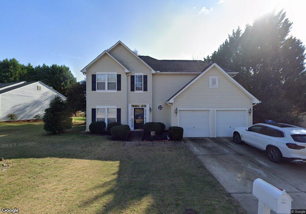
7 Laport Dr Mauldin, SC 29662
Estimated Value: $307,971 - $348,000
3
Beds
3
Baths
2,085
Sq Ft
$158/Sq Ft
Est. Value
About This Home
This home is located at 7 Laport Dr, Mauldin, SC 29662 and is currently estimated at $328,743, approximately $157 per square foot. 7 Laport Dr is a home located in Greenville County with nearby schools including Greenbrier Elementary School, Hillcrest Middle School, and Mauldin High School.
Ownership History
Date
Name
Owned For
Owner Type
Purchase Details
Closed on
Oct 15, 2014
Sold by
Bennett Upstate Enterprises Llc
Bought by
Wakefield Ayushea A
Current Estimated Value
Home Financials for this Owner
Home Financials are based on the most recent Mortgage that was taken out on this home.
Original Mortgage
$159,065
Outstanding Balance
$121,892
Interest Rate
4.4%
Mortgage Type
FHA
Estimated Equity
$206,851
Purchase Details
Closed on
Apr 25, 2006
Sold by
Bennett Family Trust
Bought by
Bennett Upstate Enterprises Llc
Purchase Details
Closed on
Jun 15, 2004
Sold by
Jones William P
Bought by
Bennett Family Trust
Purchase Details
Closed on
Mar 30, 1999
Sold by
The Ryland Group Inc
Bought by
Jones William P
Create a Home Valuation Report for This Property
The Home Valuation Report is an in-depth analysis detailing your home's value as well as a comparison with similar homes in the area
Home Values in the Area
Average Home Value in this Area
Purchase History
| Date | Buyer | Sale Price | Title Company |
|---|---|---|---|
| Wakefield Ayushea A | $162,000 | -- | |
| Bennett Upstate Enterprises Llc | -- | None Available | |
| Bennett Family Trust | -- | -- | |
| Jones William P | $134,127 | -- |
Source: Public Records
Mortgage History
| Date | Status | Borrower | Loan Amount |
|---|---|---|---|
| Open | Wakefield Ayushea A | $159,065 |
Source: Public Records
Tax History
| Year | Tax Paid | Tax Assessment Tax Assessment Total Assessment is a certain percentage of the fair market value that is determined by local assessors to be the total taxable value of land and additions on the property. | Land | Improvement |
|---|---|---|---|---|
| 2025 | $1,395 | $8,420 | $2,150 | $6,270 |
| 2024 | $1,395 | $7,320 | $1,010 | $6,310 |
| 2023 | $1,337 | $7,320 | $1,010 | $6,310 |
| 2022 | $1,259 | $7,320 | $1,010 | $6,310 |
| 2021 | $1,260 | $7,320 | $1,010 | $6,310 |
| 2020 | $1,161 | $6,360 | $880 | $5,480 |
| 2019 | $1,161 | $6,360 | $880 | $5,480 |
| 2018 | $1,204 | $6,360 | $880 | $5,480 |
| 2017 | $1,204 | $6,360 | $880 | $5,480 |
| 2016 | $1,160 | $159,090 | $22,000 | $137,090 |
| 2015 | $1,160 | $159,090 | $22,000 | $137,090 |
| 2014 | $2,984 | $159,180 | $24,500 | $134,680 |
Source: Public Records
Map
Nearby Homes
- 101 Laport Dr
- 3 Old Hastings Ct
- 104 Fawn Ridge Way
- 105 Poplar Springs Dr
- 15 Sea Oats Inlet
- 222 Horse Tack Trail
- 12 Harrow Ct
- 111 Golden Crest Ct
- 10 Croftstone Ct
- 103 Ridan Rd
- 2 Knollvine Cove
- 106 Whitestone Ave
- 464 Bishop Dr
- 712 Brooks Rd
- 8 Chelseabrook Ct
- 9 Colombard Ct
- 508 Fieldgate Ct
- 407 Bel Arbor Ln
- 4 Woodbend Ct
- 16 Deer Way
- 5 Laport Dr
- 103 Laport Dr
- 102 Shearbrook Dr
- 100 Laport Dr
- 100 Shearbrook Dr
- 6 Laport Dr
- 503 Hyde Park Ln
- 102 Laport Dr
- 104 Shearbrook Dr
- 105 Laport Dr
- 4 Laport Dr
- 104 Laport Dr
- 3 Cresswell Ct
- 505 Hyde Park Ln
- 6 Shearbrook Dr
- 403 Hyde Park Ln
- 106 Shearbrook Dr
- 4 Cresswell Ct
- 5 Cresswell Ct
- 4 Shearbrook Dr
Your Personal Tour Guide
Ask me questions while you tour the home.