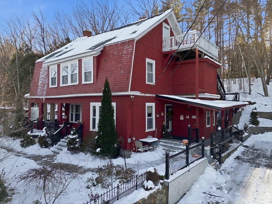
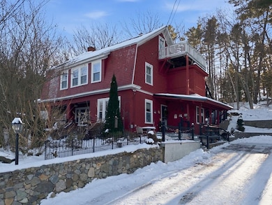
7 Moulton St Raymond, NH 03077
Estimated payment $3,285/month
Highlights
- Hot Property
- Wood Flooring
- Walk-In Closet
- Hilly Lot
- In-Law or Guest Suite
- Laundry Room
About This Home
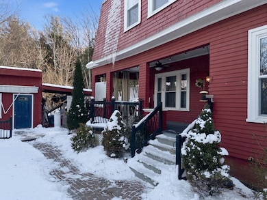
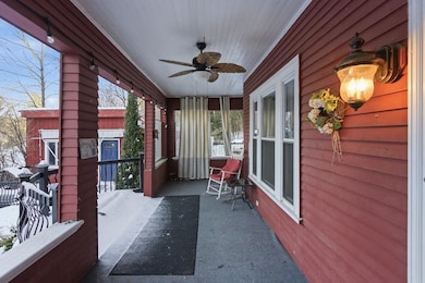
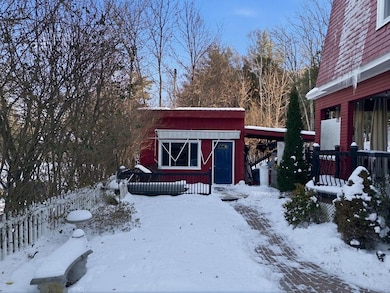
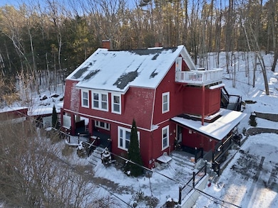
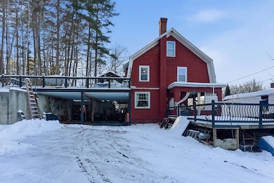
A rare opportunity awaits in this versatile property, featuring a beautifully welcoming 3-bedroom, 2-bath main home paired with a fully independent 1-bedroom, 1-bath apartment, perfect for steady income, multigenerational living, or expanded lifestyle options. Situated on a 0.25-acre lot, the property backs to mature woods that provides a peaceful sense of privacy while still being close to everything you need. Two separate driveways and a large carport provide exceptional convenience, ample parking, and easy access for both the main home and apartment. Three thoughtfully designed decks extend your living space outdoors, creating ideal areas for entertaining, hosting celebrations, or simply unwinding in the fresh air. Inside, this home offers standout features you won’t find everywhere, including convenient refrigerator drawers in the dining room and a smartly designed laundry room located within the primary walk-in closet. Chilly mornings feel extra cozy thanks to heated flooring in the kitchen and first-level bathroom. The location adds even more appeal: medical services, shopping, entertainment, Pawtuckaway State Park, Pawtuckaway Lake, and the renowned Tuckaway Tavern are all just moments away. Commuters will appreciate the easy access to Routes 102, ,27 and NH-101 at Exits 4 and 5. This is truly a must-see property offering comfort, flexibility, privacy, and exceptional convenience. Delayed showings to begin at open house Saturday from 12-2PM.
Listing Agent
East Key Realty Brokerage Phone: 603-944-1456 License #072391 Listed on: 12/11/2025

Open House Schedule
-
Saturday, December 13, 202512:00 to 2:00 pm12/13/2025 12:00:00 PM +00:0012/13/2025 2:00:00 PM +00:00Ok to park in driveway if open.Add to Calendar
Home Details
Home Type
- Single Family
Est. Annual Taxes
- $6,270
Year Built
- Built in 1920
Lot Details
- 0.25 Acre Lot
- Hilly Lot
Parking
- 2 Car Garage
- Carport
- Driveway
Home Design
- Gambrel Roof
- Concrete Foundation
Interior Spaces
- Property has 3 Levels
- Ceiling Fan
- Dining Area
- Basement
- Interior Basement Entry
- Laundry Room
Kitchen
- Gas Range
- Microwave
- Dishwasher
Flooring
- Wood
- Tile
Bedrooms and Bathrooms
- 4 Bedrooms
- Walk-In Closet
- In-Law or Guest Suite
Schools
- Lamprey River Elementary School
- Iber Holmes Gove Middle Sch
- Raymond High School
Additional Features
- Shed
- Accessory Dwelling Unit (ADU)
- Leach Field
Listing and Financial Details
- Legal Lot and Block 11 / 3
- Assessor Parcel Number 28
Map
Home Values in the Area
Average Home Value in this Area
Tax History
| Year | Tax Paid | Tax Assessment Tax Assessment Total Assessment is a certain percentage of the fair market value that is determined by local assessors to be the total taxable value of land and additions on the property. | Land | Improvement |
|---|---|---|---|---|
| 2024 | $5,984 | $273,100 | $76,200 | $196,900 |
| 2023 | $5,659 | $273,100 | $76,200 | $196,900 |
| 2022 | $4,995 | $273,100 | $76,200 | $196,900 |
| 2021 | $5,055 | $273,100 | $76,200 | $196,900 |
| 2020 | $5,298 | $202,200 | $54,500 | $147,700 |
| 2019 | $5,376 | $202,200 | $54,500 | $147,700 |
| 2018 | $5,328 | $202,200 | $54,500 | $147,700 |
| 2017 | $4,893 | $202,200 | $54,500 | $147,700 |
| 2016 | $4,800 | $202,200 | $54,500 | $147,700 |
| 2015 | $4,600 | $183,400 | $54,500 | $128,900 |
| 2014 | $4,277 | $175,800 | $54,500 | $121,300 |
| 2013 | $4,156 | $175,800 | $54,500 | $121,300 |
Property History
| Date | Event | Price | List to Sale | Price per Sq Ft |
|---|---|---|---|---|
| 12/11/2025 12/11/25 | For Sale | $525,000 | -- | $270 / Sq Ft |
Purchase History
| Date | Type | Sale Price | Title Company |
|---|---|---|---|
| Executors Deed | $163,000 | -- | |
| Deed | -- | -- |
Mortgage History
| Date | Status | Loan Amount | Loan Type |
|---|---|---|---|
| Open | $140,974 | FHA | |
| Previous Owner | $195,000 | Unknown |
Source: PrimeMLS
MLS Number: 5071773
APN: RAYM-002803-000000-000011
Disclaimer: Certain information contained herein is derived from information provided by parties other than Homes.com. All information provided is deemed reliable, but is not guaranteed to be accurate and should be independently verified.
![]() Copyright 2025 PrimeMLS, Inc. All rights reserved. This information is deemed reliable, but not guaranteed. The data relating to real estate displayed on this display comes in part from the IDX Program of PrimeMLS. The information being provided is for consumers’ personal, non-commercial use and may not be used for any purpose other than to identify prospective properties consumers may be interested in purchasing.
Copyright 2025 PrimeMLS, Inc. All rights reserved. This information is deemed reliable, but not guaranteed. The data relating to real estate displayed on this display comes in part from the IDX Program of PrimeMLS. The information being provided is for consumers’ personal, non-commercial use and may not be used for any purpose other than to identify prospective properties consumers may be interested in purchasing.
- 29 Harriman Rd
- 209 New Hampshire 27
- 9 Abbey Rd
- 14 Mica Dr Unit 3
- 10 Mica Dr Unit 1
- 16 Mica Dr Unit 4
- 20 Mica Dr Unit 6
- 17 Old Fremont Rd
- 0 Eastside Dr Unit 33
- 18 Nottingham Rd
- 47 Long Hill Rd
- 18 Lilac Ct
- 39 Prescott Rd
- 35 Locksley Ln
- 20 Locksley Ln
- 202 Route 27 Unit 36
- 6 Knights Ct
- 19 Parker Ave
- 5 Ham Rd
- 91 Fremont Rd
- 16 Cote Cir Unit Flr 1
- 40 Route 27
- 1 Feng Dr Unit 1B
- 144 Main St Unit 2
- 454 Main St
- 36 Tenney Rd
- 20 Fieldstone Estate Unit 20
- 5 Mcdaniel Rd
- 315 Old Concord Turnpike Unit 2
- 6 Rocky Ridge Cir
- 41-44 Mckay Dr
- 3 Pembroke Dr Unit 5
- 255 1st New Hampshire Turnpike Unit A through H
- 310 Wadleigh Falls Rd Unit 3
- 50 Brookside Dr Unit 3
- 50 Brookside Dr
- 12 Myrtle St
- 1 Chester Rd Unit G
- 156 Front St Unit 102
- 156 Front St Unit 409