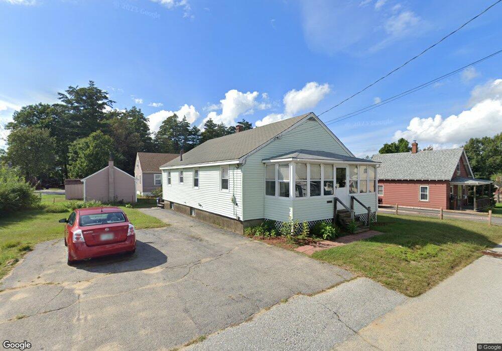
7 Notre Dame Ave Allenstown, NH 03275
Suncook NeighborhoodEstimated Value: $398,000 - $429,000
4
Beds
1
Bath
1,565
Sq Ft
$260/Sq Ft
Est. Value
About This Home
This home is located at 7 Notre Dame Ave, Allenstown, NH 03275 and is currently estimated at $406,428, approximately $259 per square foot. 7 Notre Dame Ave is a home located in Merrimack County with nearby schools including Allenstown Elementary School, Armand R. Dupont School, and Tender Years Child Care & Learning Center.
Ownership History
Date
Name
Owned For
Owner Type
Purchase Details
Closed on
Sep 1, 2010
Sold by
Rondeau Therese
Bought by
Hemeon Phyllis A
Current Estimated Value
Home Financials for this Owner
Home Financials are based on the most recent Mortgage that was taken out on this home.
Original Mortgage
$145,077
Outstanding Balance
$96,332
Interest Rate
4.55%
Mortgage Type
Purchase Money Mortgage
Estimated Equity
$310,096
Create a Home Valuation Report for This Property
The Home Valuation Report is an in-depth analysis detailing your home's value as well as a comparison with similar homes in the area
Home Values in the Area
Average Home Value in this Area
Purchase History
| Date | Buyer | Sale Price | Title Company |
|---|---|---|---|
| Hemeon Phyllis A | $140,000 | -- |
Source: Public Records
Mortgage History
| Date | Status | Borrower | Loan Amount |
|---|---|---|---|
| Open | Hemeon Phyllis A | $145,077 | |
| Previous Owner | Hemeon Phyllis A | $182,000 |
Source: Public Records
Tax History Compared to Growth
Tax History
| Year | Tax Paid | Tax Assessment Tax Assessment Total Assessment is a certain percentage of the fair market value that is determined by local assessors to be the total taxable value of land and additions on the property. | Land | Improvement |
|---|---|---|---|---|
| 2024 | $7,979 | $313,900 | $142,500 | $171,400 |
| 2023 | $6,655 | $313,900 | $142,500 | $171,400 |
| 2022 | $6,121 | $313,900 | $142,500 | $171,400 |
| 2021 | $5,664 | $179,800 | $79,100 | $100,700 |
| 2020 | $5,268 | $179,800 | $79,100 | $100,700 |
| 2019 | $5,592 | $179,800 | $79,100 | $100,700 |
| 2018 | $5,421 | $179,800 | $79,100 | $100,700 |
| 2017 | $5,773 | $179,800 | $79,100 | $100,700 |
| 2016 | $4,906 | $144,900 | $50,800 | $94,100 |
| 2015 | $4,757 | $144,900 | $50,800 | $94,100 |
| 2014 | $4,895 | $144,900 | $50,800 | $94,100 |
| 2013 | $4,502 | $142,800 | $50,800 | $92,000 |
Source: Public Records
Map
Nearby Homes
- 422 Dawn Dr Unit 23
- 427 Dawn Dr Unit 15
- 28 Notre Dame Ave
- 15 Main St
- 4 Rodger Rd
- 7 Ferry St
- 111 Glass St
- 1 1/2 Bartlett St
- 100 Main St Unit M10
- 100 Main St Unit 204
- 19 Sullivan Dr
- 12-14 Church St Unit 12,14
- 10 Lane Dr
- 2 Cheryl Dr
- 15 Sullivan Dr
- 1821 Hooksett Rd
- 259 Pembroke St
- 10 Northview Terrace
- 14 Manor Dr Unit D
- 12 Manor Dr Unit B
- 6 Lafayette St
- 42 Als Ave
- 6 Notre Dame Ave
- 8 Lafayette St
- 8 Notre Dame Ave
- 5 Notre Dame Ave
- 4 Lafayette St
- 48 Als Ave
- 5 Lafayette St
- 15 Lafayette St
- 4 Notre Dame Ave
- 41 Als Ave
- 3 Lafayette St
- 2 Lafayette St
- 50 Als Ave
- 15 Notre Dame Ave
- 2 Notre Dame Ave
- 1 Lafayette St
- 10 Notre Dame Ave
- 1 Notre Dame Ave