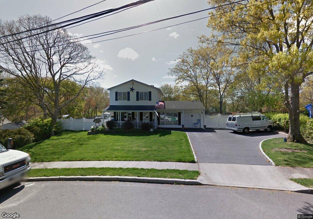
7 Sandie Ct Patchogue, NY 11772
Central Fire Island NeighborhoodEstimated Value: $634,755 - $706,000
4
Beds
2
Baths
1,971
Sq Ft
$338/Sq Ft
Est. Value
About This Home
This home is located at 7 Sandie Ct, Patchogue, NY 11772 and is currently estimated at $666,439, approximately $338 per square foot. 7 Sandie Ct is a home located in Suffolk County with nearby schools including Holy Angels Regional School.
Ownership History
Date
Name
Owned For
Owner Type
Purchase Details
Closed on
Jun 3, 2004
Sold by
Stauffer Barbara
Bought by
Morrissey Donal E and Morrissey Sandra L
Current Estimated Value
Home Financials for this Owner
Home Financials are based on the most recent Mortgage that was taken out on this home.
Original Mortgage
$32,500
Interest Rate
5.68%
Mortgage Type
Unknown
Purchase Details
Closed on
Sep 22, 2000
Sold by
Stauffer Richard and Stauffer Barbara
Bought by
Stauffer Barbara
Create a Home Valuation Report for This Property
The Home Valuation Report is an in-depth analysis detailing your home's value as well as a comparison with similar homes in the area
Home Values in the Area
Average Home Value in this Area
Purchase History
| Date | Buyer | Sale Price | Title Company |
|---|---|---|---|
| Morrissey Donal E | $325,000 | -- | |
| Stauffer Barbara | -- | Globe Title Agency |
Source: Public Records
Mortgage History
| Date | Status | Borrower | Loan Amount |
|---|---|---|---|
| Closed | Morrissey Donal E | $32,500 | |
| Open | Morrissey Donal E | $260,000 |
Source: Public Records
Tax History
| Year | Tax Paid | Tax Assessment Tax Assessment Total Assessment is a certain percentage of the fair market value that is determined by local assessors to be the total taxable value of land and additions on the property. | Land | Improvement |
|---|---|---|---|---|
| 2024 | $12,486 | $2,765 | $350 | $2,415 |
| 2023 | $12,486 | $2,765 | $350 | $2,415 |
| 2022 | $9,913 | $2,765 | $350 | $2,415 |
| 2021 | $9,913 | $2,765 | $350 | $2,415 |
| 2020 | $10,355 | $2,765 | $350 | $2,415 |
| 2019 | $10,355 | $0 | $0 | $0 |
| 2018 | $8,814 | $2,765 | $350 | $2,415 |
| 2017 | $8,814 | $2,565 | $350 | $2,215 |
| 2016 | $9,112 | $2,700 | $350 | $2,350 |
| 2015 | -- | $2,700 | $350 | $2,350 |
| 2014 | -- | $2,700 | $350 | $2,350 |
Source: Public Records
Map
Nearby Homes
- 466 Great South Bay Walk
- 529 Sail Walk
- 445 Sail Walk
- 451 Ocean Walk
- 521 Fire Island Blvd
- 313 Fire Island Blvd
- 279 Bay Walk
- 284 Bay Walk
- 362 Ocean Walk
- 487 Tarpon Walk
- 240 Harbor Walk Unit C240
- 31 Lone Hill Walk
- 4 Grandview Dr
- Harbor Harbor Walk Unit 136
- 142 Atlantic Walk Unit C142
- 92 Teal Walk
- 39 Lone Hill Walk
- 20 S Breeze Dr
- 499 Grove Ave
- 172 Pine Walk
- 95 Sandpiper Walk
- 5 Sandpiper Walk
- 12 Seafoam Walk
- 6 Seafoam Walk
- 8 Seafoam Walk
- 11 Sandpiper Walk
- 4 Seafoam Walk
- 13 Whale Bone Walk
- 2 Leeward Walk
- 2 Sandpiper Walk
- 6 Whalebone Walk
- 4 Leeward Walk
- 44 Spindrift Walk
- 36 Spindrift Walk
- 34 Danes St
- 32 Danes St
- 30 Danes St
- 1 Whale Bone Walk
- 30 Spindrift Walk
Your Personal Tour Guide
Ask me questions while you tour the home.