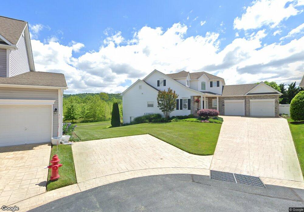
7 Stine Ct Middletown, MD 21769
Estimated Value: $688,555 - $895,000
Studio
2
Baths
3,208
Sq Ft
$240/Sq Ft
Est. Value
About This Home
This home is located at 7 Stine Ct, Middletown, MD 21769 and is currently estimated at $768,639, approximately $239 per square foot. 7 Stine Ct is a home located in Frederick County with nearby schools including Middletown Elementary School, Middletown Middle School, and Middletown High School.
Ownership History
Date
Name
Owned For
Owner Type
Purchase Details
Closed on
Nov 14, 2023
Sold by
Blough William B and Blough Anne H
Bought by
William B Blough And Anne H Blough Revocable and Blough
Current Estimated Value
Purchase Details
Closed on
Oct 1, 2008
Sold by
Coblentz Farm Ltd Part
Bought by
Blough William B and Blough Anne H
Home Financials for this Owner
Home Financials are based on the most recent Mortgage that was taken out on this home.
Original Mortgage
$260,000
Interest Rate
6.43%
Mortgage Type
Purchase Money Mortgage
Purchase Details
Closed on
Sep 26, 2008
Sold by
Coblentz Farm Ltd Part
Bought by
Blough William B and Blough Anne H
Home Financials for this Owner
Home Financials are based on the most recent Mortgage that was taken out on this home.
Original Mortgage
$260,000
Interest Rate
6.43%
Mortgage Type
Purchase Money Mortgage
Create a Home Valuation Report for This Property
The Home Valuation Report is an in-depth analysis detailing your home's value as well as a comparison with similar homes in the area
Home Values in the Area
Average Home Value in this Area
Purchase History
| Date | Buyer | Sale Price | Title Company |
|---|---|---|---|
| William B Blough And Anne H Blough Revocable | -- | None Listed On Document | |
| Blough William B | $548,446 | -- | |
| Blough William B | $548,446 | -- |
Source: Public Records
Mortgage History
| Date | Status | Borrower | Loan Amount |
|---|---|---|---|
| Previous Owner | Blough William B | $260,000 | |
| Previous Owner | Blough William B | $260,000 |
Source: Public Records
Tax History
| Year | Tax Paid | Tax Assessment Tax Assessment Total Assessment is a certain percentage of the fair market value that is determined by local assessors to be the total taxable value of land and additions on the property. | Land | Improvement |
|---|---|---|---|---|
| 2025 | $7,627 | $619,333 | -- | -- |
| 2024 | $7,627 | $558,367 | $0 | $0 |
| 2023 | $7,072 | $497,400 | $96,800 | $400,600 |
| 2022 | $6,856 | $487,333 | $0 | $0 |
| 2021 | $6,576 | $477,267 | $0 | $0 |
| 2020 | $6,576 | $467,200 | $89,700 | $377,500 |
| 2019 | $6,548 | $465,200 | $0 | $0 |
| 2018 | $6,591 | $463,200 | $0 | $0 |
| 2017 | $6,493 | $461,200 | $0 | $0 |
| 2016 | $5,760 | $441,800 | $0 | $0 |
| 2015 | $5,760 | $422,400 | $0 | $0 |
| 2014 | $5,760 | $403,000 | $0 | $0 |
Source: Public Records
Map
Nearby Homes
- 1 Keller Ln
- 204 Rod Cir
- 24 Woodmere Cir
- 706 E Main St
- 7705 Ridge Rd
- 100 Lombardy Dr
- 200 E Main St
- 7129 Limestone Ln
- 114 E Main St
- 207 Broad St
- 215 Broad St
- 4311 Zircon Rd
- 1 Walnut Pond Ct
- 25 Chester Ct
- 8511 Rosebud Ct
- 417 W Main St
- 26 Walnut St
- 710 Iron Forge Rd
- 3213 Old National Pike
- 8109 Old Hagerstown Rd
Your Personal Tour Guide
Ask me questions while you tour the home.