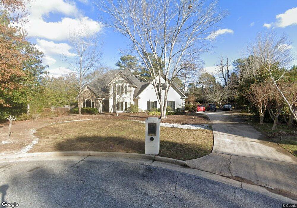
7 Stonewood Ct Columbus, GA 31904
Estimated Value: $451,000 - $595,000
4
Beds
4
Baths
3,759
Sq Ft
$134/Sq Ft
Est. Value
About This Home
This home is located at 7 Stonewood Ct, Columbus, GA 31904 and is currently estimated at $503,827, approximately $134 per square foot. 7 Stonewood Ct is a home located in Muscogee County with nearby schools including River Road Elementary School, Double Churches Middle School, and Northside High School.
Ownership History
Date
Name
Owned For
Owner Type
Purchase Details
Closed on
Jun 15, 2015
Sold by
Jinks G C
Bought by
Adamian Armen M and Adamian Wendy M
Current Estimated Value
Home Financials for this Owner
Home Financials are based on the most recent Mortgage that was taken out on this home.
Original Mortgage
$383,200
Outstanding Balance
$298,588
Interest Rate
3.92%
Mortgage Type
VA
Estimated Equity
$205,239
Create a Home Valuation Report for This Property
The Home Valuation Report is an in-depth analysis detailing your home's value as well as a comparison with similar homes in the area
Home Values in the Area
Average Home Value in this Area
Purchase History
| Date | Buyer | Sale Price | Title Company |
|---|---|---|---|
| Adamian Armen M | $371,000 | -- |
Source: Public Records
Mortgage History
| Date | Status | Borrower | Loan Amount |
|---|---|---|---|
| Open | Adamian Armen M | $383,200 |
Source: Public Records
Tax History Compared to Growth
Tax History
| Year | Tax Paid | Tax Assessment Tax Assessment Total Assessment is a certain percentage of the fair market value that is determined by local assessors to be the total taxable value of land and additions on the property. | Land | Improvement |
|---|---|---|---|---|
| 2025 | $135 | $156,220 | $30,784 | $125,436 |
| 2024 | $6,115 | $156,220 | $30,784 | $125,436 |
| 2023 | $6,154 | $156,220 | $30,784 | $125,436 |
| 2022 | $5,745 | $140,712 | $30,784 | $109,928 |
| 2021 | $5,401 | $132,276 | $30,784 | $101,492 |
| 2020 | $5,402 | $132,276 | $30,784 | $101,492 |
| 2019 | $5,419 | $132,276 | $30,784 | $101,492 |
| 2018 | $5,419 | $132,276 | $30,784 | $101,492 |
| 2017 | $5,437 | $132,276 | $30,784 | $101,492 |
| 2016 | $6,102 | $147,936 | $15,891 | $132,045 |
| 2015 | $3,275 | $147,936 | $15,891 | $132,045 |
| 2014 | -- | $147,936 | $15,891 | $132,045 |
| 2013 | -- | $147,936 | $15,891 | $132,045 |
Source: Public Records
Map
Nearby Homes
- 5 Bridgecreek Ct
- 6130 Brookstone Blvd
- 6390 Cape Cod Dr
- 6130 Bristol Blvd
- 6333 Cape Cod Dr
- 521 Newport Place
- 616 Newport Place
- 5908 Brookstone Blvd
- 438 Newport Place
- 6101 River Rd Unit 2
- 235 Pebblebrook Ln
- 223 Pebblebrook Ln
- 5777 Roaring Branch Rd
- 239 Clearbrook Ln
- 7233 Mobley Walk Dr
- 6688 Creekview Place
- 280 Zachary Ct
- 254 Cascade Rd
- 222 Cascade Rd
- 7015 Spring Walk Dr
- 6 Stonewood Ct
- 8 Stonewood Ct
- 6141 Brookstone Blvd
- 6151 Brookstone Blvd
- 5 Stonewood Ct
- 9 Stonewood Ct
- 6161 Brookstone Blvd
- 6 Bridgecreek Ct
- 4 Bridgecreek Ct
- 6201 Brookstone Blvd
- 10 Stonewood Ct
- 4 Stonewood Ct
- 6150 Brookstone Blvd
- 6140 Brookstone Blvd
- 3 Bridgecreek Ct
- 7 Bridgecreek Ct
- 6221 Brookstone Blvd
- 11 Stonewood Ct
- 6200 Brookstone Blvd
- 8 Bridgecreek Ct