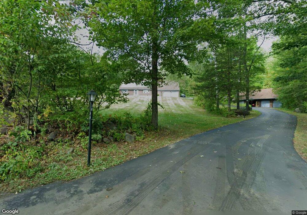
70 Curtis Farm Rd Wilton, NH 03086
Estimated Value: $625,000 - $801,000
4
Beds
3
Baths
3,041
Sq Ft
$236/Sq Ft
Est. Value
About This Home
This home is located at 70 Curtis Farm Rd, Wilton, NH 03086 and is currently estimated at $717,140, approximately $235 per square foot. 70 Curtis Farm Rd is a home located in Hillsborough County with nearby schools including Florence Rideout Elementary School, Wilton-Lyndeborough Cooperative Middle School, and Wilton-Lyndeborough Cooperative High School.
Ownership History
Date
Name
Owned For
Owner Type
Purchase Details
Closed on
Jul 31, 2019
Sold by
Jasper James A and Jasper Anne M
Bought by
Jasper Ft
Current Estimated Value
Purchase Details
Closed on
Apr 18, 2000
Sold by
Burns John E and Burns Cheryl A
Bought by
Jasper James A and Jasper Anne M
Home Financials for this Owner
Home Financials are based on the most recent Mortgage that was taken out on this home.
Original Mortgage
$136,000
Interest Rate
8.26%
Create a Home Valuation Report for This Property
The Home Valuation Report is an in-depth analysis detailing your home's value as well as a comparison with similar homes in the area
Home Values in the Area
Average Home Value in this Area
Purchase History
| Date | Buyer | Sale Price | Title Company |
|---|---|---|---|
| Jasper Ft | -- | -- | |
| Jasper James A | $245,000 | -- |
Source: Public Records
Mortgage History
| Date | Status | Borrower | Loan Amount |
|---|---|---|---|
| Previous Owner | Jasper James A | $136,000 |
Source: Public Records
Tax History Compared to Growth
Tax History
| Year | Tax Paid | Tax Assessment Tax Assessment Total Assessment is a certain percentage of the fair market value that is determined by local assessors to be the total taxable value of land and additions on the property. | Land | Improvement |
|---|---|---|---|---|
| 2024 | $12,654 | $508,800 | $121,800 | $387,000 |
| 2023 | $11,295 | $508,800 | $121,800 | $387,000 |
| 2022 | $10,512 | $508,800 | $121,800 | $387,000 |
| 2021 | $9,779 | $508,800 | $121,800 | $387,000 |
| 2020 | $10,392 | $353,600 | $91,800 | $261,800 |
| 2019 | $10,266 | $353,500 | $91,800 | $261,700 |
| 2018 | $10,167 | $353,500 | $91,800 | $261,700 |
| 2017 | $9,061 | $333,500 | $91,800 | $241,700 |
| 2016 | $8,784 | $333,500 | $91,800 | $241,700 |
| 2015 | $8,647 | $328,300 | $99,000 | $229,300 |
| 2014 | $8,542 | $331,100 | $99,000 | $232,100 |
| 2013 | $8,615 | $331,100 | $99,000 | $232,100 |
Source: Public Records
Map
Nearby Homes
- 27 Island St
- 10 Mill St
- 8 Maple St
- 81 Abbot Hill Acres
- F/88-5 McGettigan Rd
- F/88-4 McGettigan Rd
- 134 Falcon Ridge Rd Unit 23
- 24 Glass Factory Rd
- 88 McGettigan Rd Unit 88-6-1
- A 66 Burton Hwy
- Lots 4 & 7 Gibbons & Robbins Rd
- 0 Marden Rd
- F-88-10 Aria Hill Dr
- F-88-11 Aria Hill Dr
- F-88-12 Aria Hill Dr
- F-88-7 Aria Hill Dr
- Lot F-88-9 Aria Hill Dr
- 59 Goldsmith Rd
- 222 Forest Rd
- 60 Goldsmith Rd
- 60 Curtis Farm Rd
- 79 Curtis Farm Rd
- 103 Curtis Farm Rd Unit B-75-1
- 61 Curtis Farm Rd
- 48 Curtis Farm Rd
- 36 Curtis Farm Rd
- 43 Curtis Farm Rd
- 209 Forest Rd
- 31 Curtis Farm Rd
- 255 Forest Rd
- 13 Country Way
- 259 Forest Rd
- 20 Curtis Farm Rd
- 47 Country Way
- 139 Curtis Farm Rd
- 59 Country Way
- Lot 21-5 Dale St
- 193 Dale St
- 189 Dale St
- 317 Forest Rd