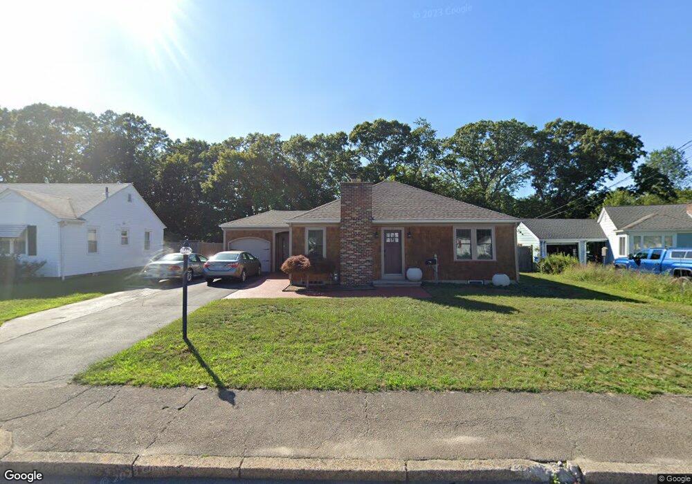
70 Forbes St Riverside, RI 02915
Riverside NeighborhoodEstimated Value: $471,000 - $499,000
4
Beds
2
Baths
1,950
Sq Ft
$249/Sq Ft
Est. Value
About This Home
This home is located at 70 Forbes St, Riverside, RI 02915 and is currently estimated at $484,925, approximately $248 per square foot. 70 Forbes St is a home located in Providence County with nearby schools including East Providence High School, St Mary Academy-Bay View, and St Luke Elementary School.
Ownership History
Date
Name
Owned For
Owner Type
Purchase Details
Closed on
May 9, 1997
Sold by
Anderson John R and Anderson Teresa
Bought by
Simpson Eric L and Simpson Laurie
Current Estimated Value
Home Financials for this Owner
Home Financials are based on the most recent Mortgage that was taken out on this home.
Original Mortgage
$105,000
Interest Rate
7.88%
Mortgage Type
Purchase Money Mortgage
Create a Home Valuation Report for This Property
The Home Valuation Report is an in-depth analysis detailing your home's value as well as a comparison with similar homes in the area
Home Values in the Area
Average Home Value in this Area
Purchase History
| Date | Buyer | Sale Price | Title Company |
|---|---|---|---|
| Simpson Eric L | $115,000 | -- | |
| Simpson Eric L | $115,000 | -- |
Source: Public Records
Mortgage History
| Date | Status | Borrower | Loan Amount |
|---|---|---|---|
| Open | Simpson Eric L | $50,000 | |
| Closed | Simpson Eric L | $71,300 | |
| Closed | Simpson Eric L | $108,000 | |
| Closed | Simpson Eric L | $105,000 |
Source: Public Records
Tax History Compared to Growth
Tax History
| Year | Tax Paid | Tax Assessment Tax Assessment Total Assessment is a certain percentage of the fair market value that is determined by local assessors to be the total taxable value of land and additions on the property. | Land | Improvement |
|---|---|---|---|---|
| 2025 | $5,985 | $457,900 | $146,100 | $311,800 |
| 2024 | $6,032 | $393,500 | $121,700 | $271,800 |
| 2023 | $5,808 | $393,500 | $121,700 | $271,800 |
| 2022 | $5,705 | $261,000 | $66,600 | $194,400 |
| 2021 | $5,612 | $261,000 | $63,400 | $197,600 |
| 2020 | $5,374 | $261,000 | $63,400 | $197,600 |
| 2019 | $5,225 | $261,000 | $63,400 | $197,600 |
| 2018 | $4,722 | $206,400 | $61,800 | $144,600 |
| 2017 | $4,617 | $206,400 | $61,800 | $144,600 |
| 2016 | $4,594 | $206,400 | $61,800 | $144,600 |
| 2015 | $4,393 | $191,400 | $60,000 | $131,400 |
| 2014 | $4,393 | $191,400 | $60,000 | $131,400 |
Source: Public Records
Map
Nearby Homes
- 151 Willett Ave Unit 2
- 151 Willett Ave Unit 5
- 25 Arnold St
- 81 Sprague Ave
- 57 Harris St
- 1 Fales St
- 74 Plum Rd
- 536 Willett Ave
- 25 Read St
- 43 Bullocks Point Ave Unit 4C
- 25 Bullocks Point Ave Unit 5C
- 25 Woodbine St
- 6 Fuller Ave
- 36 Woodbine St
- 31 Bullocks Point Ave Unit 2A
- 3421 Pawtucket Ave
- 17 Oak Ave
- 25 Winslow St
- 33 Pine St Unit 35
- 88 Lincoln Ave