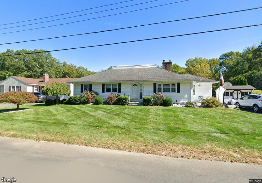
70 Hewitt St West Springfield, MA 01089
Estimated Value: $407,502 - $435,000
4
Beds
2
Baths
1,764
Sq Ft
$238/Sq Ft
Est. Value
About This Home
This home is located at 70 Hewitt St, West Springfield, MA 01089 and is currently estimated at $420,626, approximately $238 per square foot. 70 Hewitt St is a home located in Hampden County with nearby schools including West Springfield High School, Hampden Charter School of Science West, and St Thomas The Apostle School.
Ownership History
Date
Name
Owned For
Owner Type
Purchase Details
Closed on
Apr 29, 2025
Sold by
Barrett Glenn P and Page-Barrett Ann E
Bought by
Page Barrett T and Page Page-Barrett
Current Estimated Value
Purchase Details
Closed on
Oct 26, 1994
Sold by
Barrett John E and Barrett Sheila A
Bought by
Barrett Glenn P and Barrett Ann E P
Home Financials for this Owner
Home Financials are based on the most recent Mortgage that was taken out on this home.
Original Mortgage
$60,000
Interest Rate
8.65%
Mortgage Type
Purchase Money Mortgage
Create a Home Valuation Report for This Property
The Home Valuation Report is an in-depth analysis detailing your home's value as well as a comparison with similar homes in the area
Home Values in the Area
Average Home Value in this Area
Purchase History
| Date | Buyer | Sale Price | Title Company |
|---|---|---|---|
| Page Barrett T | -- | None Available | |
| Page Barrett T | -- | None Available | |
| Barrett Glenn P | $60,000 | -- | |
| Barrett Glenn P | $60,000 | -- |
Source: Public Records
Mortgage History
| Date | Status | Borrower | Loan Amount |
|---|---|---|---|
| Previous Owner | Barrett Glenn P | $82,000 | |
| Previous Owner | Barrett Glenn P | $25,000 | |
| Previous Owner | Barrett Glenn P | $60,000 |
Source: Public Records
Tax History Compared to Growth
Tax History
| Year | Tax Paid | Tax Assessment Tax Assessment Total Assessment is a certain percentage of the fair market value that is determined by local assessors to be the total taxable value of land and additions on the property. | Land | Improvement |
|---|---|---|---|---|
| 2025 | $5,112 | $343,800 | $110,300 | $233,500 |
| 2024 | $5,006 | $338,000 | $110,300 | $227,700 |
| 2023 | $5,088 | $327,400 | $110,300 | $217,100 |
| 2022 | $4,599 | $291,800 | $100,100 | $191,700 |
| 2021 | $4,504 | $266,500 | $95,300 | $171,200 |
| 2020 | $4,528 | $266,500 | $95,300 | $171,200 |
| 2019 | $4,520 | $266,500 | $95,300 | $171,200 |
| 2018 | $4,544 | $266,500 | $95,300 | $171,200 |
| 2017 | $4,544 | $266,500 | $95,300 | $171,200 |
| 2016 | $4,504 | $265,100 | $91,700 | $173,400 |
| 2015 | $4,419 | $260,100 | $89,900 | $170,200 |
| 2014 | $1,064 | $260,100 | $89,900 | $170,200 |
Source: Public Records
Map
Nearby Homes
- 75 Birnie Ave
- 86 Birnie Ave
- 89 Vincent Dr
- 34 High Meadow Dr
- 43 Wishing Well Way
- Lot 3 Hyde Rd
- 236 Forest Glen
- 64 Apple Ridge Rd
- 59 Beech Hill Rd
- 36 Shady Brook
- 9 Annie's Way
- 26 Clayton Dr
- 11 Annie's Way
- 12 Victorian Dr
- 59 Clayton Dr
- 114 Connecticut Ave
- 81 Laurence Dr
- 32 Windpath E
- 80 Brush Hill Ave Unit 35
- 80 Brush Hill Ave Unit 28