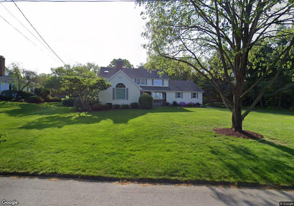
70 Puritan Rd Trumbull, CT 06611
Trumbull Center NeighborhoodEstimated Value: $955,267 - $1,099,000
4
Beds
4
Baths
3,097
Sq Ft
$331/Sq Ft
Est. Value
About This Home
This home is located at 70 Puritan Rd, Trumbull, CT 06611 and is currently estimated at $1,025,817, approximately $331 per square foot. 70 Puritan Rd is a home located in Fairfield County with nearby schools including Booth Hill School, Hillcrest Middle School, and Trumbull High School.
Ownership History
Date
Name
Owned For
Owner Type
Purchase Details
Closed on
May 3, 1999
Sold by
Smolinski Madeleine J
Bought by
Hutton R Wayne and Hutton Karen E
Current Estimated Value
Home Financials for this Owner
Home Financials are based on the most recent Mortgage that was taken out on this home.
Original Mortgage
$200,000
Outstanding Balance
$50,264
Interest Rate
6.95%
Estimated Equity
$975,553
Purchase Details
Closed on
Jan 5, 1988
Sold by
Keift John
Bought by
Smolinski Thomas
Home Financials for this Owner
Home Financials are based on the most recent Mortgage that was taken out on this home.
Original Mortgage
$165,000
Interest Rate
10.59%
Create a Home Valuation Report for This Property
The Home Valuation Report is an in-depth analysis detailing your home's value as well as a comparison with similar homes in the area
Home Values in the Area
Average Home Value in this Area
Purchase History
| Date | Buyer | Sale Price | Title Company |
|---|---|---|---|
| Hutton R Wayne | $419,000 | -- | |
| Smolinski Thomas | $476,000 | -- |
Source: Public Records
Mortgage History
| Date | Status | Borrower | Loan Amount |
|---|---|---|---|
| Open | Smolinski Thomas | $200,000 | |
| Previous Owner | Smolinski Thomas | $100,000 | |
| Previous Owner | Smolinski Thomas | $165,000 |
Source: Public Records
Tax History Compared to Growth
Tax History
| Year | Tax Paid | Tax Assessment Tax Assessment Total Assessment is a certain percentage of the fair market value that is determined by local assessors to be the total taxable value of land and additions on the property. | Land | Improvement |
|---|---|---|---|---|
| 2025 | $16,191 | $438,060 | $170,030 | $268,030 |
| 2024 | $15,725 | $438,060 | $170,030 | $268,030 |
| 2023 | $15,486 | $438,060 | $170,030 | $268,030 |
| 2022 | $15,247 | $438,060 | $170,030 | $268,030 |
| 2021 | $14,638 | $407,120 | $173,880 | $233,240 |
| 2020 | $14,638 | $407,120 | $173,880 | $233,240 |
| 2018 | $14,318 | $407,120 | $173,880 | $233,240 |
| 2017 | $14,046 | $407,120 | $173,880 | $233,240 |
| 2016 | $13,782 | $407,120 | $173,880 | $233,240 |
| 2015 | $13,713 | $406,900 | $173,900 | $233,000 |
| 2014 | $13,420 | $406,900 | $173,900 | $233,000 |
Source: Public Records
Map
Nearby Homes
- 0 Lot #4 & Lot #5 W Mischa Rd Unit 24138429
- 101 Golden Hill St
- 0 Pinewood Trail
- 401 Unity Rd
- 480 Shelton Rd
- 2921 Nichols Ave
- 1 Village Dr
- 2428 Huntington Turnpike
- 2449 Huntington Turnpike
- 50 Hemlock Trail
- 244 Strobel Rd
- 121 Paugusett Cir
- 122 Paugusett Cir
- 7 Manor Dr
- 11 Knollcrest Dr
- 11 Laurel St
- 23 Finchwood Dr
- 58 Daniels Farm Rd
- 375 Silver St
- 175 Post Oak Rd
- 74 Puritan Rd
- 32 Cornfield Rd
- 36 Cornfield Rd
- 43 Old Dairy Rd
- 47 Old Dairy Rd
- 71 Puritan Rd
- 67 Puritan Rd
- 51 Old Dairy Rd
- 33 Cornfield Rd
- 63 Puritan Rd
- 37 Old Dairy Rd
- 37 Cornfield Rd
- 59 Puritan Rd
- 26 Cornfield Rd
- 33 Robinwood Rd
- 29 Robinwood Rd
- 35 Robinwood Rd
- 25 Robinwood Rd
- 61 Green Ridge Rd
- 37 Robinwood Rd