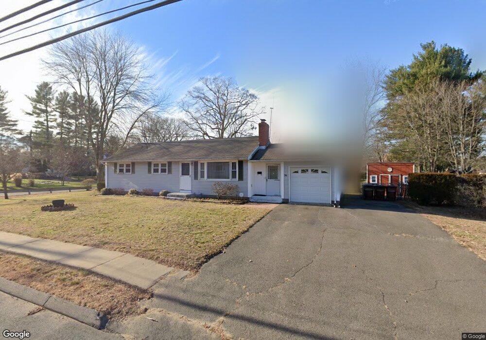
70 Raffia Rd Enfield, CT 06082
Estimated Value: $226,000 - $309,000
3
Beds
2
Baths
1,008
Sq Ft
$270/Sq Ft
Est. Value
About This Home
This home is located at 70 Raffia Rd, Enfield, CT 06082 and is currently estimated at $271,671, approximately $269 per square foot. 70 Raffia Rd is a home located in Hartford County with nearby schools including Eli Whitney Elementary School, Hazardville Memorial Elementary School, and Enfield High School.
Ownership History
Date
Name
Owned For
Owner Type
Purchase Details
Closed on
Apr 22, 2022
Sold by
Olesen Linda J
Bought by
Olesen Jody J
Current Estimated Value
Home Financials for this Owner
Home Financials are based on the most recent Mortgage that was taken out on this home.
Original Mortgage
$120,800
Outstanding Balance
$112,578
Interest Rate
4.16%
Mortgage Type
Purchase Money Mortgage
Estimated Equity
$159,093
Purchase Details
Closed on
Jul 30, 2004
Sold by
Nodland Kenneth and Nodland Diana
Bought by
Olesen Arthur and Olesen Linda
Home Financials for this Owner
Home Financials are based on the most recent Mortgage that was taken out on this home.
Original Mortgage
$100,000
Interest Rate
6.33%
Mortgage Type
Purchase Money Mortgage
Create a Home Valuation Report for This Property
The Home Valuation Report is an in-depth analysis detailing your home's value as well as a comparison with similar homes in the area
Home Values in the Area
Average Home Value in this Area
Purchase History
| Date | Buyer | Sale Price | Title Company |
|---|---|---|---|
| Olesen Jody J | $151,000 | None Available | |
| Olesen Arthur | $173,000 | -- |
Source: Public Records
Mortgage History
| Date | Status | Borrower | Loan Amount |
|---|---|---|---|
| Open | Olesen Jody J | $120,800 | |
| Previous Owner | Olesen Arthur | $114,500 | |
| Previous Owner | Olesen Arthur | $119,500 | |
| Previous Owner | Olesen Arthur | $15,000 | |
| Previous Owner | Olesen Arthur | $100,000 |
Source: Public Records
Tax History
| Year | Tax Paid | Tax Assessment Tax Assessment Total Assessment is a certain percentage of the fair market value that is determined by local assessors to be the total taxable value of land and additions on the property. | Land | Improvement |
|---|---|---|---|---|
| 2025 | $4,888 | $139,700 | $54,500 | $85,200 |
| 2024 | $4,757 | $139,700 | $54,500 | $85,200 |
| 2023 | $4,722 | $139,700 | $54,500 | $85,200 |
| 2022 | $4,287 | $139,700 | $54,500 | $85,200 |
| 2021 | $4,183 | $111,450 | $45,190 | $66,260 |
| 2020 | $4,183 | $111,450 | $45,190 | $66,260 |
| 2019 | $4,194 | $111,450 | $45,190 | $66,260 |
| 2018 | $4,124 | $111,450 | $45,190 | $66,260 |
| 2017 | $3,893 | $111,450 | $45,190 | $66,260 |
| 2016 | $3,811 | $111,070 | $46,370 | $64,700 |
| 2015 | $3,692 | $111,070 | $46,370 | $64,700 |
| 2014 | $3,596 | $111,070 | $46,370 | $64,700 |
Source: Public Records
Map
Nearby Homes
Your Personal Tour Guide
Ask me questions while you tour the home.