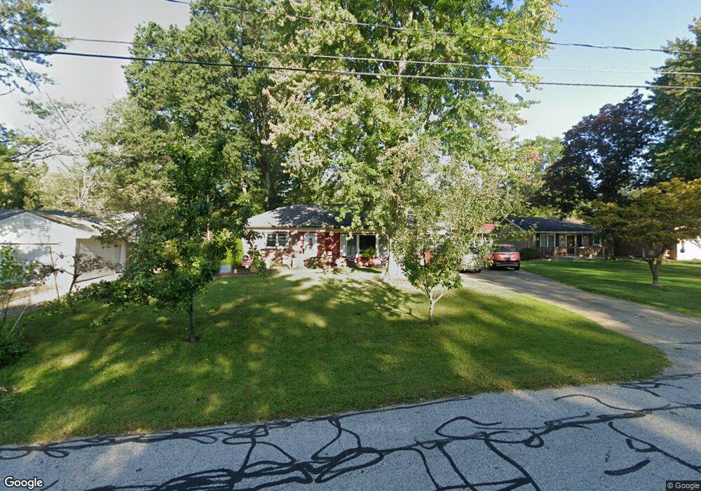
70 Shipherd Cir Oberlin, OH 44074
Estimated Value: $291,911 - $364,000
3
Beds
3
Baths
2,132
Sq Ft
$154/Sq Ft
Est. Value
About This Home
This home is located at 70 Shipherd Cir, Oberlin, OH 44074 and is currently estimated at $328,728, approximately $154 per square foot. 70 Shipherd Cir is a home located in Lorain County with nearby schools including Oberlin Elementary School, Prospect Elementary School, and Langston Middle School.
Ownership History
Date
Name
Owned For
Owner Type
Purchase Details
Closed on
Mar 29, 2007
Sold by
Freas Henry J and Freas Pauline G
Bought by
Freas Aaron P and Freas Dawn M
Current Estimated Value
Home Financials for this Owner
Home Financials are based on the most recent Mortgage that was taken out on this home.
Original Mortgage
$165,000
Interest Rate
6.31%
Mortgage Type
Purchase Money Mortgage
Purchase Details
Closed on
Jul 22, 2005
Sold by
Freas Henry J and Freas Pauline G
Bought by
Freas Henry J and Freas Pauline G
Create a Home Valuation Report for This Property
The Home Valuation Report is an in-depth analysis detailing your home's value as well as a comparison with similar homes in the area
Home Values in the Area
Average Home Value in this Area
Purchase History
We collect this data history from publicly available records. To have your information removed, we recommend requesting removal directly through your county’s website.
| Date | Buyer | Sale Price | Title Company |
|---|---|---|---|
| Freas Aaron P | $165,000 | Elyria Land Title | |
| Freas Henry J | -- | -- |
Source: Public Records
Mortgage History
We collect this data history from publicly available records. To have your information removed, we recommend requesting removal directly through your county’s website.
| Date | Status | Borrower | Loan Amount |
|---|---|---|---|
| Closed | Freas Aaron P | $165,000 |
Source: Public Records
Tax History
| Year | Tax Paid | Tax Assessment Tax Assessment Total Assessment is a certain percentage of the fair market value that is determined by local assessors to be the total taxable value of land and additions on the property. | Land | Improvement |
|---|---|---|---|---|
| 2024 | $4,354 | $88,540 | $21,039 | $67,501 |
| 2023 | $3,995 | $73,021 | $18,207 | $54,814 |
| 2022 | $3,888 | $73,021 | $18,207 | $54,814 |
| 2021 | $3,881 | $73,021 | $18,207 | $54,814 |
| 2020 | $3,503 | $61,930 | $15,440 | $46,490 |
| 2019 | $3,463 | $61,930 | $15,440 | $46,490 |
| 2018 | $3,201 | $61,930 | $15,440 | $46,490 |
| 2017 | $2,915 | $53,110 | $8,820 | $44,290 |
| 2016 | $2,944 | $53,110 | $8,820 | $44,290 |
| 2015 | $2,947 | $53,110 | $8,820 | $44,290 |
| 2014 | $2,850 | $50,100 | $8,320 | $41,780 |
| 2013 | $2,801 | $50,100 | $8,320 | $41,780 |
Source: Public Records
Map
Nearby Homes
- 95 Shipherd Cir
- 0 S Park St
- VL Oberlin Rd
- 81 S Pleasant St
- 65 E Vine St
- 65 E College St Unit 203
- 65 E College St
- 831 Kimberly Cir
- 617 E Lorain St
- VL Smith St
- 182 E Hamilton St
- 89 S Professor St
- 123 S Professor St
- 216 N Main St
- VL E Hamilton St
- 360 S Main St
- 27 Union St
- 18 Union St
- 147 Morgan St
- 149 Morgan St
- 62 Shipherd Cir
- 78 Shipherd Cir
- 84 Shipherd Cir
- 56 Shipherd Cir
- 59 Shipherd Cir
- 81 Shipherd Cir
- 94 Shipherd Cir
- 48 Shipherd Cir
- 49 Shipherd Cir
- 40 Shipherd Cir
- 102 Shipherd Cir
- 46 Stewart Ct
- 107 Shipherd Cir
- 36 Stewart Ct
- 335 E College St
- 26 Shipherd Cir
- 351 E College St
- 41 Shipherd Cir
- 129 Shipherd Cir
- 355 E College St
Your Personal Tour Guide
Ask me questions while you tour the home.