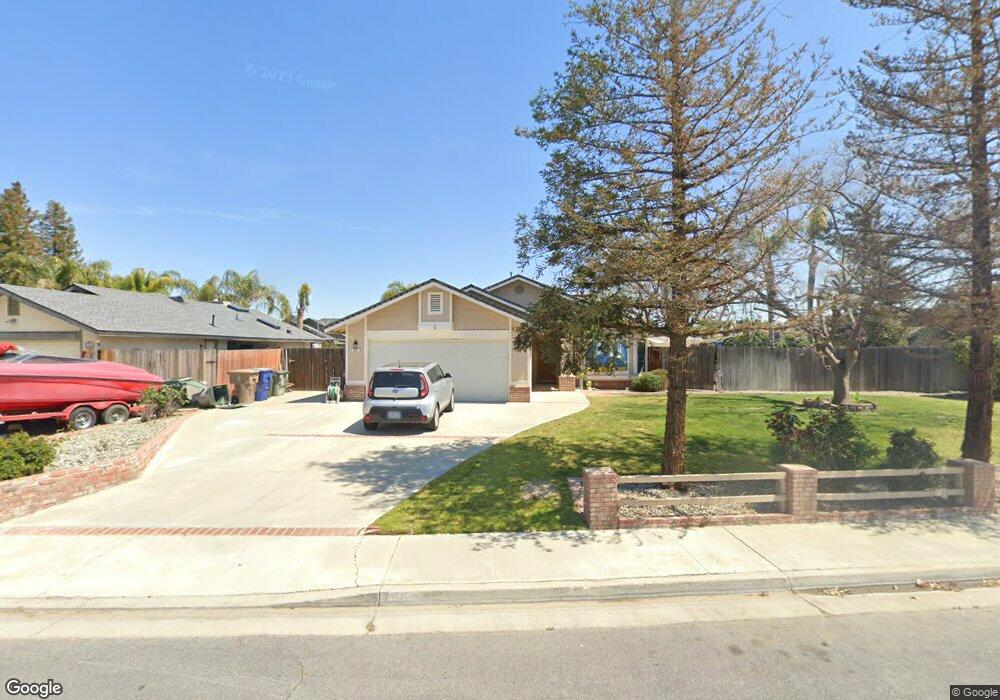
700 Jerlee St Unit C Bakersfield, CA 93314
Estimated Value: $428,882 - $441,000
3
Beds
2
Baths
1,751
Sq Ft
$248/Sq Ft
Est. Value
About This Home
This home is located at 700 Jerlee St Unit C, Bakersfield, CA 93314 and is currently estimated at $434,471, approximately $248 per square foot. 700 Jerlee St Unit C is a home located in Kern County with nearby schools including Del Rio Elementary School, Rosedale Middle School, and Liberty High School.
Ownership History
Date
Name
Owned For
Owner Type
Purchase Details
Closed on
Jul 26, 2002
Sold by
Little James and Little Brinn
Bought by
Walker Forrest Ray and Walker Nancy J
Current Estimated Value
Home Financials for this Owner
Home Financials are based on the most recent Mortgage that was taken out on this home.
Original Mortgage
$126,000
Interest Rate
6.52%
Purchase Details
Closed on
Feb 9, 1999
Sold by
Olson Wayne D and Olson Sandra A
Bought by
Little James and Little Brinn
Home Financials for this Owner
Home Financials are based on the most recent Mortgage that was taken out on this home.
Original Mortgage
$96,000
Interest Rate
6.73%
Create a Home Valuation Report for This Property
The Home Valuation Report is an in-depth analysis detailing your home's value as well as a comparison with similar homes in the area
Home Values in the Area
Average Home Value in this Area
Purchase History
| Date | Buyer | Sale Price | Title Company |
|---|---|---|---|
| Walker Forrest Ray | $158,000 | Chicago Title Co | |
| Little James | $120,000 | American Title Co |
Source: Public Records
Mortgage History
| Date | Status | Borrower | Loan Amount |
|---|---|---|---|
| Previous Owner | Walker Forrest Ray | $126,000 | |
| Previous Owner | Little James | $96,000 |
Source: Public Records
Tax History
| Year | Tax Paid | Tax Assessment Tax Assessment Total Assessment is a certain percentage of the fair market value that is determined by local assessors to be the total taxable value of land and additions on the property. | Land | Improvement |
|---|---|---|---|---|
| 2025 | $3,135 | $228,815 | $57,921 | $170,894 |
| 2024 | $3,135 | $224,330 | $56,786 | $167,544 |
| 2023 | $3,060 | $219,932 | $55,673 | $164,259 |
| 2022 | $2,996 | $215,621 | $54,582 | $161,039 |
| 2021 | $2,873 | $211,394 | $53,512 | $157,882 |
| 2020 | $2,818 | $209,228 | $52,964 | $156,264 |
| 2019 | $2,767 | $209,228 | $52,964 | $156,264 |
| 2018 | $2,703 | $201,105 | $50,908 | $150,197 |
| 2017 | $2,661 | $197,162 | $49,910 | $147,252 |
| 2016 | $2,509 | $193,297 | $48,932 | $144,365 |
| 2015 | $2,466 | $190,394 | $48,197 | $142,197 |
| 2014 | $2,409 | $186,665 | $47,253 | $139,412 |
Source: Public Records
Map
Nearby Homes
- 13116 Amanda Ct
- 15829 Cole Brook Ct
- 13301 Birkenfeld Ave
- 501 Reed St
- 13400 Frenchglen Ave
- 705 Harrisburg St
- 12411 Riverfront Park Dr
- 101 Cortez Ct
- 12811 Woodson Bridge Dr
- 804 De Oro Ct
- 13813 Toluca Dr
- 601 Las Arenas Ct
- 13904 Veracruz Dr
- 12012 Tulane Park Place
- 14004 San Lazaro Ave
- 12607 Schooner Beach Dr
- 12200 White Rapids Way
- 700 Los Mochis Dr
- 12411 Schooner Beach Dr Unit 2
- 1701 Audley End Place
- 608 Jerlee St
- 12916 Birkenfeld Ave
- 12912 Birkenfeld Ave
- 12908 Birkenfeld Ave
- 604 Jerlee St
- 701 Jerlee St
- 609 Jerlee St
- 13000 Birkenfeld Ave
- 605 Jerlee St
- 12904 Birkenfeld Ave Unit C
- 7244 Birkenfeld Ave
- 600 Jerlee St
- 12925 Birkenfeld Ave
- 12921 Birkenfeld Ave Unit C
- 13004 Birkenfeld Ave
- 601 Jerlee St
- 12929 Birkenfeld Ave
- 13100 Amanda Ct
- 12917 Birkenfeld Ave
- 12900 Birkenfeld Ave
Your Personal Tour Guide
Ask me questions while you tour the home.