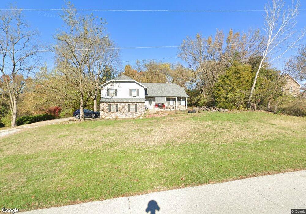
700 Maple Ln Lansing, KS 66043
Estimated Value: $279,040 - $351,000
4
Beds
2
Baths
1,619
Sq Ft
$194/Sq Ft
Est. Value
About This Home
This home is located at 700 Maple Ln, Lansing, KS 66043 and is currently estimated at $314,760, approximately $194 per square foot. 700 Maple Ln is a home located in Leavenworth County with nearby schools including Lansing Elementary School, Lansing Middle 6-8, and Lansing High 9-12.
Create a Home Valuation Report for This Property
The Home Valuation Report is an in-depth analysis detailing your home's value as well as a comparison with similar homes in the area
Home Values in the Area
Average Home Value in this Area
Tax History
| Year | Tax Paid | Tax Assessment Tax Assessment Total Assessment is a certain percentage of the fair market value that is determined by local assessors to be the total taxable value of land and additions on the property. | Land | Improvement |
|---|---|---|---|---|
| 2025 | $3,857 | $29,808 | $6,545 | $23,263 |
| 2024 | $3,632 | $28,957 | $7,608 | $21,349 |
| 2023 | $3,632 | $28,133 | $7,608 | $20,525 |
| 2022 | $3,493 | $25,576 | $5,293 | $20,283 |
| 2021 | $3,369 | $23,471 | $4,402 | $19,069 |
| 2020 | $3,203 | $21,965 | $4,240 | $17,725 |
| 2019 | $3,027 | $20,746 | $3,895 | $16,851 |
| 2018 | $2,848 | $19,550 | $4,340 | $15,210 |
| 2017 | $2,752 | $18,860 | $4,340 | $14,520 |
| 2016 | $2,754 | $18,860 | $4,340 | $14,520 |
| 2015 | $2,689 | $18,482 | $4,340 | $14,142 |
| 2014 | $2,556 | $17,943 | $4,340 | $13,603 |
Source: Public Records
Map
Nearby Homes
- 811 4-H Rd
- 922 Southfork St
- 26731 147th St
- 503 S 1st St
- 202 S Main St
- 124 S Main St
- 111 Southfork Rd
- 20958 Ida St
- 1221 S Desoto Rd
- 875 Clearview Dr
- 215 E Mary St
- 1322 Rock Creek Ct
- 189 Canyon View Dr
- 898 Clearview Dr
- 712 Rock Creek Dr
- 218 E Kay St
- 1313 Stone Ln
- 00000 Brookwood St
- 530 Holiday Ct
- 950 Holiday Dr
Your Personal Tour Guide
Ask me questions while you tour the home.