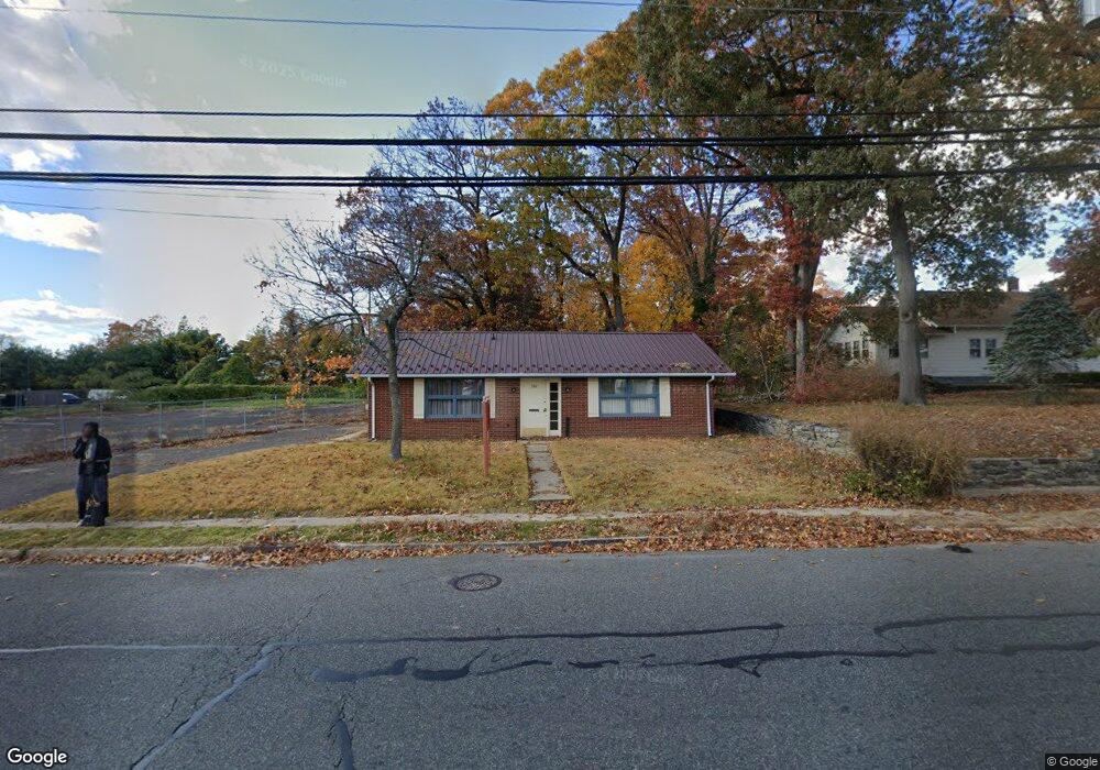
700 N Pearl St Bridgeton, NJ 08302
Estimated Value: $122,500
--
Bed
--
Bath
960
Sq Ft
$128/Sq Ft
Est. Value
About This Home
This home is located at 700 N Pearl St, Bridgeton, NJ 08302 and is currently estimated at $122,500, approximately $127 per square foot. 700 N Pearl St is a home located in Cumberland County with nearby schools including Bridgeton High School, Bridgeton Christian School, and Immaculate Conception School.
Ownership History
Date
Name
Owned For
Owner Type
Purchase Details
Closed on
Oct 22, 2024
Sold by
Day Michael L and Colaneri-Day Sherrie
Bought by
Mandujano Antonia Trenado
Current Estimated Value
Purchase Details
Closed on
Oct 1, 2003
Sold by
Iannucci James G
Bought by
Day Michael L and Day Sherrie Colaneri
Home Financials for this Owner
Home Financials are based on the most recent Mortgage that was taken out on this home.
Original Mortgage
$74,700
Interest Rate
6.15%
Mortgage Type
Commercial
Create a Home Valuation Report for This Property
The Home Valuation Report is an in-depth analysis detailing your home's value as well as a comparison with similar homes in the area
Home Values in the Area
Average Home Value in this Area
Purchase History
| Date | Buyer | Sale Price | Title Company |
|---|---|---|---|
| Mandujano Antonia Trenado | $117,500 | Dominion Title | |
| Mandujano Antonia Trenado | $117,500 | Dominion Title | |
| Day Michael L | $83,000 | -- |
Source: Public Records
Mortgage History
| Date | Status | Borrower | Loan Amount |
|---|---|---|---|
| Previous Owner | Day Michael L | $74,700 |
Source: Public Records
Tax History Compared to Growth
Tax History
| Year | Tax Paid | Tax Assessment Tax Assessment Total Assessment is a certain percentage of the fair market value that is determined by local assessors to be the total taxable value of land and additions on the property. | Land | Improvement |
|---|---|---|---|---|
| 2025 | $4,548 | $86,000 | $26,600 | $59,400 |
| 2024 | $4,548 | $86,000 | $26,600 | $59,400 |
| 2023 | $4,365 | $86,000 | $26,600 | $59,400 |
| 2022 | $4,324 | $86,000 | $26,600 | $59,400 |
| 2021 | $4,315 | $86,000 | $26,600 | $59,400 |
| 2020 | $4,286 | $86,000 | $26,600 | $59,400 |
| 2019 | $4,189 | $86,000 | $26,600 | $59,400 |
| 2018 | $4,005 | $86,000 | $26,600 | $59,400 |
| 2017 | $3,889 | $86,000 | $26,600 | $59,400 |
| 2016 | $3,773 | $86,000 | $26,600 | $59,400 |
| 2015 | $3,707 | $86,000 | $26,600 | $59,400 |
| 2014 | $4,209 | $74,300 | $10,500 | $63,800 |
Source: Public Records
Map
Nearby Homes
- 57 Dubois Ave
- 107 Cedarbrook Ave
- 10 Fieldstone Ct
- 61 American Ave
- 597 N Laurel St
- 137 Penn St
- 509 N Laurel St
- 81 Old Deerfield Pike
- 114 Magnolia Ave
- 41 Roberts Ave
- 19 Shadow Brooke Dr
- 14 1/2 Smith Dr
- 124 Old Deerfield Pike
- 7 Holly Ln
- 0 St Unit NJSA2014462
- 200 Cornwell Dr
- 555 Irving Ave
- 1737 S Burlington Rd
- 45 Acorn Dr
- 122 York St
- 704 N Pearl St
- 698 N Pearl St
- 697 N Pearl St
- 699 N Pearl St
- 694 N Pearl St Unit 2
- 694 N Pearl St Unit 4
- 695 N Pearl St
- 6 Mulford Dr
- 689 N Pearl St
- 742 N Pearl St St
- 742 N Pearl St
- 687 N Pearl St
- 9 Mulford Ct
- 7 Mulford Ct
- 5 Mulford Ct
- 3 Mulford Ct
- 683 N Pearl St Unit 685
- 717 N Pearl St
- 61 Dubois Ave
- 1 Mulford Ct