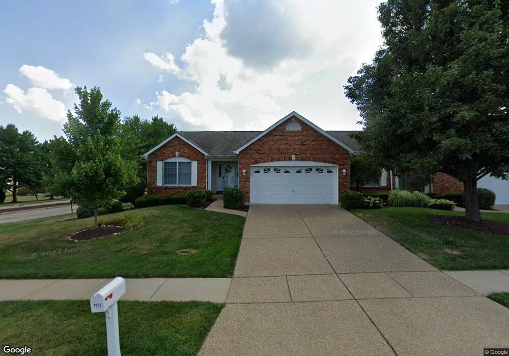
7002 Audrain Mill Dr O Fallon, MO 63368
Estimated Value: $319,000 - $377,000
2
Beds
2
Baths
1,501
Sq Ft
$229/Sq Ft
Est. Value
About This Home
This home is located at 7002 Audrain Mill Dr, O Fallon, MO 63368 and is currently estimated at $344,156, approximately $229 per square foot. 7002 Audrain Mill Dr is a home located in St. Charles County with nearby schools including Pheasant Point Elementary School, Fort Zumwalt West Middle School, and Fort Zumwalt West High School.
Ownership History
Date
Name
Owned For
Owner Type
Purchase Details
Closed on
Apr 16, 2024
Sold by
Sampl David A and Sampl Mary E
Bought by
Sampl Family Trust and Sampl
Current Estimated Value
Purchase Details
Closed on
Aug 25, 2022
Sold by
Smith Richard F and Smith Diane C
Bought by
Sampl David A and Sampl Mary E
Home Financials for this Owner
Home Financials are based on the most recent Mortgage that was taken out on this home.
Original Mortgage
$212,000
Interest Rate
4.75%
Mortgage Type
New Conventional
Purchase Details
Closed on
Sep 14, 2000
Sold by
Whittaker Construction Incorporated
Bought by
Smith Richard F and Smith Diane C
Home Financials for this Owner
Home Financials are based on the most recent Mortgage that was taken out on this home.
Original Mortgage
$50,000
Interest Rate
8.15%
Create a Home Valuation Report for This Property
The Home Valuation Report is an in-depth analysis detailing your home's value as well as a comparison with similar homes in the area
Home Values in the Area
Average Home Value in this Area
Purchase History
| Date | Buyer | Sale Price | Title Company |
|---|---|---|---|
| Sampl Family Trust | -- | None Listed On Document | |
| Sampl David A | -- | None Listed On Document | |
| Smith Richard F | $141,790 | -- |
Source: Public Records
Mortgage History
| Date | Status | Borrower | Loan Amount |
|---|---|---|---|
| Previous Owner | Sampl David A | $212,000 | |
| Previous Owner | Smith Richard F | $50,000 |
Source: Public Records
Tax History
| Year | Tax Paid | Tax Assessment Tax Assessment Total Assessment is a certain percentage of the fair market value that is determined by local assessors to be the total taxable value of land and additions on the property. | Land | Improvement |
|---|---|---|---|---|
| 2025 | $3,377 | $61,028 | -- | -- |
| 2023 | $3,379 | $50,969 | $0 | $0 |
| 2022 | $3,283 | $46,092 | $0 | $0 |
| 2021 | $3,286 | $46,092 | $0 | $0 |
| 2020 | $2,798 | $37,986 | $0 | $0 |
| 2019 | $2,805 | $37,986 | $0 | $0 |
| 2018 | $2,857 | $36,959 | $0 | $0 |
| 2017 | $2,818 | $36,959 | $0 | $0 |
| 2016 | $2,597 | $33,919 | $0 | $0 |
| 2015 | $2,415 | $33,919 | $0 | $0 |
| 2014 | $2,246 | $31,024 | $0 | $0 |
Source: Public Records
Map
Nearby Homes
- 2136 Farnsworth Dr Unit D
- 7139 Basswood Dr
- 2614 Samuel Dr Unit 711C
- 7101 Curtis Dr Unit 795B
- 7131 Curtis Dr Unit 779C
- 178 Christina Marie Dr
- 2726 Brook Meadow Ln
- 516 Sunward Dr
- 2 the Durango at the Grove
- 7409 Heathermoor Ln
- 604 Sunward Dr
- 3 Royallbend Ct
- 3 Dragonstone Ct
- 67 Simeon Ct
- 7 Dragonstone Ct
- New Build Glacier "E" at Dragonstone
- New Build Savannah "E" at Dragonstone
- 189 Sanctuary Dr
- 2613 Tysons Pkwy
- 2026 Avalon Mist Cir
- 7002 Audrain Mill Dr Unit A
- 7004 Audrain Mill Dr
- 2130 Farnsworth Dr
- 7006 Audrain Mill Dr
- 2132 Farnsworth Dr
- 7007 Audrain Mill Dr
- 2101 Ingalls Cir
- 7005 Audrain Mill Dr
- 7003 Audrain Mill Dr
- 7003 Audrain Mill Dr Unit C
- 2103 Ingalls Cir
- 7001 Audrain Mill Dr
- 7001 Audrain Mill Dr Unit D
- 2136 Farnsworth Dr
- 2102 Ingalls Cir
- 2102 Ingalls Cir Unit A
- 2107 Ingalls Cir
- 3 Farnsworth Ct
- 2105 Ingalls Cir
- 2120 Farnsworth Dr
Your Personal Tour Guide
Ask me questions while you tour the home.