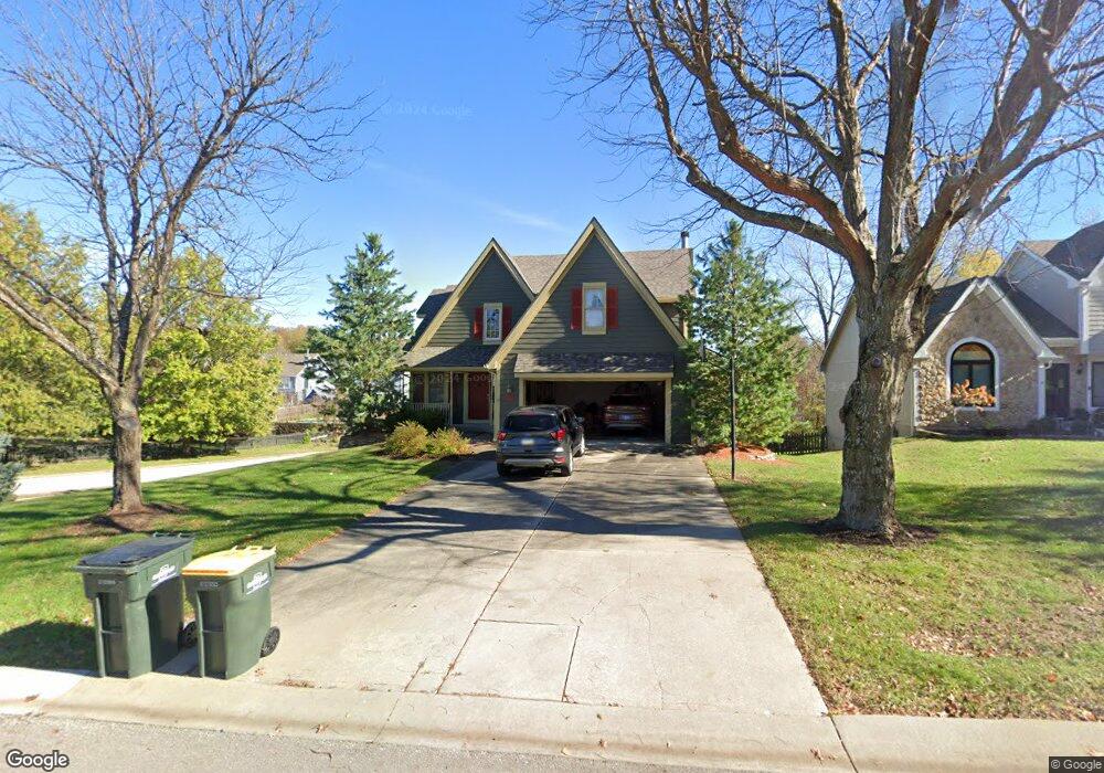
701 Bittersweet Rd Lansing, KS 66043
Estimated Value: $357,000 - $382,000
4
Beds
4
Baths
2,315
Sq Ft
$160/Sq Ft
Est. Value
About This Home
This home is located at 701 Bittersweet Rd, Lansing, KS 66043 and is currently estimated at $370,152, approximately $159 per square foot. 701 Bittersweet Rd is a home located in Leavenworth County with nearby schools including Lansing Elementary School, Lansing Middle 6-8, and Lansing High 9-12.
Ownership History
Date
Name
Owned For
Owner Type
Purchase Details
Closed on
Jun 1, 1993
Bought by
Sperl Louis J and Sperl Vicki A
Current Estimated Value
Home Financials for this Owner
Home Financials are based on the most recent Mortgage that was taken out on this home.
Original Mortgage
$72,500
Interest Rate
7.5%
Mortgage Type
New Conventional
Create a Home Valuation Report for This Property
The Home Valuation Report is an in-depth analysis detailing your home's value as well as a comparison with similar homes in the area
Home Values in the Area
Average Home Value in this Area
Purchase History
| Date | Buyer | Sale Price | Title Company |
|---|---|---|---|
| Sperl Louis J | $141,500 | -- |
Source: Public Records
Mortgage History
| Date | Status | Borrower | Loan Amount |
|---|---|---|---|
| Closed | Sperl Louis J | $72,500 | |
| Closed | Sperl Louis J | $60,000 |
Source: Public Records
Tax History
| Year | Tax Paid | Tax Assessment Tax Assessment Total Assessment is a certain percentage of the fair market value that is determined by local assessors to be the total taxable value of land and additions on the property. | Land | Improvement |
|---|---|---|---|---|
| 2025 | $5,068 | $40,520 | $5,565 | $34,955 |
| 2024 | $5,068 | $38,962 | $4,415 | $34,547 |
| 2023 | $5,068 | $38,962 | $4,415 | $34,547 |
| 2022 | $4,477 | $34,856 | $3,444 | $31,412 |
| 2021 | $4,477 | $31,084 | $3,444 | $27,640 |
| 2020 | $4,363 | $29,808 | $3,444 | $26,364 |
| 2019 | $4,222 | $28,815 | $3,444 | $25,371 |
| 2018 | $3,871 | $26,462 | $2,865 | $23,597 |
| 2017 | $3,703 | $25,266 | $2,865 | $22,401 |
| 2016 | $3,573 | $24,383 | $2,865 | $21,518 |
| 2015 | $3,563 | $24,383 | $2,865 | $21,518 |
| 2014 | $3,372 | $23,575 | $2,865 | $20,710 |
Source: Public Records
Map
Nearby Homes
- 922 Southfork St
- 811 4-H Rd
- 503 S 1st St
- 111 Southfork Rd
- 202 S Main St
- 124 S Main St
- 26731 147th St
- 215 E Mary St
- 130 Hampton Ct
- 875 Clearview Dr
- 189 Canyon View Dr
- 218 E Kay St
- 20958 Ida St
- 1221 S Desoto Rd
- 1322 Rock Creek Ct
- 712 Rock Creek Dr
- 898 Clearview Dr
- 1313 Stone Ln
- 00000 Brookwood St
- 530 Holiday Ct
- 705 Bittersweet Rd
- 705 S Bittersweet Ct
- 329 Maple Ln
- 625 Bittersweet Rd
- 625 S Bittersweet Ln
- 709 Bittersweet Rd
- 831 Blueberry St
- 700 Bittersweet Rd
- 706 Bittersweet Rd
- 327 Maple Ln
- 829 Blueberry St
- 621 Bittersweet Rd
- 711 Bittersweet Rd
- 00000 Maple Ln
- 624 Bittersweet Rd
- 827 Blueberry St
- 712 Bittersweet Rd
- 620 Bittersweet Rd
- 619 Bittersweet Rd
- 325 Maple Ln
Your Personal Tour Guide
Ask me questions while you tour the home.