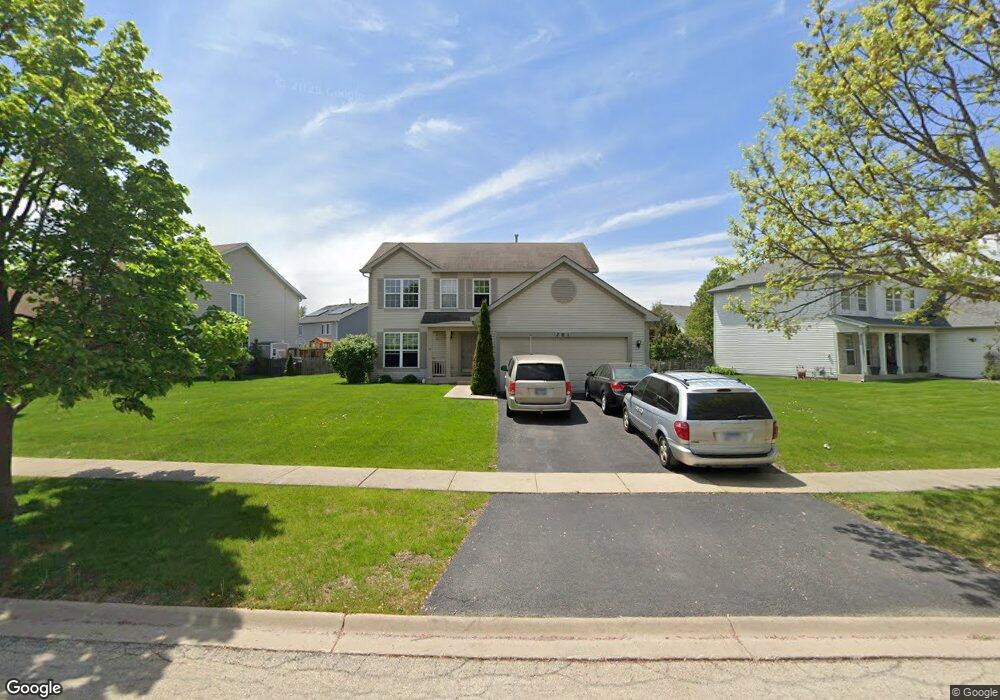
701 Brita Trail Minooka, IL 60447
Estimated Value: $316,459 - $518,000
Studio
--
Bath
2,016
Sq Ft
$189/Sq Ft
Est. Value
About This Home
This home is located at 701 Brita Trail, Minooka, IL 60447 and is currently estimated at $380,615, approximately $188 per square foot. 701 Brita Trail is a home with nearby schools including Minooka Primary Center, Aux Sable Elementary School, and Minooka Junior High School.
Ownership History
Date
Name
Owned For
Owner Type
Purchase Details
Closed on
May 5, 2023
Sold by
A & E Development Llc
Bought by
Doti Joe and Doti Shannon
Current Estimated Value
Home Financials for this Owner
Home Financials are based on the most recent Mortgage that was taken out on this home.
Original Mortgage
$428,039
Outstanding Balance
$415,874
Interest Rate
6.27%
Mortgage Type
New Conventional
Estimated Equity
-$35,259
Purchase Details
Closed on
Dec 22, 2022
Sold by
Wo Phase Ii Development Llc
Bought by
A & E Development Llc
Home Financials for this Owner
Home Financials are based on the most recent Mortgage that was taken out on this home.
Original Mortgage
$381,244
Interest Rate
6.58%
Mortgage Type
New Conventional
Create a Home Valuation Report for This Property
The Home Valuation Report is an in-depth analysis detailing your home's value as well as a comparison with similar homes in the area
Purchase History
| Date | Buyer | Sale Price | Title Company |
|---|---|---|---|
| Doti Joe | $476,555 | Greater Illinois Title | |
| A & E Development Llc | $52,500 | None Listed On Document |
Source: Public Records
Mortgage History
| Date | Status | Borrower | Loan Amount |
|---|---|---|---|
| Open | Doti Joe | $428,039 | |
| Previous Owner | A & E Development Llc | $381,244 |
Source: Public Records
Tax History
| Year | Tax Paid | Tax Assessment Tax Assessment Total Assessment is a certain percentage of the fair market value that is determined by local assessors to be the total taxable value of land and additions on the property. | Land | Improvement |
|---|---|---|---|---|
| 2024 | $6,939 | $86,512 | $11,060 | $75,452 |
| 2023 | $6,325 | $78,855 | $10,081 | $68,774 |
| 2022 | $5,881 | $73,319 | $9,373 | $63,946 |
| 2021 | $5,654 | $69,405 | $8,873 | $60,532 |
| 2020 | $5,533 | $66,392 | $8,488 | $57,904 |
| 2019 | $5,257 | $61,474 | $7,859 | $53,615 |
| 2018 | $5,327 | $60,786 | $7,771 | $53,015 |
| 2017 | $5,193 | $58,046 | $7,421 | $50,625 |
| 2016 | $4,879 | $54,488 | $6,966 | $47,522 |
| 2015 | $4,488 | $49,530 | $6,332 | $43,198 |
| 2014 | $4,355 | $52,670 | $11,150 | $41,520 |
| 2013 | $4,469 | $53,380 | $11,300 | $42,080 |
Source: Public Records
Map
Nearby Homes
- 800 Maplewood Dr
- 1509 Donegal Dr
- 1606 Donegal Dr
- 655 Chestnut Ridge
- 526 Lily Ct
- 1380 Dahlgren Ln
- 1101 Burns Ln
- 1429 Levato Ln
- 1502 Red Top Ln
- 1403 Fabiola Ct S
- 1138 Coneflower Ct
- 1315 Burns Ln
- 1952 Waters Edge Dr
- 1552 Bluestem Ln
- 1137 S Wabena Ave
- 520 High Grove Dr
- Lots 16,17,18 Waters Edge Dr
- 1105 Clover Dr
- 807 Back Bay Ct
- 2048 Waters Edge Dr
- 705 Brita Trail
- 621 Brita Trail
- 1316 Glenridge Ct N
- 709 Brita Trail
- 617 Brita Trail
- 1312 Glenridge Ct N
- 1321 Glenridge Ct N
- 625 Brita Ct
- 700 Brita Trail
- 704 Brita Trail
- 613 Brita Trail
- 713 Brita Trail
- 624 Brita Trail
- 708 Brita Trail
- 629 Brita Ct
- 1317 Glenridge Ct N
- 620 Brita Trail
- 712 Brita Trail
- 717 Brita Trail
- 633 Brita Ct
Your Personal Tour Guide
Ask me questions while you tour the home.