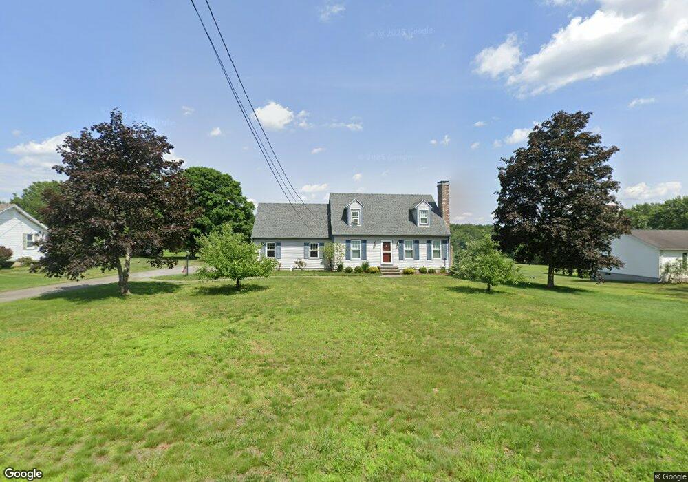
701 Country Club Rd Greenfield, MA 01301
Estimated Value: $345,000 - $401,860
3
Beds
2
Baths
1,568
Sq Ft
$242/Sq Ft
Est. Value
About This Home
This home is located at 701 Country Club Rd, Greenfield, MA 01301 and is currently estimated at $379,715, approximately $242 per square foot. 701 Country Club Rd is a home located in Franklin County with nearby schools including Greenfield Center School and Stoneleigh-Burnham School.
Ownership History
Date
Name
Owned For
Owner Type
Purchase Details
Closed on
Jun 16, 1989
Sold by
Gaudet Dodie E
Bought by
Pelc Richard T
Current Estimated Value
Home Financials for this Owner
Home Financials are based on the most recent Mortgage that was taken out on this home.
Original Mortgage
$73,000
Interest Rate
10.87%
Mortgage Type
Purchase Money Mortgage
Create a Home Valuation Report for This Property
The Home Valuation Report is an in-depth analysis detailing your home's value as well as a comparison with similar homes in the area
Home Values in the Area
Average Home Value in this Area
Purchase History
| Date | Buyer | Sale Price | Title Company |
|---|---|---|---|
| Pelc Richard T | $155,000 | -- | |
| Pelc Richard T | $155,000 | -- |
Source: Public Records
Mortgage History
| Date | Status | Borrower | Loan Amount |
|---|---|---|---|
| Closed | Pelc Richard T | $70,000 | |
| Closed | Pelc Richard T | $73,000 |
Source: Public Records
Tax History Compared to Growth
Tax History
| Year | Tax Paid | Tax Assessment Tax Assessment Total Assessment is a certain percentage of the fair market value that is determined by local assessors to be the total taxable value of land and additions on the property. | Land | Improvement |
|---|---|---|---|---|
| 2025 | $6,508 | $332,700 | $83,500 | $249,200 |
| 2024 | $6,515 | $319,500 | $71,100 | $248,400 |
| 2023 | $5,938 | $299,100 | $71,100 | $228,000 |
| 2022 | $6,080 | $272,400 | $71,300 | $201,100 |
| 2021 | $5,789 | $249,300 | $75,300 | $174,000 |
| 2020 | $5,595 | $244,000 | $75,300 | $168,700 |
| 2019 | $5,257 | $235,100 | $65,700 | $169,400 |
| 2018 | $5,208 | $232,200 | $64,500 | $167,700 |
| 2017 | $5,046 | $232,200 | $64,500 | $167,700 |
| 2016 | $5,080 | $232,900 | $64,500 | $168,400 |
| 2015 | $5,058 | $224,700 | $66,100 | $158,600 |
| 2014 | $4,613 | $224,700 | $66,100 | $158,600 |
Source: Public Records
Map
Nearby Homes
- 34 Brookside Ave
- 83 Eden Trail Branch
- 31 Lovers Ln
- 72 Meadowood Dr
- 696 Bernardston Rd
- 001 Adams Rd
- 218 Greenfield Rd
- 27 Lunt Dr
- 47 Cross St
- 79 Burnham Rd
- 319 Greenfield Rd
- 75 South St Unit 3
- 4 Pickett Ln
- 0 Pickett Ln
- 187 Plain Rd
- 539 Fox Hill Rd
- 104 Leyden Rd
- 151 Smead Hill Rd
- 59 River St
- 35-37 Shattuck St
- 707 Country Club Rd
- 695 Country Club Rd
- 687 Country Club Rd
- 708 Country Club Rd
- 698 Country Club Rd
- 715 Country Club Rd
- 714 Country Club Rd
- 258 Barton Rd
- 692 Country Club Rd
- 724 Country Club Rd
- 264 Barton Rd
- 681 Country Club Rd
- 48 Brookside Ave
- 47 Brookside Ave
- 688 Country Club Rd
- 234 Barton Rd
- 44 Brookside Ave
- 7 Brookside Ave
- 45 Brookside Ave
- 726 Country Club Rd