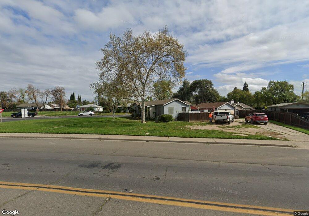
701 Motel Dr Merced, CA 95341
Southeast Merced NeighborhoodEstimated Value: $205,000 - $302,000
2
Beds
1
Bath
890
Sq Ft
$271/Sq Ft
Est. Value
About This Home
This home is located at 701 Motel Dr, Merced, CA 95341 and is currently estimated at $240,976, approximately $270 per square foot. 701 Motel Dr is a home located in Merced County with nearby schools including Charles Wright Elementary School, Herbert Hoover Middle School, and Golden Valley High School.
Ownership History
Date
Name
Owned For
Owner Type
Purchase Details
Closed on
Dec 16, 2024
Sold by
Carter Gloria A
Bought by
Gloria A Carter Trust and Carter
Current Estimated Value
Purchase Details
Closed on
Aug 1, 2001
Sold by
Washington Mutual Bank Fa
Bought by
Carter Greg A and Carter Gloria A
Home Financials for this Owner
Home Financials are based on the most recent Mortgage that was taken out on this home.
Original Mortgage
$41,500
Interest Rate
7.05%
Purchase Details
Closed on
Feb 6, 2001
Sold by
Yuen Fred Y K
Bought by
Washington Mutual Bank Fa
Purchase Details
Closed on
Sep 8, 2000
Sold by
Yuen Fred Y K
Bought by
Yuen Fred Y K and Yuen Nellie T
Create a Home Valuation Report for This Property
The Home Valuation Report is an in-depth analysis detailing your home's value as well as a comparison with similar homes in the area
Home Values in the Area
Average Home Value in this Area
Purchase History
| Date | Buyer | Sale Price | Title Company |
|---|---|---|---|
| Gloria A Carter Trust | -- | None Listed On Document | |
| Carter Greg A | $52,000 | Fidelity National Title | |
| Washington Mutual Bank Fa | $49,182 | -- | |
| Yuen Fred Y K | -- | -- |
Source: Public Records
Mortgage History
| Date | Status | Borrower | Loan Amount |
|---|---|---|---|
| Previous Owner | Carter Greg A | $41,500 |
Source: Public Records
Tax History Compared to Growth
Tax History
| Year | Tax Paid | Tax Assessment Tax Assessment Total Assessment is a certain percentage of the fair market value that is determined by local assessors to be the total taxable value of land and additions on the property. | Land | Improvement |
|---|---|---|---|---|
| 2025 | $830 | $76,649 | $44,306 | $32,343 |
| 2024 | $830 | $75,147 | $43,438 | $31,709 |
| 2023 | $819 | $73,675 | $42,587 | $31,088 |
| 2022 | $807 | $72,231 | $41,752 | $30,479 |
| 2021 | $805 | $70,816 | $40,934 | $29,882 |
| 2020 | $810 | $70,091 | $40,515 | $29,576 |
| 2019 | $797 | $68,718 | $39,721 | $28,997 |
| 2018 | $727 | $67,372 | $38,943 | $28,429 |
| 2017 | $754 | $66,052 | $38,180 | $27,872 |
| 2016 | $743 | $64,758 | $37,432 | $27,326 |
| 2015 | $731 | $63,786 | $36,870 | $26,916 |
| 2014 | $716 | $62,537 | $36,148 | $26,389 |
Source: Public Records
Map
Nearby Homes
- 1900 Ashwood Dr
- 1850 Glen Ave
- 1930 Ashwood Dr
- 530 E 18th St
- 641 E 19th St
- 1990 Ashwood Dr
- 756 Crist Ave
- 2030 Union Ave
- 1098 E 21st St
- 365 E Main St
- 380 E 19th St
- 1625 Rose Ave
- 906 E 22nd St
- 1070 E 23rd St
- 259 E 19th St
- 2238 Wood St
- 216 E 20th St
- 0 Stretch Rd Unit MC24218829
- 0 Stretch Rd Unit MC21265605
- 1616 E 21st St
- 810 Yosemite Pkwy
- 751 Motel Dr
- 789 Yosemite Pkwy
- 820 Yosemite Pkwy
- 751 Yosemite Pkwy
- 785 Motel Dr
- 725 Yosemite Pkwy
- 1750 Cypress Way
- 795 Motel Dr
- 1749 Cypress Way
- 1777 Cypress Way
- 1735 Cypress Way
- 1760 Glen Ave
- 835 Yosemite Pkwy
- 1725 Cypress Way
- 104106 E Main
- 1705 Cypress Way
- 815 Motel Dr
- 1790 Glen Ave
- 1795 Cypress Way