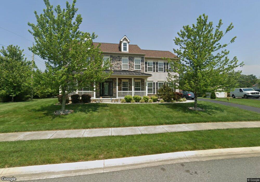
701 Waterbird Ln Middletown, DE 19709
Estimated Value: $580,000 - $671,000
4
Beds
3
Baths
2,888
Sq Ft
$217/Sq Ft
Est. Value
About This Home
This home is located at 701 Waterbird Ln, Middletown, DE 19709 and is currently estimated at $626,688, approximately $216 per square foot. 701 Waterbird Ln is a home located in New Castle County with nearby schools including Lorewood Grove Elementary School, Cantwell's Bridge Middle School, and Odessa High School.
Ownership History
Date
Name
Owned For
Owner Type
Purchase Details
Closed on
May 15, 2012
Sold by
Blenheim Properties Inc
Bought by
Albright Robert L and Albright Linda S
Current Estimated Value
Home Financials for this Owner
Home Financials are based on the most recent Mortgage that was taken out on this home.
Original Mortgage
$394,400
Outstanding Balance
$272,490
Interest Rate
3.84%
Mortgage Type
VA
Estimated Equity
$354,198
Create a Home Valuation Report for This Property
The Home Valuation Report is an in-depth analysis detailing your home's value as well as a comparison with similar homes in the area
Home Values in the Area
Average Home Value in this Area
Purchase History
| Date | Buyer | Sale Price | Title Company |
|---|---|---|---|
| Albright Robert L | $394,400 | None Available |
Source: Public Records
Mortgage History
| Date | Status | Borrower | Loan Amount |
|---|---|---|---|
| Open | Albright Robert L | $394,400 |
Source: Public Records
Tax History
| Year | Tax Paid | Tax Assessment Tax Assessment Total Assessment is a certain percentage of the fair market value that is determined by local assessors to be the total taxable value of land and additions on the property. | Land | Improvement |
|---|---|---|---|---|
| 2024 | $4,625 | $118,600 | $15,200 | $103,400 |
| 2023 | $3,881 | $118,600 | $15,200 | $103,400 |
| 2022 | $4,388 | $118,600 | $15,200 | $103,400 |
| 2021 | $4,332 | $118,600 | $15,200 | $103,400 |
| 2020 | $4,272 | $118,600 | $15,200 | $103,400 |
| 2019 | $4,107 | $118,600 | $15,200 | $103,400 |
| 2018 | $3,799 | $118,600 | $15,200 | $103,400 |
| 2017 | $3,244 | $117,500 | $15,200 | $102,300 |
| 2016 | $2,820 | $117,500 | $15,200 | $102,300 |
| 2015 | $2,735 | $117,500 | $15,200 | $102,300 |
| 2014 | $2,732 | $117,500 | $15,200 | $102,300 |
Source: Public Records
Map
Nearby Homes
- 133 Pine Valley Dr
- 301 White Pine Dr
- 1932 Dixon Way
- 325 Great Oak Dr
- 1602 Jaymes Cir
- 1525 Lesterfield Way
- 1430 Pennfield Dr
- 1511 Lesterfield Way
- 102 Newbury Ct
- 0 Port Penn Rd
- 692 Bayview Rd
- 300 Jasper Way
- 2481 N Dupont Pkwy
- 704 Bullen Dr
- 434 Baker Farm Dr
- 467 Hyetts Corner Rd
- 1102 Wickersham Way
- 1061 Wickersham Way
- 19 Golden Raintree Ct
- 17 Golden Raintree Ct
- 703 Waterbird Ln
- 700 Waterbird Ln
- 516 Bobolink Ct
- 705 Waterbird Ln
- 705 Waterbird Ln Unit SPEC
- 514 Bobolink Ct
- 704 Waterbird Ln
- 704 Waterbird Ln Unit SPEC
- 1695 Pole Bridge Rd
- 512 Bobolink Ct
- 510 Snowgeese Ct
- 707 Waterbird Ln
- 517 Bobolink Ct
- 706 Waterbird Ln
- 508 Snowgeese Ct
- 709 Waterbird Ln
- 509 Bobolink Ct
- 515 Bobolink Ct
- 513 Bobolink Ct
- 708 Waterbird Ln
Your Personal Tour Guide
Ask me questions while you tour the home.