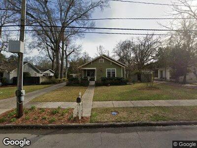
702 Concart St Hattiesburg, MS 39401
Kamper-Avenues NeighborhoodEstimated Value: $184,000 - $194,751
3
Beds
2
Baths
1,927
Sq Ft
$98/Sq Ft
Est. Value
About This Home
This home is located at 702 Concart St, Hattiesburg, MS 39401 and is currently estimated at $188,188, approximately $97 per square foot. 702 Concart St is a home located in Forrest County with nearby schools including Woodley Elementary School, N.R. Burger Middle School, and Hattiesburg High School.
Ownership History
Date
Name
Owned For
Owner Type
Purchase Details
Closed on
Nov 27, 2013
Sold by
Robertson Taylor B
Bought by
Shirley Lisa K
Current Estimated Value
Home Financials for this Owner
Home Financials are based on the most recent Mortgage that was taken out on this home.
Original Mortgage
$140,000
Interest Rate
4.13%
Purchase Details
Closed on
May 28, 2010
Sold by
Clark Nathan L and Clark Donna J
Bought by
Robertson Taylor B
Home Financials for this Owner
Home Financials are based on the most recent Mortgage that was taken out on this home.
Original Mortgage
$139,619
Interest Rate
4.75%
Mortgage Type
FHA
Create a Home Valuation Report for This Property
The Home Valuation Report is an in-depth analysis detailing your home's value as well as a comparison with similar homes in the area
Home Values in the Area
Average Home Value in this Area
Purchase History
| Date | Buyer | Sale Price | Title Company |
|---|---|---|---|
| Shirley Lisa K | -- | -- | |
| Robertson Taylor B | -- | -- |
Source: Public Records
Mortgage History
| Date | Status | Borrower | Loan Amount |
|---|---|---|---|
| Open | Mcdonald Lisa S | $52,000 | |
| Open | Mcdonald Lisa | $176,000 | |
| Closed | Mcdonald David J | $4,500,000 | |
| Closed | Shirley Lisa K | $140,000 | |
| Previous Owner | Robertson Taylor B | $139,619 |
Source: Public Records
Tax History Compared to Growth
Tax History
| Year | Tax Paid | Tax Assessment Tax Assessment Total Assessment is a certain percentage of the fair market value that is determined by local assessors to be the total taxable value of land and additions on the property. | Land | Improvement |
|---|---|---|---|---|
| 2024 | $1,443 | $9,457 | $0 | $0 |
| 2023 | $1,443 | $94,570 | $0 | $0 |
| 2022 | $1,447 | $9,457 | $0 | $0 |
| 2021 | $1,447 | $9,457 | $0 | $0 |
| 2020 | $1,354 | $9,202 | $0 | $0 |
| 2019 | $1,348 | $9,041 | $0 | $0 |
| 2018 | $1,354 | $9,041 | $0 | $0 |
| 2017 | $1,342 | $9,041 | $0 | $0 |
| 2016 | $1,226 | $8,459 | $0 | $0 |
| 2015 | $1,137 | $80,934 | $0 | $0 |
| 2014 | $1,104 | $8,093 | $0 | $0 |
Source: Public Records
Map
Nearby Homes
- 303 S 11th Ave
- 308 S 12th Ave
- 201 S 14th Ave
- 1413 Concart St
- 418 S 12th Ave
- 315 Mamie St
- 421 S 12th Ave
- 407 S 14th Ave
- 1607 Adeline St
- 213 S 16th Ave
- 312 6th Ave
- 1619 Adeline St
- 416 S 15th Ave
- 1616 Adeline St
- 709 Adeline St
- 1701 Adeline St
- 709 Corinne St
- 1715 Brooklane Dr
- 704 Crestview Dr
- 1002 W Pine St