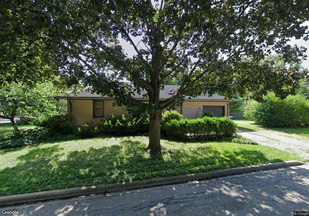
702 Eklund Ave Geneva, IL 60134
Northwest Central Geneva NeighborhoodEstimated Value: $347,120 - $384,000
2
Beds
2
Baths
1,064
Sq Ft
$341/Sq Ft
Est. Value
About This Home
This home is located at 702 Eklund Ave, Geneva, IL 60134 and is currently estimated at $363,030, approximately $341 per square foot. 702 Eklund Ave is a home located in Kane County with nearby schools including Williamsburg Elementary School, Geneva Community High School, and St. Peter School.
Ownership History
Date
Name
Owned For
Owner Type
Purchase Details
Closed on
Nov 25, 1997
Sold by
Prechodnik Joseph S and Prechodnik Barbara J
Bought by
Hayes Timothy K and Terpin Karen E
Current Estimated Value
Home Financials for this Owner
Home Financials are based on the most recent Mortgage that was taken out on this home.
Original Mortgage
$134,900
Outstanding Balance
$23,266
Interest Rate
7.45%
Estimated Equity
$339,764
Create a Home Valuation Report for This Property
The Home Valuation Report is an in-depth analysis detailing your home's value as well as a comparison with similar homes in the area
Home Values in the Area
Average Home Value in this Area
Purchase History
| Date | Buyer | Sale Price | Title Company |
|---|---|---|---|
| Hayes Timothy K | $94,666 | -- |
Source: Public Records
Mortgage History
| Date | Status | Borrower | Loan Amount |
|---|---|---|---|
| Open | Hayes Timothy K | $134,900 |
Source: Public Records
Tax History Compared to Growth
Tax History
| Year | Tax Paid | Tax Assessment Tax Assessment Total Assessment is a certain percentage of the fair market value that is determined by local assessors to be the total taxable value of land and additions on the property. | Land | Improvement |
|---|---|---|---|---|
| 2024 | $6,965 | $91,535 | $39,949 | $51,586 |
| 2023 | $6,827 | $83,213 | $36,317 | $46,896 |
| 2022 | $6,945 | $83,174 | $33,746 | $49,428 |
| 2021 | $6,754 | $80,083 | $32,492 | $47,591 |
| 2020 | $6,682 | $78,861 | $31,996 | $46,865 |
| 2019 | $6,671 | $77,368 | $31,390 | $45,978 |
| 2018 | $6,494 | $75,418 | $31,390 | $44,028 |
| 2017 | $6,430 | $73,407 | $30,553 | $42,854 |
| 2016 | $6,288 | $70,414 | $30,140 | $40,274 |
| 2015 | -- | $66,947 | $28,656 | $38,291 |
| 2014 | -- | $66,196 | $28,656 | $37,540 |
| 2013 | -- | $66,196 | $28,656 | $37,540 |
Source: Public Records
Map
Nearby Homes
- 82 Gray St
- 629 N Lincoln Ave
- 1008 Pine St
- 1028 S 5th St
- Lot 2 Geneva Rd
- Lot 1 Geneva Rd
- 885 Geneva Rd
- Lot 1 Keller Place
- 1017 S 6th St
- 806 Fellows St
- 2749 Stone Cir
- 2753 Stone Cir
- 2747 Stone Cir
- 2751 Stone Cir
- 10 Ford St Unit 103
- 839 N Bennett St
- 1211 James St
- 602 Highbury Ln
- 202 N Bennett St
- 1108 S 12th St Unit 2
- 748 Illinois St
- 742 Illinois St
- 738 Illinois St
- 717 Eklund Ave
- 641 Eklund Ave
- 732 Illinois St
- 747 Richards St
- 751 Richards St
- 806 Wilson St
- 741 Richards St
- 751 Illinois St
- 728 Illinois St
- 731 Richards St
- 808 Wilson St
- 631 Eklund Ave
- 741 Illinois St
- 725 Eklund Ave
- 809 Wilson St
- 727 Richards St
- 805 Richards St