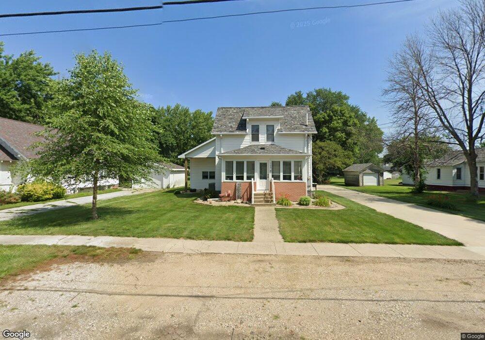
702 Maple St Sheffield, IA 50475
Estimated Value: $163,000 - $176,000
3
Beds
2
Baths
1,526
Sq Ft
$110/Sq Ft
Est. Value
About This Home
This home is located at 702 Maple St, Sheffield, IA 50475 and is currently estimated at $167,583, approximately $109 per square foot. 702 Maple St is a home with nearby schools including West Fork High School.
Create a Home Valuation Report for This Property
The Home Valuation Report is an in-depth analysis detailing your home's value as well as a comparison with similar homes in the area
Tax History
| Year | Tax Paid | Tax Assessment Tax Assessment Total Assessment is a certain percentage of the fair market value that is determined by local assessors to be the total taxable value of land and additions on the property. | Land | Improvement |
|---|---|---|---|---|
| 2025 | $2,000 | $134,600 | $13,000 | $121,600 |
| 2024 | $2,000 | $124,600 | $13,000 | $111,600 |
| 2023 | $2,074 | $123,500 | $13,000 | $110,500 |
| 2022 | $1,736 | $114,400 | $13,000 | $101,400 |
| 2021 | $1,736 | $93,100 | $13,000 | $80,100 |
| 2020 | $1,486 | $89,400 | $13,000 | $76,400 |
| 2019 | $1,368 | $81,000 | $0 | $0 |
| 2018 | $1,316 | $81,000 | $0 | $0 |
| 2017 | $1,316 | $71,800 | $0 | $0 |
| 2016 | $1,176 | $71,800 | $0 | $0 |
| 2015 | $1,176 | $66,200 | $0 | $0 |
| 2014 | $1,096 | $66,200 | $0 | $0 |
Source: Public Records
Map
Nearby Homes
- 319 S Lincoln St
- 421 Sherman St
- 718 Gilman St
- 202 Brickyard Ct
- 319 N 6th St
- 102 Cleveland St
- 200 Brickyard Ct
- 602 Claydigger Run
- 410 Brickyard Rd
- 409 Brickyard Rd
- 421 Brickyard Rd
- 417 Brickyard Rd
- 419 Brickyard Rd
- 416 Brickyard Rd
- 402 Brickyard Rd
- 411 Brickyard Rd
- 415 Brickyard Rd
- 400 Brickyard Rd
- 418 Brickyard Rd
- 600 Claydigger Run
Your Personal Tour Guide
Ask me questions while you tour the home.