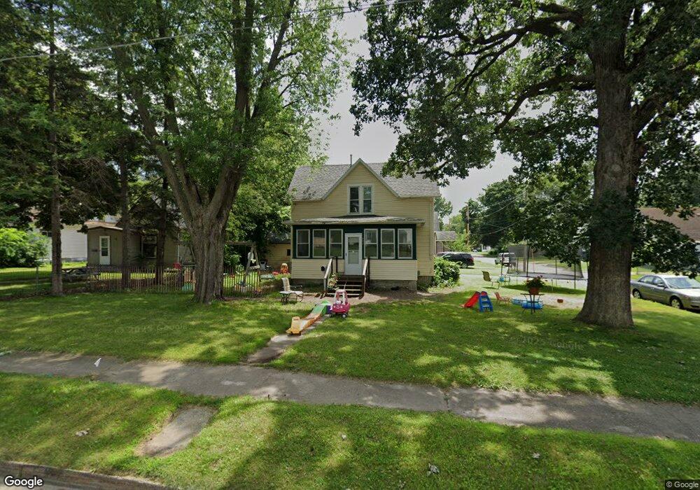
702 Sheridan St Albert Lea, MN 56007
Estimated Value: $128,000 - $507,966
6
Beds
4
Baths
1,200
Sq Ft
$204/Sq Ft
Est. Value
About This Home
This home is located at 702 Sheridan St, Albert Lea, MN 56007 and is currently estimated at $244,742, approximately $203 per square foot. 702 Sheridan St is a home located in Freeborn County with nearby schools including Hawthorne Elementary School, Southwest Middle School, and Albert Lea Senior High School.
Ownership History
Date
Name
Owned For
Owner Type
Purchase Details
Closed on
Aug 1, 2022
Sold by
St Ives Corporation
Bought by
Tuttle Enterprises Llc
Current Estimated Value
Purchase Details
Closed on
Jun 30, 2022
Sold by
Klassen Jr. James
Bought by
Lea Development Llc
Purchase Details
Closed on
Mar 30, 2009
Sold by
Johnson Corinne M and Johnson Corrine M
Bought by
Attig Mark A and Attig Casie M
Purchase Details
Closed on
Mar 25, 2009
Sold by
Weite Kenneth D and Weite Marcia
Bought by
Attig Mark A and Attig Casie M
Purchase Details
Closed on
Mar 23, 2009
Sold by
Weite Paul E and Weite Deborah S
Bought by
Attig Mark A and Attig Casie M
Create a Home Valuation Report for This Property
The Home Valuation Report is an in-depth analysis detailing your home's value as well as a comparison with similar homes in the area
Home Values in the Area
Average Home Value in this Area
Purchase History
| Date | Buyer | Sale Price | Title Company |
|---|---|---|---|
| Tuttle Enterprises Llc | $83,000 | -- | |
| Lea Development Llc | $43,000 | -- | |
| Attig Mark A | -- | -- | |
| Attig Mark A | -- | -- | |
| Attig Mark A | -- | -- |
Source: Public Records
Tax History Compared to Growth
Tax History
| Year | Tax Paid | Tax Assessment Tax Assessment Total Assessment is a certain percentage of the fair market value that is determined by local assessors to be the total taxable value of land and additions on the property. | Land | Improvement |
|---|---|---|---|---|
| 2025 | $1,644 | $104,500 | $25,200 | $79,300 |
| 2024 | $1,452 | $102,600 | $25,200 | $77,400 |
| 2023 | $1,164 | $92,900 | $25,200 | $67,700 |
| 2022 | $750 | $98,100 | $25,200 | $72,900 |
| 2021 | $744 | $60,700 | $20,200 | $40,500 |
| 2020 | $694 | $55,500 | $20,200 | $35,300 |
| 2019 | $598 | $48,700 | $17,800 | $30,900 |
| 2018 | $588 | $0 | $0 | $0 |
| 2016 | $590 | $0 | $0 | $0 |
| 2015 | $514 | $0 | $0 | $0 |
| 2014 | $774 | $0 | $0 | $0 |
| 2012 | $946 | $0 | $0 | $0 |
Source: Public Records
Map
Nearby Homes
- 605 E Hawthorne St
- 613 & 615 Giles Place
- 618 & 620 Giles Place
- 902 Clausen Ave
- 713 Minnesota Ave
- 711 Clausen Ave
- 1020 Saint Jacob Ave
- 602 Minnesota Ave
- 314 Burr Oak Dr
- 819 Pillsbury Ave
- 209 Burr Oak Dr
- 505 Pillsbury Ave
- 313 Glenn Rd
- 614 Garfield Ave
- 1321 Garfield Ave
- 1626 Keystone Dr
- 212 N Broadway Ave Unit C1
- 115 N Newton Ave
- 1200 Crestview Rd
- 611 Ulstad Ave
- 706 Sheridan St
- 808 Harding Ave
- 710 Sheridan St
- 626 Sheridan St
- 806 Harding Ave
- 809 Harding Ave
- 622 Sheridan St
- 714 Sheridan St
- 802 Harding Ave
- 703 Sheridan St
- 807 Harding Ave
- 625 Sheridan St
- 709 Sheridan St
- 711 Sheridan St
- 618 Sheridan St
- 718 Sheridan St
- 623 Sheridan St
- 623 Hope Ln
- 800 Harding Ave
- 713 Sheridan St