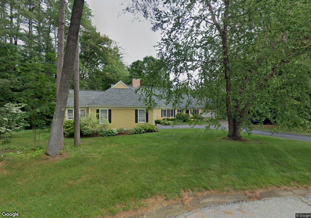
702 Smithfield Rd Contoocook, NH 03229
Contoocook NeighborhoodEstimated Value: $535,000 - $561,839
2
Beds
3
Baths
2,390
Sq Ft
$228/Sq Ft
Est. Value
About This Home
This home is located at 702 Smithfield Rd, Contoocook, NH 03229 and is currently estimated at $545,210, approximately $228 per square foot. 702 Smithfield Rd is a home located in Merrimack County with nearby schools including Harold Martin School, Hopkinton Middle School, and The Contoocook School.
Ownership History
Date
Name
Owned For
Owner Type
Purchase Details
Closed on
Mar 23, 2018
Sold by
Patricia C Ayers T
Bought by
Hemingson Celeslte A
Current Estimated Value
Purchase Details
Closed on
Feb 14, 2012
Sold by
Ayers Patricia C
Bought by
Patricia C Ayers T
Purchase Details
Closed on
Aug 26, 1999
Sold by
Lew Dev Corp
Bought by
Collins Lawrence V and Collins Judith P
Home Financials for this Owner
Home Financials are based on the most recent Mortgage that was taken out on this home.
Original Mortgage
$50,000
Interest Rate
7.53%
Mortgage Type
Purchase Money Mortgage
Create a Home Valuation Report for This Property
The Home Valuation Report is an in-depth analysis detailing your home's value as well as a comparison with similar homes in the area
Home Values in the Area
Average Home Value in this Area
Purchase History
| Date | Buyer | Sale Price | Title Company |
|---|---|---|---|
| Hemingson Celeslte A | $292,000 | -- | |
| Patricia C Ayers T | -- | -- | |
| Collins Lawrence V | $205,300 | -- |
Source: Public Records
Mortgage History
| Date | Status | Borrower | Loan Amount |
|---|---|---|---|
| Previous Owner | Collins Lawrence V | $50,000 |
Source: Public Records
Tax History Compared to Growth
Tax History
| Year | Tax Paid | Tax Assessment Tax Assessment Total Assessment is a certain percentage of the fair market value that is determined by local assessors to be the total taxable value of land and additions on the property. | Land | Improvement |
|---|---|---|---|---|
| 2024 | $12,095 | $522,900 | $0 | $522,900 |
| 2023 | $12,617 | $343,600 | $0 | $343,600 |
| 2022 | $11,634 | $343,600 | $0 | $343,600 |
| 2020 | $10,610 | $343,600 | $0 | $343,600 |
| 2019 | $10,569 | $343,600 | $0 | $343,600 |
| 2018 | $10,393 | $282,100 | $0 | $282,100 |
| 2017 | $10,271 | $282,100 | $0 | $282,100 |
| 2016 | $10,820 | $322,500 | $0 | $322,500 |
| 2015 | $10,842 | $322,500 | $0 | $322,500 |
| 2014 | $10,501 | $322,500 | $0 | $322,500 |
| 2013 | $8,760 | $304,800 | $103,700 | $201,100 |
Source: Public Records
Map
Nearby Homes
- 108 Maple St
- 38 Woodwells Garrison Rd
- 455 Maple St
- 104 River Grant Dr
- 0 Bound Tree Rd Unit 50 5060705
- 93-1 Pine St
- 0 Pine St Unit 38 5061613
- 0 Pine St Unit 50 5060731
- 2 Granite Valley
- 656 Dolly Rd
- 356 E Penacook Rd
- 89 Old Henniker Rd
- 1036 Bound Tree Rd
- 105 Clement Hill Rd
- 102 Fieldstone Rd
- 155 Pamela Dr
- 106 Stacey Dr
- 256 Irish Hill Rd
- 541 South Rd
- 464 Irish Hill Rd
- 802 Smithfield Rd
- 701 Smithfield Rd
- 801 Smithfield Rd
- 502 Smithfield Rd
- 401 Smithfield Rd
- 601 Smithfield Rd
- 501 Smithfield Rd
- 602 Smithfield Rd
- 602 Smithfield Rd Unit 1
- 402 Smithfield Rd
- 301 Smithfield Rd
- 302 Smithfield Rd
- 697 Main St
- 202 Smithfield Rd
- 201 Smithfield Rd
- 717 Main St
- 102 Smithfield Rd
- 101 Smithfield Rd
- 144 Woodland Dr
- 134 Woodland Dr