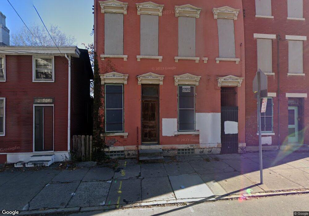
702 State Ave Cincinnati, OH 45204
East Price Hill Neighborhood
Studio
--
Bath
--
Sq Ft
1,742
Sq Ft
About This Home
This home is located at 702 State Ave, Cincinnati, OH 45204. 702 State Ave is a home located in Hamilton County with nearby schools including Oyler School, Robert A. Taft Information Technology High School, and Gilbert A. Dater High School.
Create a Home Valuation Report for This Property
The Home Valuation Report is an in-depth analysis detailing your home's value as well as a comparison with similar homes in the area
Home Values in the Area
Average Home Value in this Area
Tax History
| Year | Tax Paid | Tax Assessment Tax Assessment Total Assessment is a certain percentage of the fair market value that is determined by local assessors to be the total taxable value of land and additions on the property. | Land | Improvement |
|---|---|---|---|---|
| 2025 | $324 | $3,815 | $1,708 | $2,107 |
| 2024 | -- | $3,815 | $1,708 | $2,107 |
| 2023 | $71 | $3,815 | $1,708 | $2,107 |
| 2022 | $43 | $3,606 | $1,845 | $1,761 |
| 2021 | $21 | $3,606 | $1,845 | $1,761 |
| 2020 | $38 | $3,606 | $1,845 | $1,761 |
| 2019 | $5 | $3,606 | $1,845 | $1,761 |
| 2018 | $5 | $3,606 | $1,845 | $1,761 |
| 2017 | $483 | $3,606 | $1,845 | $1,761 |
| 2016 | $891 | $3,049 | $1,586 | $1,463 |
| 2015 | $472 | $3,049 | $1,586 | $1,463 |
| 2014 | $273 | $3,049 | $1,586 | $1,463 |
| 2013 | $310 | $3,466 | $1,803 | $1,663 |
Source: Public Records
Map
Nearby Homes
- 2152 Staebler St
- 2430 Maryland Ave
- 2358 Glenway Ave
- 309 Mount Hope Ave
- 2414 River Rd
- 2360 Wilder Ave
- 2485 Warsaw Ave
- 2403 Elberon Ave
- 2425 Glenway Ave
- 720 Grand Ave
- 2462 River Rd
- 540 Grand Ave
- 538 Grand Ave
- 2519 Warsaw Ave
- 552 Grand Ave
- 658 Hawthorne Ave
- 454 Grand Ave
- 452 Grand Ave
- 578 Considine Ave
- 817 Hawthorne Ave
Your Personal Tour Guide
Ask me questions while you tour the home.