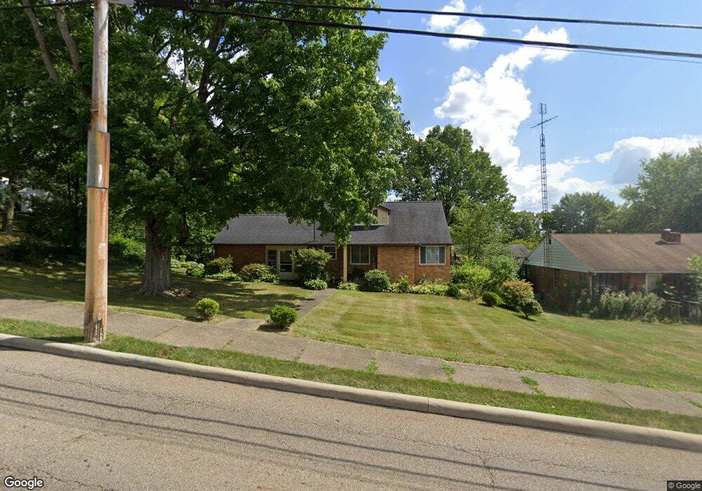
702 W Maple St North Canton, OH 44720
Estimated Value: $209,000 - $233,000
4
Beds
2
Baths
1,427
Sq Ft
$153/Sq Ft
Est. Value
About This Home
This home is located at 702 W Maple St, North Canton, OH 44720 and is currently estimated at $217,766, approximately $152 per square foot. 702 W Maple St is a home located in Stark County with nearby schools including Orchard Hill Intermediate School, North Canton Middle School, and Hoover High School.
Ownership History
Date
Name
Owned For
Owner Type
Purchase Details
Closed on
Jun 7, 2004
Sold by
Oleskey Joseph S and Oleskey Nancy S
Bought by
Brahler Ronald L and Brahler Lynne S
Current Estimated Value
Home Financials for this Owner
Home Financials are based on the most recent Mortgage that was taken out on this home.
Original Mortgage
$40,000
Interest Rate
6.06%
Mortgage Type
Purchase Money Mortgage
Purchase Details
Closed on
Jul 8, 1994
Sold by
Moine David W
Bought by
Oleskey Joseph S and Oleskey Nancy
Home Financials for this Owner
Home Financials are based on the most recent Mortgage that was taken out on this home.
Original Mortgage
$71,400
Interest Rate
8.61%
Mortgage Type
New Conventional
Create a Home Valuation Report for This Property
The Home Valuation Report is an in-depth analysis detailing your home's value as well as a comparison with similar homes in the area
Home Values in the Area
Average Home Value in this Area
Purchase History
| Date | Buyer | Sale Price | Title Company |
|---|---|---|---|
| Brahler Ronald L | $119,000 | Mk Title Agency Of Stark Cou | |
| Oleskey Joseph S | $84,000 | -- |
Source: Public Records
Mortgage History
| Date | Status | Borrower | Loan Amount |
|---|---|---|---|
| Closed | Brahler Ronald L | $40,000 | |
| Previous Owner | Oleskey Joseph S | $71,400 |
Source: Public Records
Tax History
| Year | Tax Paid | Tax Assessment Tax Assessment Total Assessment is a certain percentage of the fair market value that is determined by local assessors to be the total taxable value of land and additions on the property. | Land | Improvement |
|---|---|---|---|---|
| 2025 | -- | $65,170 | $17,780 | $47,390 |
| 2024 | -- | $65,170 | $17,780 | $47,390 |
| 2023 | $2,586 | $47,360 | $13,340 | $34,020 |
| 2022 | $2,488 | $47,360 | $13,340 | $34,020 |
| 2021 | $2,402 | $47,360 | $13,340 | $34,020 |
| 2020 | $2,302 | $40,740 | $11,620 | $29,120 |
| 2019 | $2,147 | $40,740 | $11,620 | $29,120 |
Source: Public Records
Map
Nearby Homes
- 331 Harmon St SW
- 827 Summit St SW
- 422 Werstler Ave NW
- 1134 W Maple St Unit 3A
- 1124 Valley Dr NW
- 1222 W Maple St Unit 6A
- 514 6th St NW
- 545 Pittsburg Ave NW
- 800 Emerson Ave NW
- 0 Pittsburg Ave NW
- 140 5th St NE
- 0 V L Milton St NW
- 416 Adena St NE
- 1276 Linwood Ave SW
- 245 James St SW
- 534 E Maple St
- 1254 Los Angeles Blvd NW
- 5613 Thunderbird Cir NW
- 1367 Elmwood Ave SW
- 762 Summit Cir SE
- 630 W Maple St
- 703 Harmon St SW
- 720 W Maple St
- 709 Harmon St SW
- 105 Donner Ave NW
- 707 W Maple St
- 715 W Maple St
- 639 W Maple St
- 721 Harmon St SW
- 721 W Maple St
- 130 Donner Ave SW
- 635 W Maple St
- 730 W Maple St
- 620 W Maple St
- 727 W Maple St
- 629 W Maple St
- 120 Lindy Lane Ave SW
- 627 Harmon St SW
- 733 W Maple St
- 625 W Maple St
Your Personal Tour Guide
Ask me questions while you tour the home.