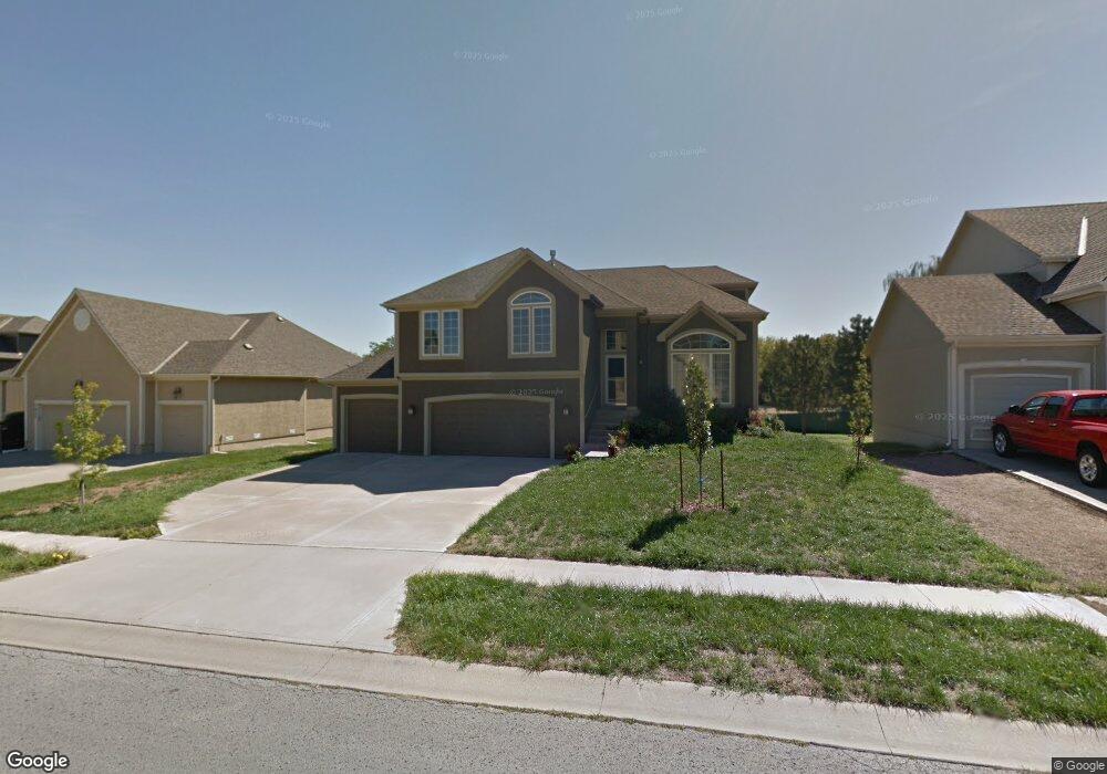
7029 Round Prairie St Shawnee, KS 66226
Estimated Value: $441,909 - $466,000
4
Beds
3
Baths
1,947
Sq Ft
$234/Sq Ft
Est. Value
About This Home
This home is located at 7029 Round Prairie St, Shawnee, KS 66226 and is currently estimated at $456,227, approximately $234 per square foot. 7029 Round Prairie St is a home located in Johnson County with nearby schools including Horizon Elementary School, Mill Creek Middle School, and Mill Valley High School.
Ownership History
Date
Name
Owned For
Owner Type
Purchase Details
Closed on
Dec 8, 2009
Sold by
Horizon Building Co Llc
Bought by
Merrihew Michelle C
Current Estimated Value
Home Financials for this Owner
Home Financials are based on the most recent Mortgage that was taken out on this home.
Original Mortgage
$167,523
Outstanding Balance
$109,883
Interest Rate
5.01%
Mortgage Type
New Conventional
Estimated Equity
$346,344
Purchase Details
Closed on
May 26, 2006
Sold by
Madison Heights Llc
Bought by
Horizon Huilders Co Llc
Home Financials for this Owner
Home Financials are based on the most recent Mortgage that was taken out on this home.
Original Mortgage
$220,000
Interest Rate
6.56%
Mortgage Type
Construction
Create a Home Valuation Report for This Property
The Home Valuation Report is an in-depth analysis detailing your home's value as well as a comparison with similar homes in the area
Home Values in the Area
Average Home Value in this Area
Purchase History
| Date | Buyer | Sale Price | Title Company |
|---|---|---|---|
| Merrihew Michelle C | -- | First American Title Ins Co | |
| Horizon Huilders Co Llc | -- | None Available |
Source: Public Records
Mortgage History
| Date | Status | Borrower | Loan Amount |
|---|---|---|---|
| Open | Merrihew Michelle C | $167,523 | |
| Previous Owner | Horizon Huilders Co Llc | $220,000 |
Source: Public Records
Tax History Compared to Growth
Tax History
| Year | Tax Paid | Tax Assessment Tax Assessment Total Assessment is a certain percentage of the fair market value that is determined by local assessors to be the total taxable value of land and additions on the property. | Land | Improvement |
|---|---|---|---|---|
| 2024 | $5,343 | $45,988 | $9,638 | $36,350 |
| 2023 | $5,479 | $46,598 | $9,638 | $36,960 |
| 2022 | $5,248 | $43,723 | $9,638 | $34,085 |
| 2021 | $5,248 | $39,410 | $9,638 | $29,772 |
| 2020 | $4,790 | $38,019 | $8,766 | $29,253 |
| 2019 | $4,726 | $36,962 | $8,039 | $28,923 |
| 2018 | $4,544 | $35,225 | $8,039 | $27,186 |
| 2017 | $4,461 | $33,729 | $7,307 | $26,422 |
| 2016 | $4,368 | $32,625 | $7,307 | $25,318 |
| 2015 | $4,255 | $31,222 | $7,307 | $23,915 |
| 2013 | -- | $26,461 | $7,307 | $19,154 |
Source: Public Records
Map
Nearby Homes
- 7908 Millridge St
- 9309 Aminda St
- 22707 W 73rd St
- 00 75th St
- 000 75th St
- 0000 75th St
- 7342 Mccoy St
- 6820 Marion St
- 23154 W 71st Terrace
- 23136 W 71st Terrace
- 21405 W 73rd Terrace
- 7512 Mccoy St
- 23217 W 71st Terrace
- 22408 W 76th St
- 22410 W 76th St
- 22310 W 76th St
- 22312 W 76th St
- 7153 Meadow View St
- 7943 Noble St
- 7939 Noble St
- 7025 Round Prairie St
- 7033 Round Prairie St
- 7021 Round Prairie St
- 7037 Round Prairie St
- 22104 W 70th Terrace
- 7017 Round Prairie St
- 7024 Round Prairie St
- 22105 W 70th Terrace
- 22108 W 70th Terrace
- 7013 Round Prairie St
- 22109 W 70th Terrace
- 7012 Round Prairie St
- 22022 W 71st Terrace
- 22106 W 71st Terrace
- 22119 W 70th St
- 22112 W 70th Terrace
- 7009 Round Prairie St
- 22115 W 70th St
- 22210 W 71st St
- 22113 W 70th Terrace