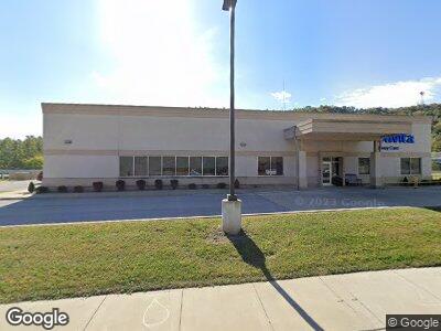
703 Main St Bridge Port, OH 43912
--
Bed
--
Bath
6,780
Sq Ft
3
Acres
About This Home
This home is located at 703 Main St, Bridge Port, OH 43912. 703 Main St is a home located in Belmont County with nearby schools including Bridgeport Elementary School, Bridgeport Middle School, and Bridgeport High School.
Ownership History
Date
Name
Owned For
Owner Type
Purchase Details
Closed on
Jun 6, 2019
Bought by
Bridgeport Main Llc
Home Financials for this Owner
Home Financials are based on the most recent Mortgage that was taken out on this home.
Interest Rate
3.82%
Purchase Details
Closed on
Jun 27, 2018
Sold by
Maroon Joseph C and Tumolo John A
Bought by
Bridgeport Main Llc
Home Financials for this Owner
Home Financials are based on the most recent Mortgage that was taken out on this home.
Original Mortgage
$1,690,000
Interest Rate
4.5%
Mortgage Type
Future Advance Clause Open End Mortgage
Purchase Details
Closed on
Mar 17, 2016
Bought by
Maroon Joseph C
Home Financials for this Owner
Home Financials are based on the most recent Mortgage that was taken out on this home.
Interest Rate
3.73%
Purchase Details
Closed on
Jan 1, 1987
Sold by
Maroon Joseph C
Bought by
Maroon Joseph C
Create a Home Valuation Report for This Property
The Home Valuation Report is an in-depth analysis detailing your home's value as well as a comparison with similar homes in the area
Home Values in the Area
Average Home Value in this Area
Purchase History
| Date | Buyer | Sale Price | Title Company |
|---|---|---|---|
| Bridgeport Main Llc | -- | -- | |
| Bridgeport Main Llc | $500 | None Available | |
| Maroon Joseph C | -- | -- | |
| Maroon Joseph C | -- | -- |
Source: Public Records
Mortgage History
| Date | Status | Borrower | Loan Amount |
|---|---|---|---|
| Open | Bridgeport Main Llc | $9,571,000 | |
| Closed | Maroon Joseph C | -- | |
| Previous Owner | Bridgeport Main Llc | $1,690,000 | |
| Previous Owner | Maroon Joseph C | -- | |
| Previous Owner | Maroon Joseph C | $500,000 |
Source: Public Records
Tax History Compared to Growth
Tax History
| Year | Tax Paid | Tax Assessment Tax Assessment Total Assessment is a certain percentage of the fair market value that is determined by local assessors to be the total taxable value of land and additions on the property. | Land | Improvement |
|---|---|---|---|---|
| 2024 | $25,024 | $429,710 | $65,040 | $364,670 |
| 2023 | $25,822 | $407,230 | $124,670 | $282,560 |
| 2022 | $25,830 | $407,224 | $124,666 | $282,558 |
| 2021 | $26,071 | $407,224 | $124,666 | $282,558 |
| 2020 | $24,787 | $407,230 | $124,670 | $282,560 |
| 2019 | $24,758 | $407,230 | $124,670 | $282,560 |
| 2018 | $6,971 | $112,820 | $61,540 | $51,280 |
| 2017 | $6,966 | $110,010 | $59,860 | $50,150 |
| 2016 | $6,873 | $110,010 | $59,860 | $50,150 |
| 2015 | $896 | $14,360 | $14,360 | $0 |
| 2014 | $830 | $13,420 | $13,420 | $0 |
| 2013 | -- | $13,420 | $13,420 | $0 |
Source: Public Records
Map
Nearby Homes
- 810 Howard St
- 1039 Howard St
- 516 Bennett St
- 422 Whitely St
- 9 Poplar St
- 67578 Kirkwood Heights Rd
- 211 Scotts Ln
- 67764 Kirkwood Heights Rd
- 67620 Kirkwood Heights Rd
- 67730 Kirkwood Heights Rd
- 56559 Boyd Ave
- 67656 Kirkwood Heights Rd
- 129-131 S Huron St
- 220 N Wabash St
- 56400 Boyd Ave
- 217 N Huron St
- 301 N Huron St
- 44 Kentucky St
- 434 N Erie St
- 92 New Jersey St