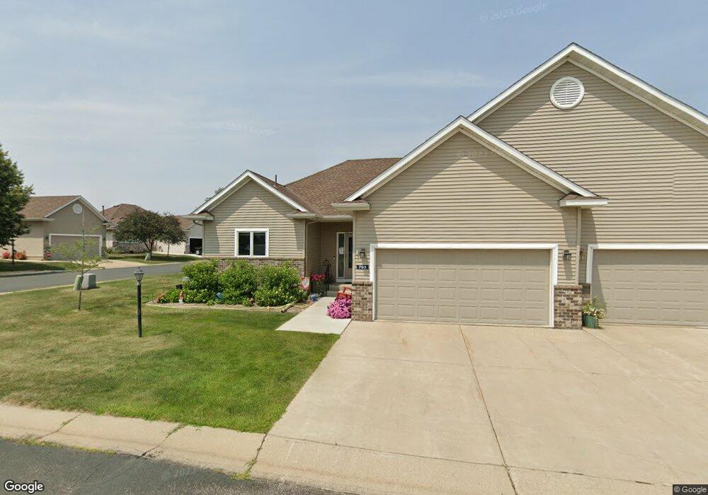
703 Pointe Ln Northfield, MN 55057
Estimated Value: $395,763 - $443,000
2
Beds
3
Baths
1,582
Sq Ft
$263/Sq Ft
Est. Value
About This Home
This home is located at 703 Pointe Ln, Northfield, MN 55057 and is currently estimated at $416,441, approximately $263 per square foot. 703 Pointe Ln is a home located in Rice County with nearby schools including Bridgewater Elementary School, Northfield Middle School, and Northfield Senior High School.
Ownership History
Date
Name
Owned For
Owner Type
Purchase Details
Closed on
Sep 15, 2017
Sold by
Henze Pamela K
Bought by
Wassmund Keith D and Wassmund Linda
Current Estimated Value
Home Financials for this Owner
Home Financials are based on the most recent Mortgage that was taken out on this home.
Original Mortgage
$189,500
Outstanding Balance
$158,246
Interest Rate
3.9%
Mortgage Type
New Conventional
Estimated Equity
$258,195
Purchase Details
Closed on
Dec 15, 2005
Sold by
Olson Brothers Construction Inc
Bought by
Henze Steven D and Henze Pamela K
Create a Home Valuation Report for This Property
The Home Valuation Report is an in-depth analysis detailing your home's value as well as a comparison with similar homes in the area
Home Values in the Area
Average Home Value in this Area
Purchase History
| Date | Buyer | Sale Price | Title Company |
|---|---|---|---|
| Wassmund Keith D | $269,500 | Titlesmart Inc | |
| Henze Steven D | $265,667 | -- |
Source: Public Records
Mortgage History
| Date | Status | Borrower | Loan Amount |
|---|---|---|---|
| Open | Wassmund Keith D | $189,500 |
Source: Public Records
Tax History
| Year | Tax Paid | Tax Assessment Tax Assessment Total Assessment is a certain percentage of the fair market value that is determined by local assessors to be the total taxable value of land and additions on the property. | Land | Improvement |
|---|---|---|---|---|
| 2025 | $6,058 | $367,100 | $69,000 | $298,100 |
| 2024 | $6,058 | $340,300 | $64,000 | $276,300 |
| 2023 | $4,906 | $340,300 | $64,000 | $276,300 |
| 2022 | $4,472 | $310,300 | $56,000 | $254,300 |
| 2021 | $4,342 | $276,800 | $44,000 | $232,800 |
| 2020 | $4,416 | $265,700 | $44,000 | $221,700 |
| 2019 | $4,232 | $264,500 | $44,000 | $220,500 |
| 2018 | $242 | $251,200 | $44,000 | $207,200 |
| 2017 | $3,458 | $241,200 | $44,000 | $197,200 |
| 2016 | $3,446 | $221,900 | $41,500 | $180,400 |
| 2015 | $3,028 | $211,400 | $41,500 | $169,900 |
| 2014 | -- | $189,700 | $36,500 | $153,200 |
Source: Public Records
Map
Nearby Homes
- 1802 Van Buren Ct
- 1741 Roosevelt Dr
- 2100 Taylor Ct
- 2004 Lincoln St S
- 1513 Senate Ln
- XXXX Division St S
- 2300 Pepper Ridge Ln
- 2106 Sunnyview Ln
- 1301 Presidential Dr
- 1908 Sibley View Ln
- 2432 Aspen St
- 2505 Aspen St
- 205 Linden Place S
- 2620 Oak Lawn Dr
- 318 Ford St E
- 402 Ford St E
- Outlot Honeylocust Dr
- 421 Ford St E
- 406 Ford St E
- 410 Ford St E
- 701 Pointe Ln
- 2005 Park Pointe Ct
- 2016 Park Pointe Ct
- 2012 Park Pointe Ct
- 2100 Park Pointe Dr
- 2008 Park Pointe Ct
- 702 Pointe Ln
- 2001 Park Pointe Ct
- 700 Pointe Ln
- 2104 Park Pointe Dr
- 2000 Park Pointe Ct
- 2004 Park Pointe Ct
- 617 Hayes Dr
- 613 Hayes Dr
- 2108 Park Pointe Dr
- 2107 Park Pointe Dr
- 609 Hayes Dr
- 2111 Park Pointe Dr
- 2000 Johnson Ct
- 2112 Park Pointe Dr
Your Personal Tour Guide
Ask me questions while you tour the home.