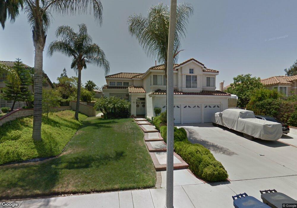
7031 Westport St Riverside, CA 92506
Mission Grove NeighborhoodEstimated Value: $806,442 - $967,000
5
Beds
3
Baths
2,650
Sq Ft
$331/Sq Ft
Est. Value
About This Home
This home is located at 7031 Westport St, Riverside, CA 92506 and is currently estimated at $878,361, approximately $331 per square foot. 7031 Westport St is a home located in Riverside County with nearby schools including William Howard Taft Elementary School, Amelia Earhart Middle School, and Martin Luther King Junior High School.
Ownership History
Date
Name
Owned For
Owner Type
Purchase Details
Closed on
Nov 25, 2019
Sold by
Department Of Veterans Affairs Of The St
Bought by
Davis Richard A and Davis Lynn R
Current Estimated Value
Purchase Details
Closed on
Jun 18, 1998
Sold by
Davis Richard A and Davis Lynn R
Bought by
Davis Richard A and Davis Lynn R
Create a Home Valuation Report for This Property
The Home Valuation Report is an in-depth analysis detailing your home's value as well as a comparison with similar homes in the area
Home Values in the Area
Average Home Value in this Area
Purchase History
We collect this data history from publicly available records. To have your information removed, we recommend requesting removal directly through your county’s website.
| Date | Buyer | Sale Price | Title Company |
|---|---|---|---|
| Davis Richard A | -- | None Available | |
| Davis Richard A | -- | -- |
Source: Public Records
Tax History
| Year | Tax Paid | Tax Assessment Tax Assessment Total Assessment is a certain percentage of the fair market value that is determined by local assessors to be the total taxable value of land and additions on the property. | Land | Improvement |
|---|---|---|---|---|
| 2025 | $4,312 | $403,814 | $108,201 | $295,613 |
| 2023 | $4,312 | $388,135 | $104,000 | $284,135 |
| 2022 | $4,211 | $380,525 | $101,961 | $278,564 |
| 2021 | $4,156 | $373,064 | $99,962 | $273,102 |
| 2020 | $4,124 | $369,240 | $98,938 | $270,302 |
| 2019 | $4,045 | $362,001 | $96,999 | $265,002 |
| 2018 | $3,965 | $354,904 | $95,098 | $259,806 |
| 2017 | $3,894 | $347,946 | $93,234 | $254,712 |
| 2016 | $3,643 | $341,124 | $91,406 | $249,718 |
| 2015 | $3,590 | $336,002 | $90,034 | $245,968 |
| 2014 | $3,555 | $329,421 | $88,271 | $241,150 |
Source: Public Records
Map
Nearby Homes
- 1003 Clearwood Ave
- 901 Clearwood Ave
- 110 Sandpoint Ln
- 7158 Golden Vale Dr
- 200 E Alessandro Blvd Unit 34
- 282 Port Royal Way
- 7007 Golden Vale Dr
- 1210 Versailles Cir
- 1248 Shakespeare Dr
- 19121 Broken Bow Dr
- 7639 Hillhurst Dr
- 7361 Via Vista Dr
- 14119 Ashton Ln
- 14420 Merlot Ct
- 1719 Crystal Ridge Ct
- 14251 Ashton Ln
- 14182 Crystal View Terrace
- 0 Via Vista Dr Unit IV25239083
- 14435 Wood Rd
- 14427 Ashton Ln
- 7037 Westport St
- 7025 Westport St
- 7043 Westport St
- 1053 New Star Cir
- 1054 Sunlight Cir
- 1052 New Star Cir
- 1068 Sunlight Cir
- 7049 Westport St
- 1039 New Star Cir
- 7048 Westport St
- 7018 Westport St
- 1038 New Star Cir
- 7055 Westport St
- 7058 Westport St
- 1025 New Star Cir
- 7012 Westport St
- 1092 Sunlight Cir
- 1055 Sunlight Cir
- 1069 Sunlight Cir
- 7061 Westport St
Your Personal Tour Guide
Ask me questions while you tour the home.