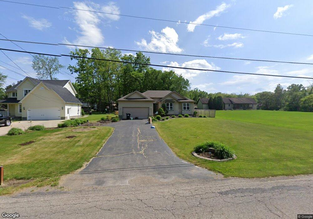
7033 Kirk Rd Canfield, OH 44406
Austintown NeighborhoodEstimated Value: $258,005 - $283,000
3
Beds
2
Baths
1,451
Sq Ft
$188/Sq Ft
Est. Value
About This Home
This home is located at 7033 Kirk Rd, Canfield, OH 44406 and is currently estimated at $273,001, approximately $188 per square foot. 7033 Kirk Rd is a home located in Mahoning County with nearby schools including Austintown Elementary School, Austintown Intermediate School, and Austintown Middle School.
Ownership History
Date
Name
Owned For
Owner Type
Purchase Details
Closed on
Aug 19, 1997
Sold by
D E B Enterprises Inc
Bought by
Gannon Margaret C
Current Estimated Value
Purchase Details
Closed on
Jun 3, 1992
Bought by
Mill Creek Land Corp
Create a Home Valuation Report for This Property
The Home Valuation Report is an in-depth analysis detailing your home's value as well as a comparison with similar homes in the area
Home Values in the Area
Average Home Value in this Area
Purchase History
| Date | Buyer | Sale Price | Title Company |
|---|---|---|---|
| Gannon Margaret C | $124,780 | -- | |
| Mill Creek Land Corp | $558,600 | -- |
Source: Public Records
Tax History
| Year | Tax Paid | Tax Assessment Tax Assessment Total Assessment is a certain percentage of the fair market value that is determined by local assessors to be the total taxable value of land and additions on the property. | Land | Improvement |
|---|---|---|---|---|
| 2025 | $3,574 | $74,540 | $9,730 | $64,810 |
| 2024 | $3,411 | $74,540 | $9,730 | $64,810 |
| 2023 | $3,358 | $74,540 | $9,730 | $64,810 |
| 2022 | $3,129 | $55,700 | $9,730 | $45,970 |
| 2021 | $3,131 | $55,700 | $9,730 | $45,970 |
| 2020 | $3,144 | $55,700 | $9,730 | $45,970 |
| 2019 | $3,058 | $49,360 | $9,730 | $39,630 |
| 2018 | $2,942 | $49,360 | $9,730 | $39,630 |
| 2017 | $2,783 | $49,360 | $9,730 | $39,630 |
| 2016 | $2,627 | $43,690 | $9,730 | $33,960 |
| 2015 | $2,547 | $43,690 | $9,730 | $33,960 |
| 2014 | $2,559 | $43,690 | $9,730 | $33,960 |
| 2013 | $2,531 | $43,690 | $9,730 | $33,960 |
Source: Public Records
Map
Nearby Homes
- 3449 Meanderwood Dr
- 3121 Meanderwood Dr
- 2998 Whispering Pines Dr
- 6948 Meander Reserve Ct
- 4849 My Way
- 6581 Country Ridge Ave
- 6438 Calvary Ct
- 9112 New Rd
- 6343 Gibson Rd
- 583 Wyndclift Cir
- 242 Wilcox Rd Unit 242
- 379 Wyndclift Place
- 21 Timber Run Ct
- 68 Timber Run Dr
- 0 Maple Ave Unit 5190079
- 0 Maple Ave Unit 5190077
- 0 Maple Ave Unit 5190082
- 5552 Callaway Cir Unit 2
- 1556 Pimlico Dr Unit 15
- 6042 Callaway Cir Unit 5
- 7025 Kirk Rd
- 3421 Meanderwood Dr
- 7467 Kirk Rd
- 3425 Meanderwood Dr
- 7001 Kirk Rd
- 7050 Kirk Rd
- 3420 Meanderwood Dr
- 3429 Meanderwood Dr
- 7477 Kirk Rd
- 7080 Kirk Rd
- 3428 Meanderwood Dr
- 6983 Kirk Rd
- 6983 Kirk Rd
- 3433 Meanderwood Dr
- 3434 Meanderwood Dr
- 7065 Berry Blossom Dr
- 7004 Kirk Rd
- 7057 Berry Blossom Dr
- 6975 Kirk Rd
- 3438 Meanderwood Dr
Your Personal Tour Guide
Ask me questions while you tour the home.