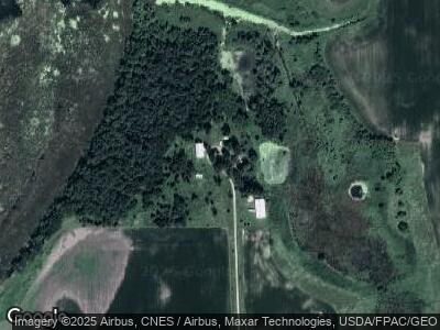
70380 State Line Rd Emmons, MN 56029
Estimated Value: $358,203 - $495,000
3
Beds
2
Baths
2,104
Sq Ft
$201/Sq Ft
Est. Value
About This Home
This home is located at 70380 State Line Rd, Emmons, MN 56029 and is currently estimated at $422,801, approximately $200 per square foot. 70380 State Line Rd is a home located in Freeborn County with nearby schools including Glenville Emmons Elementary School and Glenville-Emmons Secondary School.
Ownership History
Date
Name
Owned For
Owner Type
Purchase Details
Closed on
Jun 17, 2019
Sold by
Pfenning William and Pfenning Elizabeth
Bought by
Penkert Brian P
Current Estimated Value
Home Financials for this Owner
Home Financials are based on the most recent Mortgage that was taken out on this home.
Original Mortgage
$223,920
Outstanding Balance
$198,531
Interest Rate
4%
Mortgage Type
New Conventional
Estimated Equity
$224,270
Create a Home Valuation Report for This Property
The Home Valuation Report is an in-depth analysis detailing your home's value as well as a comparison with similar homes in the area
Home Values in the Area
Average Home Value in this Area
Purchase History
| Date | Buyer | Sale Price | Title Company |
|---|---|---|---|
| Penkert Brian P | $279,900 | None Available |
Source: Public Records
Mortgage History
| Date | Status | Borrower | Loan Amount |
|---|---|---|---|
| Open | Penkert Brian P | $223,920 | |
| Previous Owner | Pfenning William E | $10,000 |
Source: Public Records
Tax History Compared to Growth
Tax History
| Year | Tax Paid | Tax Assessment Tax Assessment Total Assessment is a certain percentage of the fair market value that is determined by local assessors to be the total taxable value of land and additions on the property. | Land | Improvement |
|---|---|---|---|---|
| 2024 | $2,668 | $284,800 | $162,400 | $122,400 |
| 2023 | $2,378 | $279,600 | $162,400 | $117,200 |
| 2022 | $2,094 | $263,900 | $142,400 | $121,500 |
| 2021 | $2,100 | $203,800 | $115,500 | $88,300 |
| 2020 | $2,082 | $192,000 | $105,500 | $86,500 |
| 2019 | $1,856 | $195,400 | $105,500 | $89,900 |
| 2018 | $1,662 | $0 | $0 | $0 |
| 2016 | $952 | $0 | $0 | $0 |
| 2015 | $940 | $0 | $0 | $0 |
| 2014 | $1,046 | $0 | $0 | $0 |
| 2012 | $1,264 | $0 | $0 | $0 |
Source: Public Records
Map
Nearby Homes
- 10874 690th Ave
- 11899 690th Ave Unit LotWP001
- 11899 690th Ave
- 13230 705th Ave
- 12665 750th Ave
- 204 N Oak St
- 207 N Lincoln St
- 409 N Western St
- 401 E Main St
- 305 S Winnebago St
- 501 S Washington St
- 605 S Mill St
- 802 S Lake St
- 710 S Mill St
- 0 Wheelerwood Rd
- 65430 160th St
- XXX 782nd Ave
- 24396 Maple Dr
- 24411 Maple Dr
- 66 Hill Ave
