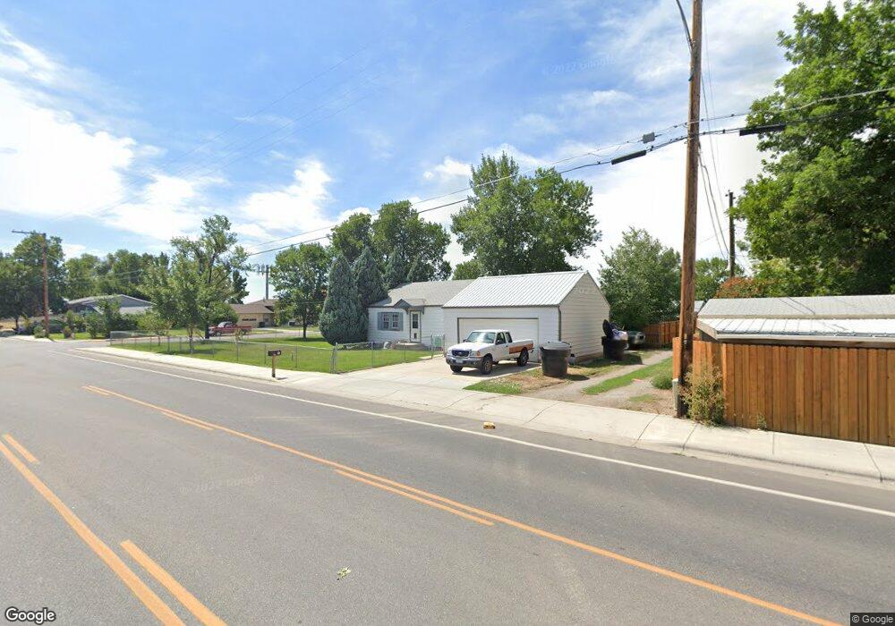
704 Calhoun Ln Billings, MT 59101
South Central Billings NeighborhoodEstimated Value: $217,109 - $241,000
2
Beds
1
Bath
768
Sq Ft
$297/Sq Ft
Est. Value
About This Home
This home is located at 704 Calhoun Ln, Billings, MT 59101 and is currently estimated at $228,277, approximately $297 per square foot. 704 Calhoun Ln is a home located in Yellowstone County with nearby schools including Newman School, Riverside Junior High School, and Billings West High School.
Ownership History
Date
Name
Owned For
Owner Type
Purchase Details
Closed on
Jan 28, 2009
Sold by
Rawhouser William L
Bought by
Asbeck Mitchell J and Asbeck Kathy L
Current Estimated Value
Home Financials for this Owner
Home Financials are based on the most recent Mortgage that was taken out on this home.
Original Mortgage
$92,400
Outstanding Balance
$58,533
Interest Rate
5.14%
Mortgage Type
Purchase Money Mortgage
Estimated Equity
$169,744
Create a Home Valuation Report for This Property
The Home Valuation Report is an in-depth analysis detailing your home's value as well as a comparison with similar homes in the area
Home Values in the Area
Average Home Value in this Area
Purchase History
| Date | Buyer | Sale Price | Title Company |
|---|---|---|---|
| Asbeck Mitchell J | -- | None Available |
Source: Public Records
Mortgage History
| Date | Status | Borrower | Loan Amount |
|---|---|---|---|
| Open | Asbeck Mitchell J | $92,400 |
Source: Public Records
Tax History Compared to Growth
Tax History
| Year | Tax Paid | Tax Assessment Tax Assessment Total Assessment is a certain percentage of the fair market value that is determined by local assessors to be the total taxable value of land and additions on the property. | Land | Improvement |
|---|---|---|---|---|
| 2025 | $1,947 | $221,000 | $41,588 | $179,412 |
| 2024 | $1,947 | $177,300 | $41,448 | $135,852 |
| 2023 | $1,956 | $177,300 | $41,448 | $135,852 |
| 2022 | $1,896 | $152,500 | $33,352 | $119,148 |
| 2021 | $1,809 | $152,500 | $0 | $0 |
| 2020 | $1,770 | $140,700 | $0 | $0 |
| 2019 | $1,698 | $140,700 | $0 | $0 |
| 2018 | $1,698 | $138,600 | $0 | $0 |
| 2017 | $1,283 | $138,600 | $0 | $0 |
| 2016 | $1,517 | $126,900 | $0 | $0 |
| 2015 | $1,486 | $126,900 | $0 | $0 |
| 2014 | $1,229 | $53,318 | $0 | $0 |
Source: Public Records
Map
Nearby Homes
- 605 Calhoun Ln
- 4645 Phillip St
- 4413 Ryan Ave
- 820 Arlington Dr Unit 7
- 4429 Lux Ave
- 4231 Stone St
- 307 S Billings Blvd Unit 36
- 226 Moore Ln
- 12 Macarthur Ave
- 4039 Cambridge Dr
- 342 Jackson St
- 19 Patton Ave
- 3905 King Ave E
- 329 Jackson St
- 231 S 12th St W
- 720 Washington St
- 141 S 12th St W
- 137 Jackson St
- 418 Cook Ave
- 1219 Fairvale Dr
- 4602 Stone St
- 4611 Murphy Ave
- 4606 Stone St
- 4615 Murphy Ave
- 4547 Murphy Ave
- 4616 Stone St
- 4543 Murphy Ave
- 4548 Stone St
- 4548 Murphy Ave
- 4620 Stone St
- 4544 Stone St
- 4544 Murphy Ave
- 4537 Murphy Ave
- 742 Calhoun Ln
- 4603 Stone St
- 4620 Murphy Ave
- 4610 Murphy Ave
- 4609 Stone St
- 743 Calhoun Ln
- 4614 Murphy Ave