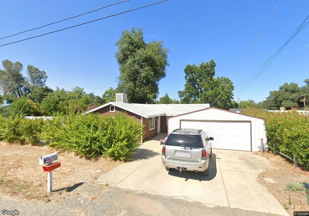
7041 Carroll Ln Anderson, CA 96007
Estimated Value: $248,000 - $254,000
2
Beds
1
Bath
1,192
Sq Ft
$210/Sq Ft
Est. Value
About This Home
This home is located at 7041 Carroll Ln, Anderson, CA 96007 and is currently estimated at $250,333, approximately $210 per square foot. 7041 Carroll Ln is a home located in Shasta County with nearby schools including Meadow Lane Elementary School, Anderson Heights Elementary School, and Anderson Middle School.
Ownership History
Date
Name
Owned For
Owner Type
Purchase Details
Closed on
Jul 9, 2025
Sold by
Main James R
Bought by
Main James R
Current Estimated Value
Home Financials for this Owner
Home Financials are based on the most recent Mortgage that was taken out on this home.
Original Mortgage
$480,000
Interest Rate
6.75%
Mortgage Type
Reverse Mortgage Home Equity Conversion Mortgage
Purchase Details
Closed on
Jun 16, 2004
Sold by
Main James Roger and Main Linda Kay
Bought by
Main James R and Main Linda K
Home Financials for this Owner
Home Financials are based on the most recent Mortgage that was taken out on this home.
Original Mortgage
$104,600
Interest Rate
6.29%
Mortgage Type
Stand Alone Refi Refinance Of Original Loan
Create a Home Valuation Report for This Property
The Home Valuation Report is an in-depth analysis detailing your home's value as well as a comparison with similar homes in the area
Purchase History
| Date | Buyer | Sale Price | Title Company |
|---|---|---|---|
| Main James R | -- | Placer Title | |
| Main James R | -- | Chicago Title Co |
Source: Public Records
Mortgage History
| Date | Status | Borrower | Loan Amount |
|---|---|---|---|
| Previous Owner | Main James R | $480,000 | |
| Previous Owner | Main James R | $104,600 |
Source: Public Records
Tax History
| Year | Tax Paid | Tax Assessment Tax Assessment Total Assessment is a certain percentage of the fair market value that is determined by local assessors to be the total taxable value of land and additions on the property. | Land | Improvement |
|---|---|---|---|---|
| 2025 | $1,536 | $148,356 | $44,188 | $104,168 |
| 2024 | $1,504 | $145,448 | $43,322 | $102,126 |
| 2023 | $1,504 | $142,597 | $42,473 | $100,124 |
| 2022 | $1,456 | $139,802 | $41,641 | $98,161 |
| 2021 | $1,441 | $137,062 | $40,825 | $96,237 |
| 2020 | $1,454 | $135,658 | $40,407 | $95,251 |
| 2019 | $1,389 | $132,999 | $39,615 | $93,384 |
| 2018 | $1,366 | $130,392 | $38,839 | $91,553 |
| 2017 | $1,370 | $127,836 | $38,078 | $89,758 |
| 2016 | $1,267 | $125,331 | $37,332 | $87,999 |
| 2015 | $1,270 | $123,450 | $36,772 | $86,678 |
| 2014 | $1,174 | $115,000 | $40,000 | $75,000 |
Source: Public Records
Map
Nearby Homes
- 18376 Utility Ave
- 7252 Whitehouse Dr
- 18411 Majestic View Dr
- 6820 California 273
- 6973 Happy Valley Rd
- 7155 The Terrace St
- 7728 Pit Rd
- 7575 Pit Rd
- 8641 Redbank Rd
- 7420 Platinum Way
- 7253 Legacy
- 7060 Pit Rd
- 7022 Marvin Trail
- 17622 China Gulch Dr
- 6955 Yvonne Ct
- 6871 Hemlock St
- 7035 Riverside Dr
- 3182 Island Dr
- 19301 Clover Rd
- 000 Glenbo Ln
- 7050 Marie Ln
- 7049 Carroll Ln
- 7033 Carroll Ln
- 7058 Marie Ln
- 7040 Carroll Ln
- 7032 Marie Ln
- 7048 Carroll Ln
- 7030 Carroll Ln
- 7011 Carroll Ln
- 7016 Carroll Ln
- 6986 White Oak Dr
- 6989 White Oak Dr
- 7009 White Oak Dr
- 7017 White Oak Dr
- 7019 White Oak Dr
- 6981 White Oak Dr
- 18538 Lloyd Ln
- 18552 Lloyd Ln Unit 18554
- 18552 Lloyd Ln
- 18536 Lloyd Ln
Your Personal Tour Guide
Ask me questions while you tour the home.