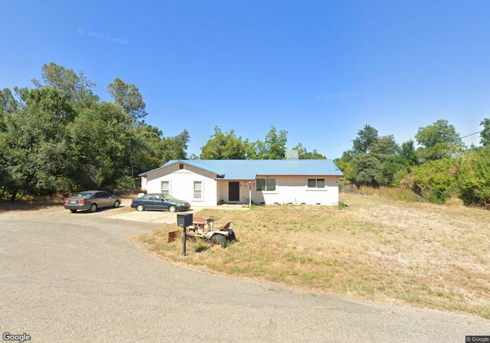
7049 Carroll Ln Anderson, CA 96007
Estimated Value: $234,000 - $282,000
3
Beds
1
Bath
1,200
Sq Ft
$214/Sq Ft
Est. Value
About This Home
This home is located at 7049 Carroll Ln, Anderson, CA 96007 and is currently estimated at $257,118, approximately $214 per square foot. 7049 Carroll Ln is a home located in Shasta County with nearby schools including Meadow Lane Elementary School, Anderson Heights Elementary School, and Anderson Middle School.
Ownership History
Date
Name
Owned For
Owner Type
Purchase Details
Closed on
Jan 5, 2010
Sold by
Lowery Brian K
Bought by
Dasilva Lowery Roberta Anna
Current Estimated Value
Purchase Details
Closed on
Oct 30, 2009
Sold by
Brilena Inc
Bought by
Dasilva Lowery Roberta Anna
Purchase Details
Closed on
Feb 10, 2009
Sold by
Ayotte Ruben and Doss Christy Marie
Bought by
Brilena Inc
Purchase Details
Closed on
Aug 8, 2007
Sold by
Doss Christy Marie and Ayotte Ruben
Bought by
Ayotte Ruben and Doss Christy Marie
Home Financials for this Owner
Home Financials are based on the most recent Mortgage that was taken out on this home.
Original Mortgage
$65,000
Interest Rate
6.62%
Mortgage Type
New Conventional
Purchase Details
Closed on
Apr 27, 1999
Sold by
Sp Mcbroome Jacqueline S
Bought by
Doss Christy Marie
Create a Home Valuation Report for This Property
The Home Valuation Report is an in-depth analysis detailing your home's value as well as a comparison with similar homes in the area
Home Values in the Area
Average Home Value in this Area
Purchase History
| Date | Buyer | Sale Price | Title Company |
|---|---|---|---|
| Dasilva Lowery Roberta Anna | -- | Fidelity Natl Title Co Of Ca | |
| Dasilva Lowery Roberta Anna | $70,000 | Fidelity Natl Title Co Of Ca | |
| Brilena Inc | $77,013 | None Available | |
| Ayotte Ruben | -- | Southland Title Corporation | |
| Doss Christy Marie | -- | -- |
Source: Public Records
Mortgage History
| Date | Status | Borrower | Loan Amount |
|---|---|---|---|
| Previous Owner | Ayotte Ruben | $65,000 |
Source: Public Records
Tax History Compared to Growth
Tax History
| Year | Tax Paid | Tax Assessment Tax Assessment Total Assessment is a certain percentage of the fair market value that is determined by local assessors to be the total taxable value of land and additions on the property. | Land | Improvement |
|---|---|---|---|---|
| 2025 | $923 | $90,342 | $45,171 | $45,171 |
| 2024 | $904 | $88,572 | $44,286 | $44,286 |
| 2023 | $904 | $86,836 | $43,418 | $43,418 |
| 2022 | $874 | $85,134 | $42,567 | $42,567 |
| 2021 | $864 | $83,466 | $41,733 | $41,733 |
| 2020 | $871 | $82,612 | $41,306 | $41,306 |
| 2019 | $832 | $80,994 | $40,497 | $40,497 |
| 2018 | $818 | $79,406 | $39,703 | $39,703 |
| 2017 | $819 | $77,850 | $38,925 | $38,925 |
| 2016 | $758 | $76,324 | $38,162 | $38,162 |
| 2015 | $759 | $75,178 | $37,589 | $37,589 |
| 2014 | $739 | $73,706 | $36,853 | $36,853 |
Source: Public Records
Map
Nearby Homes
- 7059 Marie Ln
- 18376 Utility Ave
- 7725 Happy Valley Rd
- 7252 Whitehouse Dr
- 18411 Majestic View Dr
- 0 Nut Tree Ln
- 6973 Happy Valley Rd
- 8500 Copper Dr
- 7728 Pit Rd
- 7795 Pit Rd
- 8641 Redbank Rd
- 8818 Valley View Rd
- 6951 Marvin Trail
- 6955 Yvonne Ct
- 6871 Hemlock St
- 7035 Riverside Dr
- 2486 Neighborly Way
- 6787 Hemlock St
- 19301 Clover Rd
- 000 Glenbo Ln
- 7041 Carroll Ln
- 7058 Marie Ln
- 7050 Marie Ln
- 7048 Carroll Ln
- 7040 Carroll Ln
- 7033 Carroll Ln
- 7017 White Oak Dr
- 7019 White Oak Dr
- 7030 Carroll Ln
- 7009 White Oak Dr
- 7032 Marie Ln
- 7025 White Oak Dr
- 6989 White Oak Dr
- 6986 White Oak Dr
- 7011 Carroll Ln
- 7033 White Oak Dr
- 6981 White Oak Dr
- 7016 Carroll Ln
- 0 White Oak Dr
- 7043 White Oak Dr