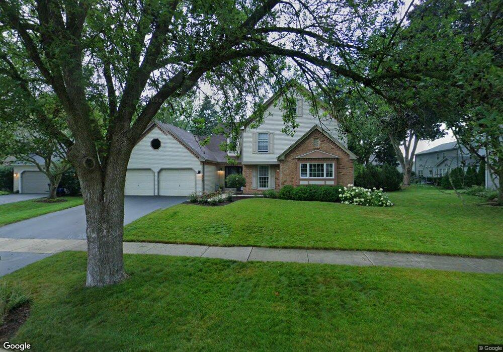
705 Antietam Ct Naperville, IL 60540
Hobson West NeighborhoodEstimated Value: $630,000 - $843,000
4
Beds
3
Baths
2,639
Sq Ft
$284/Sq Ft
Est. Value
About This Home
This home is located at 705 Antietam Ct, Naperville, IL 60540 and is currently estimated at $750,427, approximately $284 per square foot. 705 Antietam Ct is a home located in DuPage County with nearby schools including Elmwood Elementary School, Lincoln Jr. High School, and Naperville Central High School.
Ownership History
Date
Name
Owned For
Owner Type
Purchase Details
Closed on
Apr 5, 2022
Sold by
Sterr Daniel J and Sterr Jodie L
Bought by
Daniel J Sterr Trust and Jodie L Sterr Trust
Current Estimated Value
Purchase Details
Closed on
Oct 10, 2007
Sold by
Sandefur Debra
Bought by
Sterr Daniel J and Sterr Jodie L
Home Financials for this Owner
Home Financials are based on the most recent Mortgage that was taken out on this home.
Original Mortgage
$320,000
Interest Rate
6.5%
Mortgage Type
Purchase Money Mortgage
Purchase Details
Closed on
Apr 4, 2000
Sold by
Nash Steven R
Bought by
Sandefur Debra
Purchase Details
Closed on
Aug 21, 1997
Sold by
Kearby Robert W and Kearby Jacqueline M
Bought by
Sandefur Debra
Home Financials for this Owner
Home Financials are based on the most recent Mortgage that was taken out on this home.
Original Mortgage
$200,000
Interest Rate
7.57%
Create a Home Valuation Report for This Property
The Home Valuation Report is an in-depth analysis detailing your home's value as well as a comparison with similar homes in the area
Home Values in the Area
Average Home Value in this Area
Purchase History
| Date | Buyer | Sale Price | Title Company |
|---|---|---|---|
| Daniel J Sterr Trust | -- | None Listed On Document | |
| Sterr Daniel J | $510,000 | First American Title | |
| Sandefur Debra | -- | -- | |
| Sandefur Debra | $233,000 | Premier Title Company |
Source: Public Records
Mortgage History
| Date | Status | Borrower | Loan Amount |
|---|---|---|---|
| Previous Owner | Sterr Daniel J | $320,000 | |
| Previous Owner | Sandefur Debra | $200,000 |
Source: Public Records
Tax History
| Year | Tax Paid | Tax Assessment Tax Assessment Total Assessment is a certain percentage of the fair market value that is determined by local assessors to be the total taxable value of land and additions on the property. | Land | Improvement |
|---|---|---|---|---|
| 2024 | $12,458 | $211,139 | $79,650 | $131,489 |
| 2023 | $11,791 | $189,720 | $71,570 | $118,150 |
| 2022 | $11,131 | $178,270 | $66,780 | $111,490 |
| 2021 | $10,740 | $171,910 | $64,400 | $107,510 |
| 2020 | $10,706 | $171,910 | $64,400 | $107,510 |
| 2019 | $10,324 | $163,500 | $61,250 | $102,250 |
| 2018 | $9,977 | $158,420 | $58,940 | $99,480 |
| 2017 | $9,773 | $153,050 | $56,940 | $96,110 |
| 2016 | $9,537 | $146,880 | $54,640 | $92,240 |
| 2015 | $9,551 | $139,460 | $51,880 | $87,580 |
| 2014 | $9,329 | $132,380 | $48,910 | $83,470 |
| 2013 | $9,265 | $133,300 | $49,250 | $84,050 |
Source: Public Records
Map
Nearby Homes
- 840 Mobile Ct
- 316 Hemlock Ln
- 1033 Emerald Dr
- 808 Shiloh Cir
- 845 Tulip Ln
- 1161 Banyon Ct
- 7S410 Arbor Dr
- 1246 Ardmore Dr
- 816 S River Rd
- 854 Raintree Dr
- 817 Cardiff Rd
- 316 Sycamore Dr Unit 11
- 534 Grimes Ave
- 313 W Gartner Rd
- 731 S River Rd
- 1447 Baldwin Ct
- 1095 Devonshire Ave
- 308 Tamarack Ave
- 7S146 Wild Cherry Rd
- 661 Willow Rd
- 701 Antietam Ct
- 851 Williamsburg Dr
- 862 Appomattox Cir
- 858 Appomattox Cir
- 847 Williamsburg Dr
- 713 Antietam Ct
- 868 Appomattox Cir
- 704 Antietam Ct
- 913 Williamsburg Dr
- 874 Appomattox Cir
- 717 Antietam Ct
- 880 Appomattox Cir
- 708 Antietam Ct
- 712 Antietam Ct
- 629 Virginia Ct
- 848 Williamsburg Dr
- 844 Williamsburg Dr
- 716 Antietam Ct
- 861 Appomattox Cir
- 917 Williamsburg Dr
Your Personal Tour Guide
Ask me questions while you tour the home.