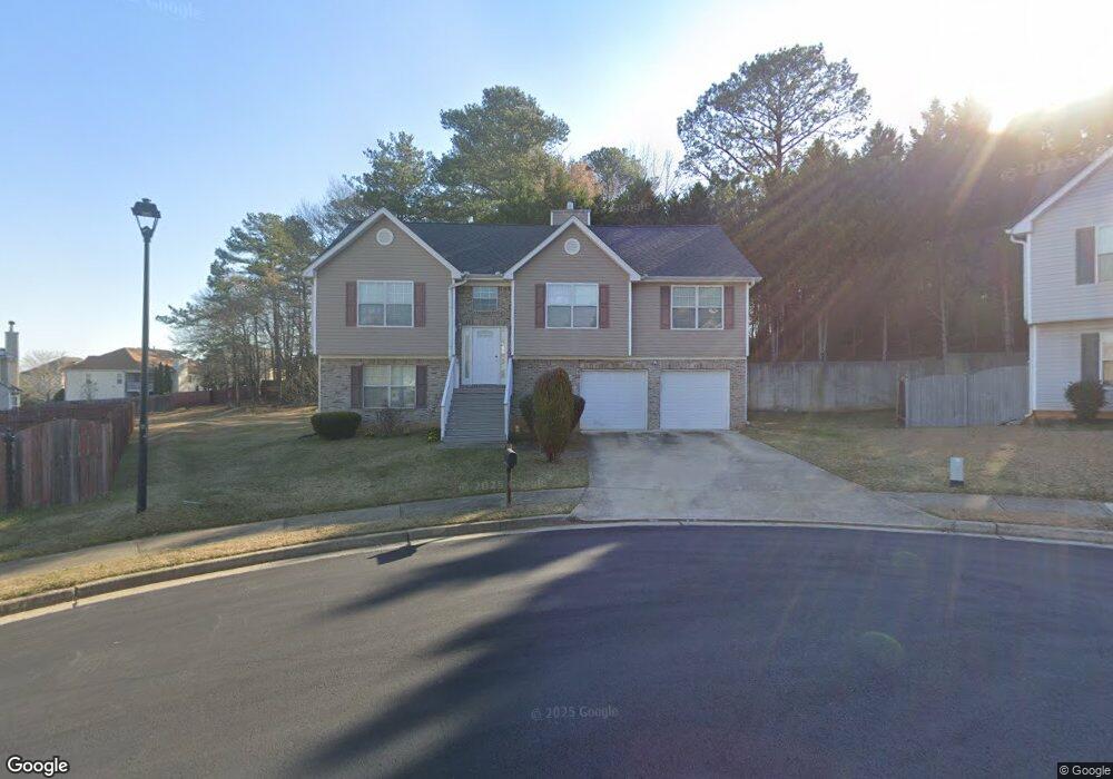
705 Davenport Ct Unit 1 Stockbridge, GA 30281
Estimated Value: $321,047 - $335,000
4
Beds
3
Baths
2,304
Sq Ft
$142/Sq Ft
Est. Value
About This Home
This home is located at 705 Davenport Ct Unit 1, Stockbridge, GA 30281 and is currently estimated at $327,512, approximately $142 per square foot. 705 Davenport Ct Unit 1 is a home located in Henry County with nearby schools including Cotton Indian Elementary School, Stockbridge Middle School, and Stockbridge High School.
Ownership History
Date
Name
Owned For
Owner Type
Purchase Details
Closed on
Jul 29, 2005
Sold by
Roosevelt Bldrs Inc
Bought by
Thompson Charles
Current Estimated Value
Home Financials for this Owner
Home Financials are based on the most recent Mortgage that was taken out on this home.
Original Mortgage
$33,360
Interest Rate
5.18%
Mortgage Type
New Conventional
Create a Home Valuation Report for This Property
The Home Valuation Report is an in-depth analysis detailing your home's value as well as a comparison with similar homes in the area
Home Values in the Area
Average Home Value in this Area
Purchase History
| Date | Buyer | Sale Price | Title Company |
|---|---|---|---|
| Thompson Charles | $166,800 | -- |
Source: Public Records
Mortgage History
| Date | Status | Borrower | Loan Amount |
|---|---|---|---|
| Closed | Thompson Charles | $33,360 | |
| Open | Thompson Charles | $133,400 |
Source: Public Records
Tax History Compared to Growth
Tax History
| Year | Tax Paid | Tax Assessment Tax Assessment Total Assessment is a certain percentage of the fair market value that is determined by local assessors to be the total taxable value of land and additions on the property. | Land | Improvement |
|---|---|---|---|---|
| 2025 | $4,447 | $137,640 | $16,000 | $121,640 |
| 2024 | $4,447 | $130,160 | $16,000 | $114,160 |
| 2023 | $3,802 | $127,640 | $16,000 | $111,640 |
| 2022 | $3,546 | $111,040 | $20,000 | $91,040 |
| 2021 | $3,043 | $89,800 | $20,000 | $69,800 |
| 2020 | $2,854 | $81,800 | $20,000 | $61,800 |
| 2019 | $2,604 | $74,640 | $10,000 | $64,640 |
| 2018 | $2,447 | $67,960 | $10,000 | $57,960 |
| 2016 | $2,113 | $57,480 | $8,000 | $49,480 |
| 2015 | $1,707 | $45,920 | $5,760 | $40,160 |
| 2014 | $1,488 | $40,080 | $4,800 | $35,280 |
Source: Public Records
Map
Nearby Homes
- 485 Brunswick Cir
- 805 Abarca Ln
- 1600 Gallup Dr
- 809 Abarca Ln
- 813 Abarca Ln
- 515 Valley Hill Rd
- 20 Highlane Dr
- 120 Mossy Brook Dr
- 110 Cactus Ln E
- 0 Stagecoach Rd Unit 20.17 ACRES 10455441
- 101 Valleydale Dr
- 124 Meadow Ridge Dr Unit I
- 236 Hillandale Dr
- 126 Kinsey Dr
- 225 Hillandale Dr
- 952 E Atlanta Rd
- Dallas Plan at Diamante
- Austin Plan at Diamante
- 905 E Atlanta Rd
- 300 Shine Dr
- 701 Davenport Ct
- 480 Brunswick Cir Unit 1
- 709 Davenport Ct
- 708 Davenport Ct
- 484 Brunswick Cir
- 484 Brunswick Cir Unit LOT 223
- 700 Davenport Ct Unit 1
- 1412 Gallup Dr
- 473 Brunswick Cir
- 469 Brunswick Cir
- 1416 Gallup Dr
- 465 Brunswick Cir
- 1108 Hockstra Point
- 477 Brunswick Cir Unit 1
- 468 Brunswick Cir
- 1104 Hockstra Point
- 1104 Hockstra Point Unit 114
- 1112 Hockstra Point
- 461 Brunswick Cir
- 1420 Gallup Dr