Estimated Value: $380,968 - $441,000
--
Bed
--
Bath
1,929
Sq Ft
$210/Sq Ft
Est. Value
About This Home
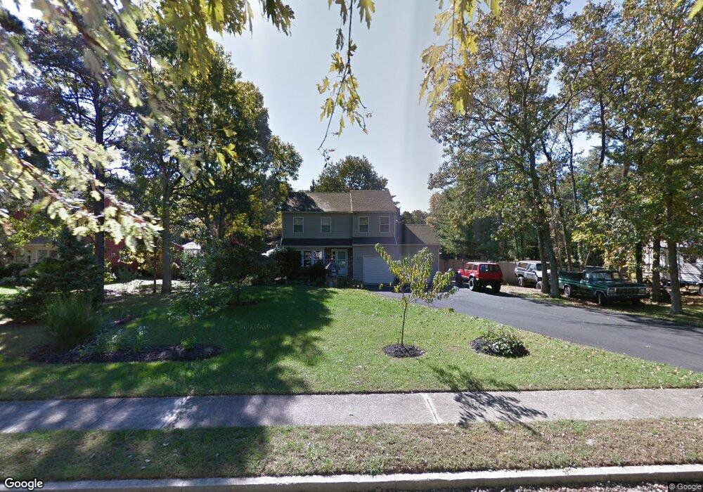
This home is located at 705 Forrest Dr, Atco, NJ 08004 and is currently estimated at $405,742, approximately $210 per square foot. 705 Forrest Dr is a home located in Camden County with nearby schools including Thomas Richards Elementary School, Waterford Elementary School, and Atco Elementary School.
Ownership History
Date
Name
Owned For
Owner Type
Purchase Details
Closed on
May 17, 2007
Sold by
Anastasio Ralph
Bought by
Johnson Joseph and Kane Christine
Current Estimated Value
Home Financials for this Owner
Home Financials are based on the most recent Mortgage that was taken out on this home.
Original Mortgage
$105,000
Outstanding Balance
$64,112
Interest Rate
6.24%
Mortgage Type
New Conventional
Estimated Equity
$341,630
Purchase Details
Closed on
Apr 29, 2004
Sold by
Harris William Roger
Bought by
Ewan Pamela J and Anastasio Ralph
Home Financials for this Owner
Home Financials are based on the most recent Mortgage that was taken out on this home.
Original Mortgage
$206,250
Interest Rate
5.94%
Purchase Details
Closed on
Oct 1, 1999
Sold by
Duda Antonio M
Bought by
Roger William and Harris Donna
Home Financials for this Owner
Home Financials are based on the most recent Mortgage that was taken out on this home.
Original Mortgage
$77,000
Interest Rate
7.73%
Create a Home Valuation Report for This Property
The Home Valuation Report is an in-depth analysis detailing your home's value as well as a comparison with similar homes in the area
Home Values in the Area
Average Home Value in this Area
Purchase History
| Date | Buyer | Sale Price | Title Company |
|---|---|---|---|
| Johnson Joseph | $245,000 | -- | |
| Ewan Pamela J | $206,900 | -- | |
| Roger William | $109,800 | -- |
Source: Public Records
Mortgage History
| Date | Status | Borrower | Loan Amount |
|---|---|---|---|
| Open | Johnson Joseph | $105,000 | |
| Previous Owner | Ewan Pamela J | $206,250 | |
| Previous Owner | Roger William | $77,000 |
Source: Public Records
Tax History Compared to Growth
Tax History
| Year | Tax Paid | Tax Assessment Tax Assessment Total Assessment is a certain percentage of the fair market value that is determined by local assessors to be the total taxable value of land and additions on the property. | Land | Improvement |
|---|---|---|---|---|
| 2025 | $8,072 | $183,200 | $44,000 | $139,200 |
| 2024 | $7,872 | $183,200 | $44,000 | $139,200 |
| 2023 | $7,872 | $183,200 | $44,000 | $139,200 |
| 2022 | $7,522 | $183,200 | $44,000 | $139,200 |
| 2021 | $7,486 | $183,200 | $44,000 | $139,200 |
| 2020 | $7,449 | $183,200 | $44,000 | $139,200 |
| 2019 | $7,335 | $183,200 | $44,000 | $139,200 |
| 2018 | $7,328 | $183,200 | $44,000 | $139,200 |
| 2017 | $7,214 | $183,200 | $44,000 | $139,200 |
| 2016 | $7,110 | $183,200 | $44,000 | $139,200 |
| 2015 | $7,089 | $187,600 | $44,000 | $143,600 |
| 2014 | $6,318 | $114,400 | $33,100 | $81,300 |
Source: Public Records
Map
Nearby Homes
- 2422 Louden Ln
- 2470 Medford Rd
- 2315 Ilene Ln
- 687 Jackson Rd
- 535 Jackson Rd
- 746 Raritan Ave
- 2336 Auburn Ave
- 893 Willow Way
- 2329 Fernwood Ave
- 881 Willow Way
- 2239 Ellwood Ave
- 538 3rd St
- 537 3rd St
- 2254 Clifford Ave
- 2216 Harrison
- 2216 Harrison Ave
- 344 Raritan Ave
- 2148 Bartram Ave
- 2157 Almira Ave
- 2307 Cooper Rd
- 707 Forrest Dr
- 703 Forrest Dr
- 2420 Louden Ln
- 709 Forrest Dr
- 710 Forrest Dr
- 708 Forrest Dr
- 2418 Louden Ln
- 712 Forrest Dr
- 701 Forrest Dr
- 711 Forrest Dr
- 714 Forrest Dr
- 2424 Louden Ln
- 706 Forrest Dr
- 2416 Louden Ln
- 700 Forrest Dr
- 716 Forrest Dr
- 2475 Richards Ave
- 2479 Richards Ave
- 2426 Louden Ln
- 2471 Richards Ave