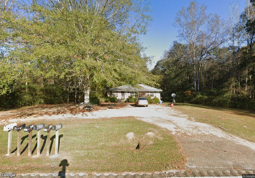
705 Highway 532 Mount Olive, MS 39119
Estimated Value: $62,766 - $124,000
3
Beds
1
Bath
1,200
Sq Ft
$79/Sq Ft
Est. Value
About This Home
This home is located at 705 Highway 532, Mount Olive, MS 39119 and is currently estimated at $94,942, approximately $79 per square foot. 705 Highway 532 is a home located in Covington County with nearby schools including Mount Olive Attendance Center.
Ownership History
Date
Name
Owned For
Owner Type
Purchase Details
Closed on
Oct 3, 2019
Sold by
White Billy K
Bought by
Gray Cody A and Gray Paris
Current Estimated Value
Home Financials for this Owner
Home Financials are based on the most recent Mortgage that was taken out on this home.
Original Mortgage
$98,989
Outstanding Balance
$85,566
Interest Rate
3.4%
Mortgage Type
New Conventional
Estimated Equity
$9,376
Purchase Details
Closed on
Aug 7, 2018
Sold by
Wilborn Carole Jean and Wilborn Jimmy
Bought by
White Billy K
Home Financials for this Owner
Home Financials are based on the most recent Mortgage that was taken out on this home.
Original Mortgage
$79,797
Interest Rate
4.5%
Mortgage Type
New Conventional
Create a Home Valuation Report for This Property
The Home Valuation Report is an in-depth analysis detailing your home's value as well as a comparison with similar homes in the area
Purchase History
We collect this data history from publicly available records. To have your information removed, we recommend requesting removal directly through your county’s website.
| Date | Buyer | Sale Price | Title Company |
|---|---|---|---|
| Gray Cody A | -- | -- | |
| White Billy K | -- | -- |
Source: Public Records
Mortgage History
We collect this data history from publicly available records. To have your information removed, we recommend requesting removal directly through your county’s website.
| Date | Status | Borrower | Loan Amount |
|---|---|---|---|
| Open | Gray Cody A | $98,989 | |
| Previous Owner | White Billy K | $79,797 |
Source: Public Records
Tax History
| Year | Tax Paid | Tax Assessment Tax Assessment Total Assessment is a certain percentage of the fair market value that is determined by local assessors to be the total taxable value of land and additions on the property. | Land | Improvement |
|---|---|---|---|---|
| 2025 | $493 | $5,136 | $0 | $0 |
| 2024 | $493 | $5,136 | $0 | $0 |
| 2023 | $453 | $5,136 | $0 | $0 |
| 2022 | $461 | $5,136 | $0 | $0 |
| 2021 | $403 | $4,733 | $0 | $0 |
| 2020 | $403 | $4,733 | $0 | $0 |
| 2019 | $380 | $4,733 | $0 | $0 |
| 2018 | $377 | $4,733 | $0 | $0 |
| 2017 | $377 | $4,406 | $0 | $0 |
| 2015 | $360 | $4,406 | $0 | $0 |
| 2014 | $351 | $4,406 | $0 | $0 |
Source: Public Records
Map
Nearby Homes
- 948 Horseshoe Rd
- 43 Shows Ln
- 55 Keys and Clark Rd
- 181 County Road 30a
- 988 Salem Church Rd
- Highway 35 Mississippi 35
- 40 Acres Hwy 35
- 209 11th St
- 4438 Highway 49
- 409 Shepard St
- 200 S Bluff St
- 108 S Bluff St
- 101 S Main St
- 81.64 Rd
- 314 N Main St
- 0 Club Dr
- 0 Club Dr Unit 144371
- 53 Jones Chapel Rd
- 33 Scr 50a1
- 0 William Warren Rd Unit 25384393
- 705 Highway 532
- 698 Highway 532
- 698 Highway 532
- 700 Highway 532
- 668 Highway 532
- 668 Highway 532
- 669 Highway 532
- 66 Jordan Ln
- 41 Jordan Ln
- 34 Jordan Ln
- 925 Horseshoe Rd
- 92 J P Rutland Ln
- 825 Highway 532
- 1454 William Warren Rd
- 863 Horseshoe Rd
- 863 Horseshoe Rd
- 1432 William Warren Rd
- 1469 William Warren Rd
- 943 Horseshoe Rd
- 922 Horseshoe Rd
Your Personal Tour Guide
Ask me questions while you tour the home.