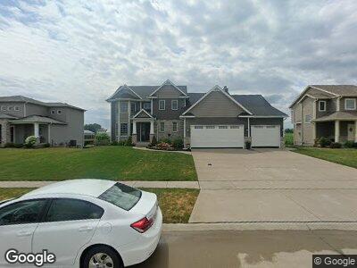
705 St Andrews Cir Eldridge, IA 52748
Eldridge NeighborhoodEstimated Value: $479,000 - $620,000
4
Beds
3
Baths
2,569
Sq Ft
$210/Sq Ft
Est. Value
About This Home
This home is located at 705 St Andrews Cir, Eldridge, IA 52748 and is currently estimated at $539,596, approximately $210 per square foot. 705 St Andrews Cir is a home located in Scott County with nearby schools including Alan Shepard Elementary School, North Scott Junior High School, and North Scott Senior High School.
Ownership History
Date
Name
Owned For
Owner Type
Purchase Details
Closed on
May 10, 2021
Sold by
Costello Matthew K and Bartolo Costello Abigail
Bought by
Bea Revocable Trust
Current Estimated Value
Purchase Details
Closed on
Apr 18, 2017
Sold by
Costello Matthew K
Bought by
Costello Matthew K and Bartolo Costello Abigail A
Create a Home Valuation Report for This Property
The Home Valuation Report is an in-depth analysis detailing your home's value as well as a comparison with similar homes in the area
Home Values in the Area
Average Home Value in this Area
Purchase History
| Date | Buyer | Sale Price | Title Company |
|---|---|---|---|
| Bea Revocable Trust | -- | None Available | |
| Costello Matthew K | $500 | None Available |
Source: Public Records
Mortgage History
| Date | Status | Borrower | Loan Amount |
|---|---|---|---|
| Previous Owner | Costello Matthew K | $50,000 | |
| Previous Owner | Costello Matthew K | $272,000 | |
| Previous Owner | Costello Matthew K | $50,000 |
Source: Public Records
Tax History Compared to Growth
Tax History
| Year | Tax Paid | Tax Assessment Tax Assessment Total Assessment is a certain percentage of the fair market value that is determined by local assessors to be the total taxable value of land and additions on the property. | Land | Improvement |
|---|---|---|---|---|
| 2024 | $5,766 | $472,000 | $90,500 | $381,500 |
| 2023 | $6,524 | $472,000 | $90,500 | $381,500 |
| 2022 | $6,322 | $457,480 | $83,520 | $373,960 |
| 2021 | $6,322 | $457,480 | $83,520 | $373,960 |
| 2020 | $6,474 | $415,180 | $83,520 | $331,660 |
| 2019 | $6,114 | $415,180 | $83,520 | $331,660 |
| 2017 | $2,370 | $426,160 | $83,520 | $342,640 |
| 2016 | $120 | $7,800 | $0 | $0 |
Source: Public Records
Map
Nearby Homes
- 845 E Lincoln Rd
- 1406 Colonial Ct
- 1201 Colonial Ct
- 1218 S 2nd St
- 306 Torrey Pines Dr
- 1862 Redbud Cir
- 1856 Redbud Cir
- Lot 22 S 5th St
- 601 S 9th Ave
- 342 W Heather Glen Dr
- Lot 28 Linden Ln
- 409 Pinehurst Dr
- 0 S 6th Unit 4104359
- 751 Muirfield Cir
- 513 S 7th St
- 206 S 5th St
- 3211 S 16th Ave Unit 301
- 3205 S 16th Ave Unit 203
- 102 W Torrey Pines Dr
- 3209 S 16th Ave Unit 302
- 705 St Andrews Cir
- 709 St Andrews Cir
- 704 St Andrews Cir
- 713 St Andrews Cir
- 700 St Andrews Cir
- 708 St Andrews Cir
- 620 St Andrews Cir
- 609 St Andrews Cir
- 717 St Andrews Cir
- 721 St Andrews Cir
- 605 St Andrews Cir
- 1570 Fox Ridge Rd
- 1540 Fox Ridge Rd
- 1600 Fox Ridge Rd
- 616 St Andrews Cir
- 1510 Fox Ridge Rd
- 725 St Andrews Cir
- 0 230th Unit 4178627
- 601 St Andrews Cir
- 791 St Andrews